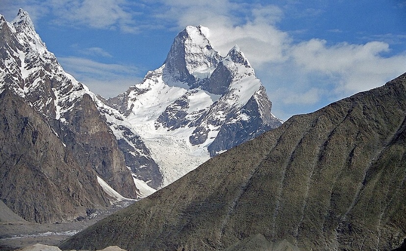
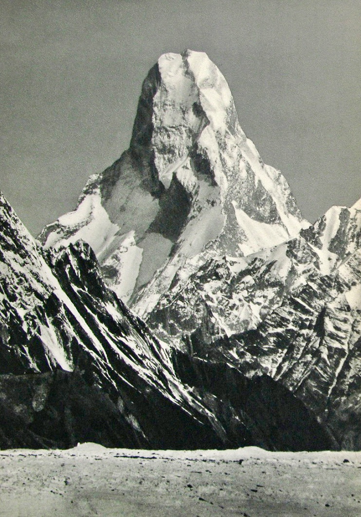
For nearly half a century, the legend of the Muztagh Tower was defined not by boots on the ground, but by a singular, haunting image captured on a glass-plate negative. In 1909, during the Duke of the Abruzzi’s celebrated K2 expedition, the Italian photographer and mountaineer Vittorio Sella pointed his telephoto lens toward a remote spire in the Karakoram range. The resulting image—a stark, vertical needle of rock and ice—was so daunting that it effectively paralyzed the climbing community for decades. To the eyes of 20th-century alpinists, the Muztagh Tower appeared as an "impregnable tooth," a geological anomaly that seemed to defy the laws of gravity and physics. This photograph became the definitive representation of the peak, casting a long shadow that convinced generations of explorers that the mountain was physically impossible to summit.
The Power of the Lens: Sella’s Legacy
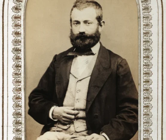
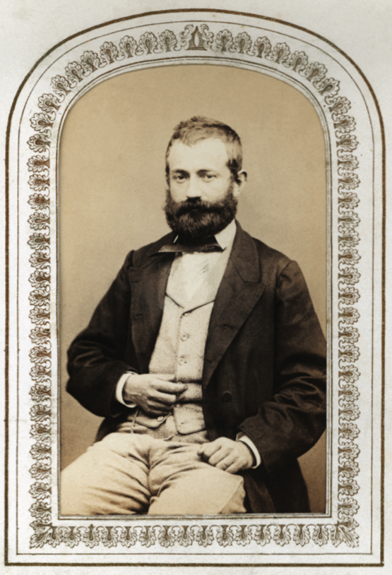
Vittorio Sella, born in 1859, was an instrumental figure in the intersection of high-altitude exploration and professional photography. His work transcended mere documentation; he treated the mountain landscape as a subject of spiritual and aesthetic significance. By the time he reached the Karakoram in 1909, he had already pioneered winter ascents in the Alps and documented the most remote corners of the globe.
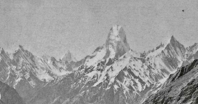
Sella’s technical prowess allowed him to capture detail that would later be scrutinized by the world’s elite mountaineers. However, his most famous image of the Muztagh Tower was an optical illusion born of perspective. By shooting from the Upper Baltoro Glacier, he compressed the peak’s depth, aligning its twin summits to create the silhouette of a razor-thin blade. When this image was published in Filippo De Filippi’s official 1912 account of the K2 expedition, it solidified the mountain’s reputation. Even by 1941, when the image was featured in climbing literature as "The Last Citadel," the myth of the mountain’s verticality remained unchallenged, discouraging even the most daring attempts at ascent.
The 1956 Summer of Discovery
The spell was finally broken in 1956, when two independent, high-caliber teams arrived in the Baltoro region, both independently concluding that the "impossible" peak was ripe for a first ascent. The arrival of the British and French expeditions marked a watershed moment in Karakoram mountaineering, signaling a shift from the era of massive, resource-heavy siege tactics to a more agile, technical approach.
The British team, led by John Hartog and featuring the legendary Joe Brown, Ian McNaught-Davis, and Tom Patey, targeted the Northwest Ridge. Their strategy relied on navigating the treacherous Muztagh and Chagaran glaciers, a route that required meticulous pathfinding through unstable icefalls. Meanwhile, the French expedition, led by the renowned Guido Magnone, focused on the eastern side of the peak. This dual-front assault on the mountain, occurring simultaneously on opposite flanks, was not a competitive race for national prestige, but rather a testament to the international spirit of post-war exploration.
Chronology of the Ascent
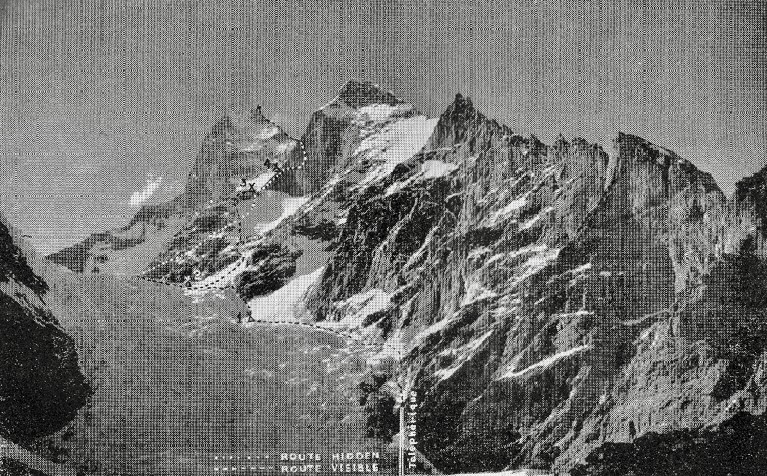
The logistics of the 1956 expeditions were Herculean by contemporary standards. The British party established their base camp on May 28, at an altitude of 4,282 meters. For nearly a month, they labored to ferry supplies across the Chagaran Glacier, establishing a series of camps that culminated in a high camp on the West Col at 6,355 meters. The technical crux of their climb involved an exposed traverse on the South Face, navigated by Joe Brown, followed by the ascent of a precarious rock leaf between the two summits.
On July 6, 1956, Joe Brown and Ian McNaught-Davis successfully reached the western summit. The following day, Hartog and Patey completed the ascent to the higher eastern summit. The French team, meanwhile, had faced their own set of challenges on the eastern arête. After conducting reconnaissance that ruled out the North Ridge, they navigated the icefalls of the Younghusband Glacier to reach the summit pyramid. Despite being delayed by a severe two-day storm, the French party reached the main summit on July 12, successfully completing the second ascent just six days after the British.
Alpine Solidarity and Professional Conduct
One of the most remarkable aspects of the 1956 Muztagh Tower expedition was the absence of friction between the two rival parties. Modern historical analysis of the event reveals a significant degree of cooperation and mutual respect. The French team, upon realizing the British were pursuing a line on the opposite flank, deliberately maintained their position on the east to avoid logistical interference.
When the British team faced an emergency during their descent—specifically, John Hartog suffering from severe frostbite—the French team acted as a vital support system. This instance of "alpine solidarity" underscored a shift in the culture of mountaineering, where the achievement of the summit was secondary to the safety and well-being of the collective climbing community. The French, despite having their own objective, did not perceive the British success as a failure, but rather as an inspiration to complete their own route, ultimately contributing to a more comprehensive understanding of the mountain’s topography.
Post-1956: A Legacy of Technical Challenge
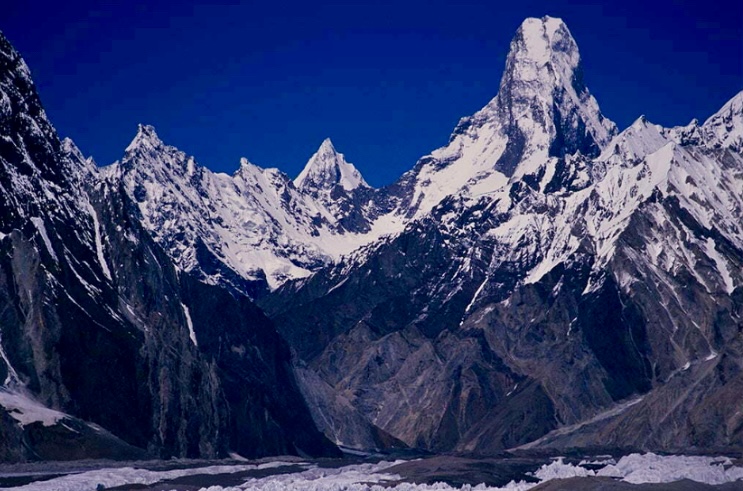
In the decades following the 1956 success, the Muztagh Tower has remained a sparsely populated peak, attracting only the most elite technical climbers. The 1984 repeat of the Northwest Ridge and the 1990 Swedish expedition confirmed the viability of the original British route, yet the peak never became a destination for commercial trekking.
The mountain regained international attention in 2012 when the Russian team of Sergey Nilov, Dmitry Golovchenko, and Alexander Lange completed a 17-day ascent of the Northeast Spur. Their route, dubbed "Think Twice," remains one of the most significant technical achievements in the history of the Karakoram. The Russian expedition, which earned the Piolet d’Or for their efforts, measured the peak at 7,284 meters, slightly refining previous estimates.
Implications and Broader Context
The story of the Muztagh Tower is fundamentally a lesson in the reliability of perception. The "impossible" nature of the mountain was, for 47 years, a construct of a two-dimensional photograph. When the 1956 climbers finally stood on its summit, they proved that the mountain was not a vertical blade, but a complex massif with accessible, albeit dangerous, lines of ascent.
This realization had profound implications for mountaineering. It forced explorers to look beyond the "official" narrative provided by previous images and documents, encouraging a more cautious, ground-level assessment of terrain. The Muztagh Tower serves as a reminder that in high-altitude environments, the most significant obstacles are often those created by our own preconceived notions. Today, the peak stands as a monument to the 1956 pioneers who ignored the myth, challenged the lens of Vittorio Sella, and redefined the boundaries of what was considered possible in the world’s highest ranges.