Teen Hiker Rescued from British Columbia Cliffside After Relying on AI-Generated Hiking Route

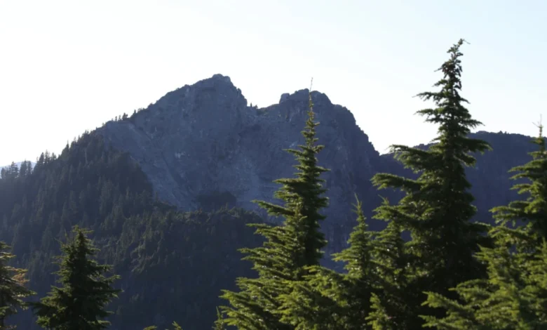
Emergency rescue personnel in British Columbia were forced to intervene on October 3, 2026, to airlift a stranded 16-year-old hiker from a treacherous cliffside on Crown Mountain. The teenager had inadvertently wandered into extreme, vertical terrain after relying on an unidentified artificial intelligence tool to map out his backcountry excursion. The incident highlights a rapidly growing and alarming trend among outdoor recreationists who increasingly turn to generative AI models and chatbots for wilderness navigation, often with perilous results.
According to reports from North Shore Rescue (NSR), the young solo hiker had used an AI itinerary planner that suggested an ambitious and technically demanding trajectory. The flawed algorithm instructed him to begin his trek on Grouse Mountain, navigate through a remote gully, and ascend "Widowmaker"—a notoriously difficult 10-pitch, 5.9 alpine climbing route located on the northeast ridge of Crown Mountain. Typically reserved for experienced mountaineers equipped with specialized technical gear and advanced rope skills, the route proved entirely unsuitable for an unaccompanied teenager.
Instead of safely reaching the summit, the exhausted and disoriented hiker found himself trapped at the base of the climb’s final vertical headwall, with sheer drops surrounding him and no safe way back down. Facing imminent danger, he made an emergency call for assistance.
A Timely Rescue Operation on Crown Mountain
The rescue operation unfolded rapidly, aided by a fortunate coincidence in scheduling. Moments before receiving the distress call, North Shore Rescue had just completed a helicopter hover entry and exit recertification training exercise directly on Crown Mountain. This positioned elite technical rescue teams close to the operational zone.
Paul Markey, search manager for North Shore Rescue, noted the gravity of the situation when rescue crews finally made visual and physical contact with the teenager. By the time technicians reached him, the boy was deeply frightened and aware that he was in a life-threatening predicament.
"It put him into a situation which was beyond his abilities, so things could have gone sideways pretty quickly," Markey told the regional outlet North Shore News.
Because the teenager was pressed tightly against a sheer vertical rock face, standard helicopter extraction was impossible due to insufficient rotor clearance. To circumvent this obstacle, NSR dispatched a specialized technical team. The rescuers were inserted by helicopter to a higher vantage point above the subject’s coordinates. Once on the ground, the crew constructed a secure mountain anchor system and deployed a team member via rope belay to reach the stranded teen. The rescuer established additional safety protection on the cliffside before physically guiding and rigging the hiker to a designated, safe extraction point where a hoist could safely pull him to safety.
The Broader Phenomenon: AI in the Backcountry
While the Crown Mountain rescue ended without physical injury, it marks only the latest in a string of high-profile search and rescue (SAR) operations linked directly to faulty artificial intelligence route planning. Mountain safety experts and park rangers across North America are sounding the alarm over what they describe as a dangerous technological misapplication.
Just weeks prior to the British Columbia incident, a group of three climbers had to be rescued from California’s Mount Shasta after utilizing Google’s Gemini AI chatbot to plan their ascent. The trio successfully summited via the Clear Creek Route, but their phones subsequently lost power. Relying on their initial, flawed AI-generated conceptual map, they wandered off the correct descent path and stumbled into the notoriously hazardous Mud Creek Canyon. Local rescue squads located the exhausted group the following morning, successfully airlifting them to safety.
The Mount Shasta region has recorded multiple AI-induced navigation errors. Nick Meyers, the lead climbing ranger for Mount Shasta, detailed several disturbing encounters to Business Insider. In one instance, rangers confronted a camper illegally pitching a tent directly next to explicit signage prohibiting camping. When questioned, the camper defended her actions by stating that ChatGPT had informed her the location was permitted. In another case, a hiker presented rangers with a custom map generated by an AI tool for a planned route. Upon inspection, rangers found the map placed prominent geographic features and trails in completely erroneous locations, prompting Meyers to describe the output as "terrible, totally terrible."
Understanding the Technical Limitations of Generative AI
The root cause of these incidents lies in the fundamental architecture of large language models (LLMs). Unlike dedicated geographic information systems (GIS) or specialized topographic software, AI chatbots do not "understand" geography, elevation profiles, weather conditions, or human physical limitations. Instead, LLMs operate on statistical probability, predicting the next most likely word in a sequence based on vast amounts of internet text.
When asked to plan a wilderness route, an AI model may synthesize blog posts, climbing forums, and outdated trail descriptions, stitching them together into a plausible-sounding narrative that bears no relation to physical reality. These models routinely fail to distinguish between a moderate walking trail and a technical alpine climbing route rated for expert mountaineers. They also lack real-time awareness of seasonal hazards, snowpacks, daylight duration, and cellular coverage dead zones.
Expert Recommendations for Safe Outdoor Navigation
In the wake of the Crown Mountain rescue, search and rescue authorities are issuing stern warnings to hikers, backpackers, and climbers regarding the dangers of algorithmic complacency. Paul Markey strongly urged outdoor enthusiasts to completely abandon AI chatbots for route planning, advocating instead for industry-standard digital tools designed specifically for backcountry navigation.
Safety officials recommend utilizing verified mapping applications and platforms such as:
- CalTopo: For detailed topographic mapping and route planning.
- AllTrails: For community-vetted trail reviews and difficulty ratings.
- Gaia GPS (owned by Outside, Inc.): For offline topographical navigation and satellite tracking.
Furthermore, experts emphasize that even when using dedicated mapping software, outdoor recreationists must cross-reference digital routes with official park service websites, physical paper topographic maps, and current weather forecasts. Hikers are continuously reminded of the universal tenet of wilderness safety: never embark on a route that exceeds your demonstrated skill level, and always ensure you have a reliable, non-digital backup navigation method, such as a physical compass and a waterproof map.
As generative AI continues to infiltrate everyday consumer technology, wilderness search and rescue organizations anticipate facing more missions driven by algorithmic miscalculations. For emergency responders like North Shore Rescue, the message is clear: while technology can enhance our lives, relying on a chatbot for wilderness navigation can quickly turn fatal.