
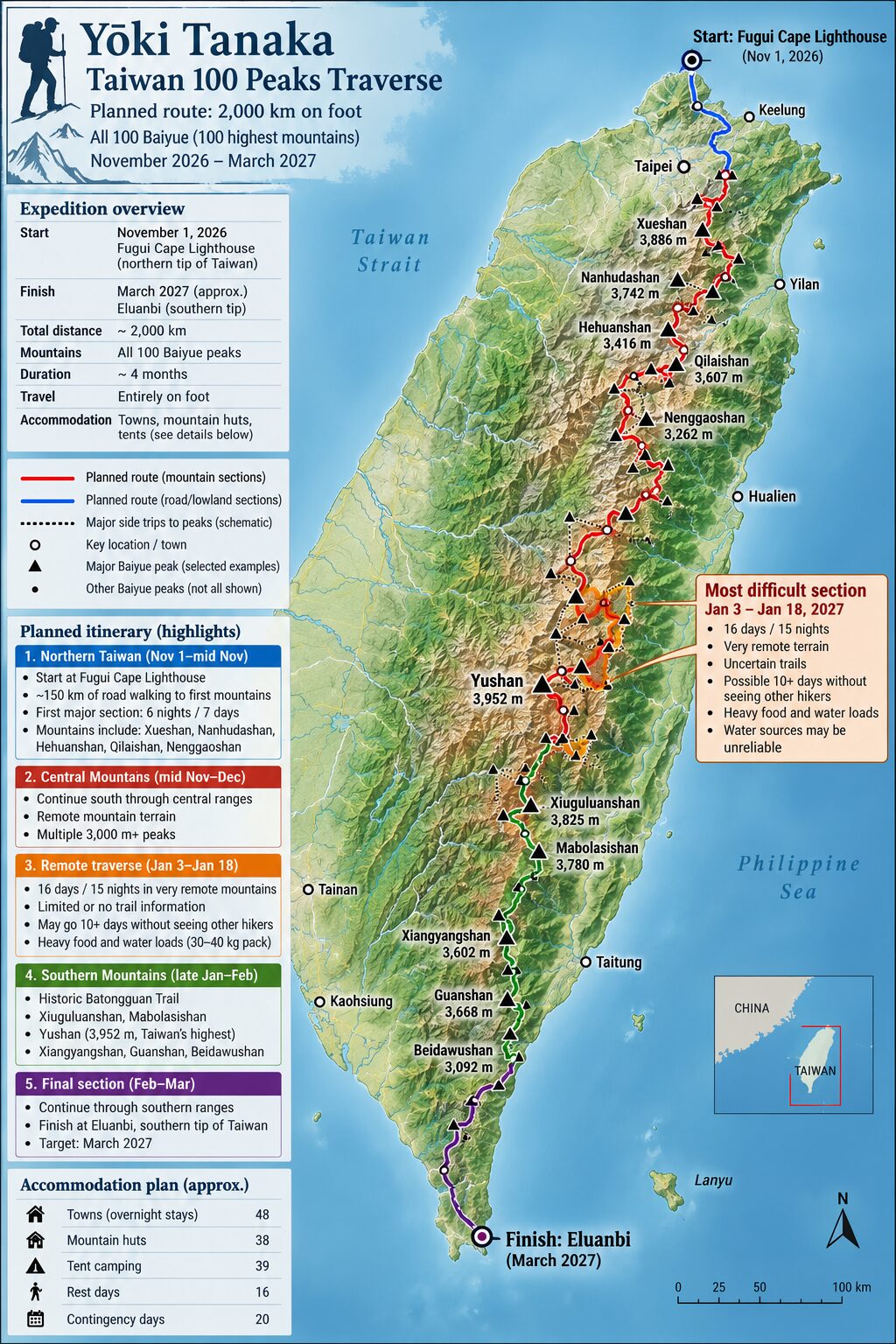
On November 1, Japanese endurance athlete Yoki Tanaka will embark on a gargantuan undertaking: a 2,000-kilometer trek that will see him traverse the entire longitudinal length of Taiwan. The expedition, which is scheduled to span four months, is not merely a test of physical stamina but a deliberate attempt to summit the 100 celebrated mountains known collectively as the Baiyue. By connecting the northernmost tip of the island to its southern extremity, Tanaka is positioning himself to redefine the limits of alpine logistics in a region defined by its rugged, vertical topography.
The Significance of the Baiyue
The Baiyue—a term denoting the "100 Peaks" of Taiwan—represents the pinnacle of the island’s mountaineering culture. Established in the early 1970s by a group of prominent local climbers, the list serves as a cultural and geographic benchmark. Unlike lists that prioritize elevation alone, the Baiyue was curated based on a complex matrix of criteria including aesthetic beauty, technical difficulty, prominence, and historical significance.
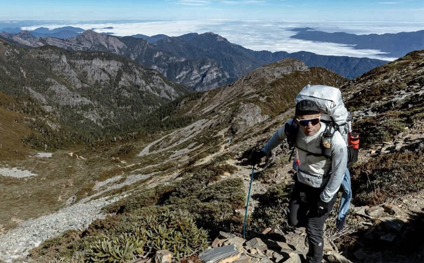
While Taiwan boasts a staggering 268 peaks exceeding 3,000 meters in altitude, the selection of these specific 100 mountains mirrors the tradition of Japan’s "100 Famous Mountains." Interestingly, the list maintains a historical quirk: Lushan, standing at 2,981 meters, remains a member of the elite group despite modern surveying technology proving it falls just short of the 3,000-meter threshold. Originally measured at 3,043 meters, the peak retains its status as a testament to the cultural importance placed on the list by the Taiwanese mountaineering community.
A Proven Track Record of Endurance
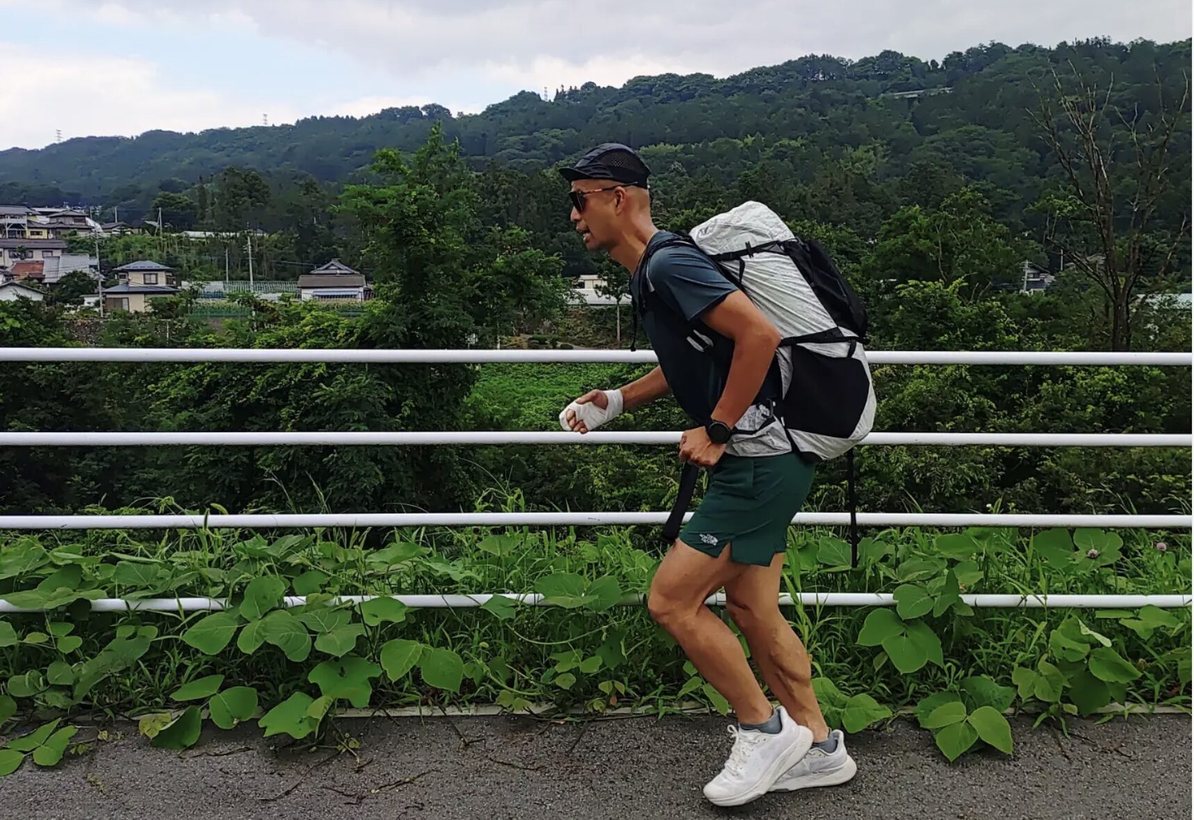
Yoki Tanaka is no stranger to such high-stakes, long-distance ventures. At 43, he has carved out a niche as one of the world’s foremost specialists in combining continuous long-distance walking with high-altitude peak bagging. His career trajectory in endurance sports is defined by a series of progressively difficult challenges in his home country.
In 2014, Tanaka completed an ambitious 7,800-kilometer walk across Japan, summiting the country’s 100 famous mountains in the process. That journey lasted 208 days. Unsatisfied with the milestone, he returned the following year to scale 200 mountains, covering 8,000 kilometers in 222 days. His most monumental achievement came when he scaled 300 mountains over a three-year period, covering roughly 20,000 kilometers on foot. The transition to the Taiwanese landscape represents a shift from the massive island of Japan to the concentrated, vertical intensity of Taiwan’s Central Mountain Range.

Expedition Chronology and Logistics
The logistical framework for this trek is nothing short of clinical. Starting at the Cape Fugui lighthouse in northern Taiwan, Tanaka will spend his first phase covering 150 kilometers of road walking before reaching the threshold of the mountain wilderness. His trajectory is designed to take him through the heart of the island, culminating in March at the Eluanbi lighthouse at the southern tip of the island.
Tanaka’s planning is characterized by a precise, almost bureaucratic, breakdown of his expected daily reality. His itinerary allocates:
- 48 days of town-based resupply stays.
- 38 days utilizing established mountain huts.
- 39 days of tent-based alpine camping.
- 16 designated rest days.
- 20 contingency days for weather and unforeseen delays.
The most critical window of the journey is projected for early January. During this period, Tanaka will navigate the remote, unpopulated interior of the Central Mountain Range. This segment will require total self-sufficiency, with the climber forced to carry his own provisions while navigating trails that have, in many areas, been reclaimed by the forest. Water scarcity remains his primary concern; during a reconnaissance trip in December 2025, Tanaka found that several primary water sources on Xueshan—the island’s second-highest peak—were entirely dry, suggesting that climate-driven environmental changes could pose a significant threat to his mission.
Historical Context: The Batongguan Trail
As he maneuvers through the high country, Tanaka will utilize the historic Batongguan Trail. This route is a palimpsest of colonial history. Originally carved into the mountainside in 1875 during the Qing dynasty to facilitate movement across the impassable interior, it was later expanded by Japanese colonial authorities. Today, it remains one of the few gateways into the most remote sections of the Yushan range. Negotiating this path requires not only physical fitness but also an appreciation for the structural decay of 19th-century infrastructure, which serves as a poignant reminder of the island’s layered history.
Professional Coordination and Safety
The decision to launch in November was not arbitrary. Tanaka originally intended to begin his trek in the spring of 2025 but deferred to the expertise of local Taiwanese mountaineers. Experts cautioned that the spring and summer months in Taiwan are fraught with high humidity, monsoon-related rainfall, and, most critically, the unpredictable and violent nature of Pacific typhoons. By opting for a winter start, Tanaka seeks to minimize the risk of weather-related isolation, though he must contend with the significant drop in temperature and the potential for snow at high altitudes.
The logistical complexity of the trek has caught the attention of the international mountaineering community. According to representatives of Taiwan’s cultural office in Japan, the previous fastest completion of the Baiyue by a foreign climber took three years and eight months, a feat achieved through multiple separate trips rather than a single, continuous traverse. Tanaka’s goal is to condense this into a single, four-month push.
Implications and Future Outlook
From an analytical perspective, Tanaka’s attempt to consolidate the Baiyue into a single expedition is an experiment in extreme human geography. The implications for the mountaineering community are twofold. First, it highlights the viability of the "long traverse" model in regions where wilderness areas are becoming increasingly fragmented by modern infrastructure. Second, it serves as a rigorous testing ground for gear and nutritional strategies in subtropical high-altitude environments.
The data gathered during his trek—specifically regarding water availability and trail conditions—could prove invaluable to the Taiwanese National Park authorities. As climate change continues to impact the hydrology of the Central Mountain Range, the observations made by an experienced climber on a 2,000-kilometer mission provide a granular look at environmental shifts that satellite data might otherwise miss.
As of the eve of his departure, the expedition is fully operational. Supporters and enthusiasts can track the progress of the trek via his official expedition website, which will provide near-real-time updates as he moves through the mountains. Whether he succeeds in his four-month timeline remains to be seen, but the sheer scale of the planning and the commitment to the region’s historical trails underscore a profound respect for the mountains he intends to conquer. For Yoki Tanaka, this is more than a record-breaking attempt; it is a synthesis of history, geography, and the relentless pursuit of human endurance.