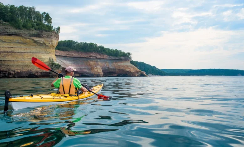
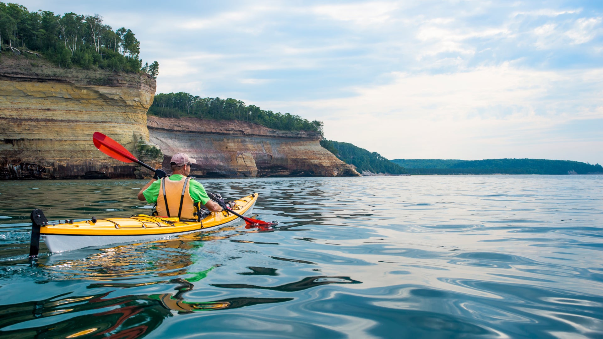
Paddling the Gitchi Gumee: A Comprehensive Guide to the Lake Superior State Water Trail. Lake Superior, the colossal heart of North America’s Great Lakes, stands as the world’s largest freshwater lake by surface area and the third largest by volume, holding an astounding ten percent of the Earth’s unfrozen fresh surface water. Its immense scale is such that it significantly influences regional weather patterns, akin to towering landmasses like Denali or Mount Everest. This majestic body of water forms a natural boundary between two nations—the United States and Canada—spanning across three U.S. states (Minnesota, Wisconsin, Michigan) and one Canadian province (Ontario). Long before these contemporary political borders were drawn, its rugged and pristine shoreline served as the ancestral home to numerous First Nations and Indigenous communities, whose deep connection to Gitchi Gumee, the "Great Water," continues to resonate today.
For those seeking an intimate and unparalleled exploration of this freshwater sea, the Lake Superior State Water Trail offers an extraordinary opportunity. This 150-mile paddling route navigates the Minnesota North Shore, commencing from the St. Louis Bay in Duluth and extending northeastward to the Pigeon River, marking the international border with Canada. It presents an immersive journey through a landscape defined by ancient geology, dense boreal forests, and secluded coves, revealing the profound beauty and raw power of one of the planet’s most significant natural resources.
Abby Halom, a seasoned paddling guide and co-founder of Day Tripper of Duluth, eloquently describes the trail’s profound appeal. "With its impressive basalt rock geology, sprawling forests, and many secluded beaches, it is one of the best ways to explore the lake from a completely different perspective," Halom remarked in an interview with Backpacker magazine. Having navigated extensive portions of the trail over her 17-year career, Halom’s company frequently curates custom itineraries and day trips along this iconic waterway. She shared invaluable insights into the trail’s offerings for paddlers, hikers, and anyone drawn to experience Lake Superior’s grandeur up close.
Historical and Geological Context: Billions of Years in the Making
Lake Superior’s origins are deeply rooted in geological time, a testament to billions of years of Earth’s dynamic processes. The lake occupies a vast basin carved primarily by glacial forces during the last Ice Age, approximately 10,000 to 12,000 years ago, as massive ice sheets retreated and scoured the ancient bedrock. However, the underlying geology tells an even older story. Much of the striking landscape visible along the North Shore, particularly the dramatic basalt cliffs and ancient rock formations, is a remnant of the Midcontinent Rift System. This monumental geological event, occurring about 1.1 billion years ago, saw the North American continent begin to split apart, creating a massive basin filled with volcanic rock and sediments. Subsequent erosion, faulting, and glacial activity sculpted this landscape over eons, resulting in the rugged cliffs, sea caves, and unique rocky formations that define the shoreline today. These billion-year-old rocks offer a tangible connection to Earth’s deep past, providing a breathtaking backdrop for the modern adventurer.
For millennia, this region has been inhabited by Indigenous peoples, including the Ojibwe (Anishinaabe), Dakota, and others, who revered Lake Superior as a source of life, sustenance, and spiritual significance. Their oral traditions, spiritual beliefs, and historical presence are deeply woven into the fabric of the land, with numerous sacred sites, ancient pictographs, and traditional trade routes existing along the very shores paddlers traverse today. The Ojibwe term "Gitchi Gumee" itself, meaning "Great Water" or "Great Sea," encapsulates the profound reverence and respect held for this powerful body of water. Understanding this deep historical and cultural context enriches the paddling experience, connecting adventurers to a heritage that predates contemporary colonial borders and offers a glimpse into a timeless relationship with the land and water.
The establishment of the Lake Superior State Water Trail by the Minnesota Department of Natural Resources (DNR) represents a modern effort to provide structured access and promote responsible recreation along this magnificent coastline. While Indigenous peoples have navigated these waters for thousands of years, the formalized trail, with its designated campsites and navigational aids, seeks to balance accessibility with the preservation of its wild character. This initiative aligns with broader conservation goals for the Great Lakes, recognizing Lake Superior not just as a recreational playground but as a vital ecological system requiring careful stewardship, particularly in the face of environmental challenges.
Navigating the Trail: A Segment-by-Segment Guide
The Lake Superior State Water Trail is meticulously structured into five distinct segments, each offering unique challenges and scenic rewards. While the entire 150-mile journey from Duluth to the Canadian border is a formidable undertaking, section paddling is a popular option, allowing adventurers to tailor their experience based on time, skill level, and desired immersion. Sea kayaks are strongly recommended for their stability, cargo capacity, and ability to handle the lake’s often-unpredictable conditions, including waves that can reach several feet in height. Paddlers must be prepared for self-supported camping for the majority of the trip, although a few points along the route offer limited opportunities for lodging in nearby towns, often requiring arrangements for kayak storage and transportation into town.
Segment 1: Duluth to Knife River Marina (27 miles)
The journey commences at Boy Scout Landing, strategically located near the Wisconsin-Minnesota border within Duluth’s St. Louis Bay. This initial 27-mile stretch offers a relatively gentle introduction to the trail, characterized by the protective embrace of the bay. A significant highlight is the passage through the St. Louis River estuary, recognized as the world’s longest freshwater sandspit system. This intricate maze of protected bays, islands, and calmer waters provides an ideal environment for beginner paddlers to hone their skills and explore diverse ecosystems. The estuary is a vital habitat for migratory birds, including various species of ducks, geese, and raptors, as well as a nursery for numerous fish species, offering excellent wildlife viewing opportunities before the open lake challenges begin. The segment concludes at the Knife River Marina, a small but functional stopover point.
Segment 2: Knife River to Split Rock Lighthouse State Park (30 miles)
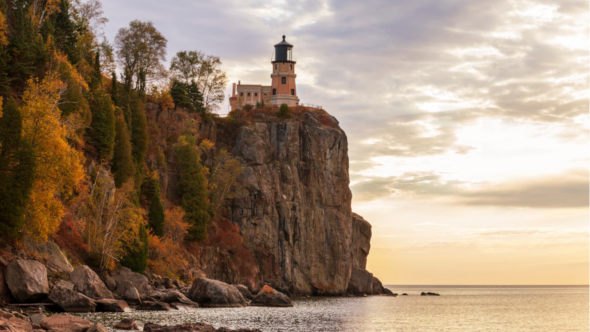
From Knife River, paddlers embark on the 30-mile second segment, heading towards the iconic Split Rock Lighthouse State Park. This section begins to reveal the dramatic basalt geology that characterizes much of the North Shore, with the shoreline becoming more rugged. Along the way, the charming town of Two Harbors emerges as a crucial resupply point. Its harbor, originally built for iron ore shipping in the late 19th century, now serves as a hub for recreational boaters and offers essential amenities, including a grocery store. This makes Two Harbors an indispensable stop for restocking provisions, accessing fuel, and perhaps enjoying a momentary break from the wilderness. The majestic Split Rock Lighthouse, a National Historic Landmark, perched atop a 130-foot cliff, serves as a prominent navigational landmark and a historical beacon, having guided ships and now paddlers since its construction in 1910 after a devastating storm.
Segment 3: Split Rock Lighthouse State Park to Schroeder (41 miles)
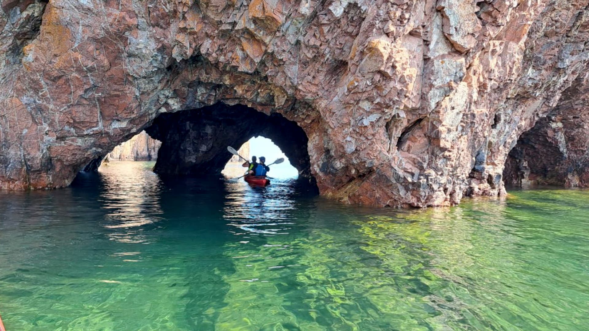
The third segment, spanning 41 miles, is one of the longest continuous stretches and takes paddlers from Split Rock Lighthouse State Park to the small community of Schroeder. This part of the trail is defined by its rugged beauty, with the shoreline primarily composed of ancient basalt outcrops and a succession of rocky beaches. Paddlers will experience the raw power of Lake Superior as they navigate alongside imposing cliffs, often seeing the geological layers laid bare by millennia of erosion and wave action. The relative lack of major towns or easy access points in this segment emphasizes the need for self-sufficiency and careful planning, as emergency pull-out options can be limited during adverse weather. The solitude offered here is profound, allowing for deep immersion in the natural soundscape of the lake.
Segment 4: Schroeder to Grand Marais (33 miles)
As the trail progresses into its fourth segment, covering 33 miles from Schroeder to Grand Marais, the landscape undergoes a subtle but noticeable transformation. While cliffs remain, the shoreline begins to offer distant, sweeping views of Minnesota’s majestic Sawtooth Mountains, a range sculpted by glacial activity and characterized by its distinct, jagged peaks. The forests become denser, dominated by a rich tapestry of pine, spruce, and fir trees, characteristic of the boreal forest ecosystem that thrives in this northern climate. Grand Marais, often dubbed "America’s Coolest Small Town" by various publications, serves as a vibrant cultural and logistical hub. Its picturesque harbor, thriving arts scene, and array of restaurants and outfitters make it an ideal place to refuel, rest, and immerse oneself in local culture before the final push north. It’s a popular spot for both local residents and tourists, offering a lively contrast to the trail’s wilderness.
Segment 5: Grand Marais to Pigeon Point (46 miles)
The fifth and final segment is the longest, a challenging 46-mile stretch connecting Grand Marais to Pigeon Point, located within the Grand Portage Indian Reservation at the Canadian border. This remote section offers some of the most profound solitude and wilderness experiences, traversing an area less developed and more rugged than previous segments. Public access points become significantly scarcer, with limited tent sites primarily available at the Grand Portage Lodge. Reservations are crucial for docking and overnight stays in this area, especially during peak season. It is imperative for paddlers to remember that the trail officially concludes at the Canadian border, necessitating proper identification and documentation, such as a valid passport, for legal entry into Canada if one intends to continue beyond Pigeon Point. This segment truly tests a paddler’s preparedness, navigation skills, and appreciation for unspoiled nature.
Expert Insights and Safety Considerations for the Gitchi Gumee
While the allure of a multi-day paddling expedition on Lake Superior is undeniable, the lake’s formidable nature demands respect and meticulous preparation. Abby Halom, with her extensive experience, underscores the importance of allowing ample time for the journey. "Experienced paddlers might be tempted to complete the trip in a few days, but Halom recommends setting aside at least three weeks for a full thru-paddle," she advises. This extended timeframe is not merely for leisure and appreciation of the scenery but, crucially, for safety.
Lake Superior is renowned for its capricious temperament and unpredictable weather patterns. "While the water can seem flat as glass, Lake Superior is feisty and erratic, so always plan a ‘zero day’ during bad weather," Halom cautions. Unlike smaller, more predictable waterways, Lake Superior can transition from calm, mirror-like conditions to violent squalls with alarming speed, generating significant waves (often 6 feet or more) and dangerous currents. A critical aspect of safety on this trail is the prevalence of cliff-lined shorelines in many segments. "Plus, a lot of the shoreline is along cliffs, so there’s nowhere to pull out if the weather turns," Halom explains, highlighting the serious implications of misjudging weather forecasts or underestimating the lake’s power. Her pragmatic rule of thumb is to aim for 10 to 15 miles of paddling per day, meticulously building in contingency days for inclement weather. This flexibility is not a luxury but a necessity for survival and enjoyment.
Beyond weather, paddlers must be prepared for cold water immersion, even in summer. Lake Superior’s average surface temperature rarely exceeds 60°F (15°C) and can be significantly colder, with deeper sections remaining near 39°F (4°C) year-round. Hypothermia remains a significant risk. Proper cold-water gear, including dry suits or wet suits, is essential, especially for spring and fall paddling. Furthermore, navigating such a vast body of water requires advanced paddling skills, including self-rescue techniques, strong bracing to handle waves, and effective group communication protocols. Knowledge of marine navigation, including chart reading, compass use, and GPS usage, is also highly recommended. Carrying an emergency communication device, such as a satellite messenger, personal locator beacon (PLB), or marine radio, is not just advisable but often critical given the remote nature and lack of cell service along much of the