
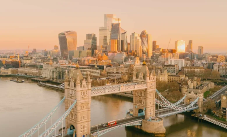
London, a sprawling metropolis defined by its centuries-old history and contemporary urban design, is increasingly being recognized for its walkability. Navigating the capital on foot provides a depth of experience that public transport cannot replicate, allowing visitors to engage directly with the city’s architectural evolution, green corridors, and cultural districts. As the city continues to prioritize pedestrian-friendly infrastructure, several established walking routes have emerged as essential itineraries for both domestic and international visitors. These paths range from the highly centralized, monument-heavy corridors to peripheral green belts that reveal a quieter, residential side of the city.

The Evolution of Urban Walkability in London
Urban planners in London have, over the last decade, shifted focus toward the "15-minute city" concept, encouraging residents and tourists to access key amenities on foot. According to data from Transport for London (TfL), walking accounts for approximately 25% of all journeys made within the Greater London area. This shift is supported by the creation of "Footways"—a network of pedestrian-focused streets that bypass the congestion of major arterial roads—and the expansion of the Capital Ring, which connects various open spaces through the outer boroughs.

1. The Central Landmark Corridor: A Historical Deep Dive
The most frequented walking route in London centers on the historic heart of the city, stretching from the royal residences of West London to the financial epicenters in the East. This route functions as a linear museum, connecting Kensington Palace, the Royal Albert Hall, and the museum quarter of South Kensington.

The chronology of this walk begins in the Victorian era, as visitors pass the Albert Memorial, before transitioning into the civic and political landmarks of Westminster. The path effectively highlights the contrast between the palatial grandeur of Buckingham Palace and the gritty, historic significance of Whitehall and Downing Street. The route continues toward the City of London, where the medieval street plans meet the modern glass facades of the financial district. Observers note that this path is essential for understanding the transition of London from an imperial capital to a global financial hub.

2. The Regent’s Canal: Industrial Heritage and Urban Regeneration
Regent’s Canal, which stretches from the Paddington Basin in the west to Limehouse in the east, offers a study in urban regeneration. Once the primary artery for goods transport during the Industrial Revolution, the canal towpath has been transformed into a primary pedestrian thoroughfare.

The route through Camden Lock provides a clear view of the shift in land use, where former warehouses and stables have been repurposed into vibrant marketplaces and high-end residential complexes. Data from the Canal & River Trust indicates that the towpaths are among the most heavily trafficked recreational routes in the UK, serving as both a commuting artery for local workers and a cultural destination for tourists visiting London Zoo and the surrounding parklands.

3. The Central London Circular: Mapping Civic Connectivity
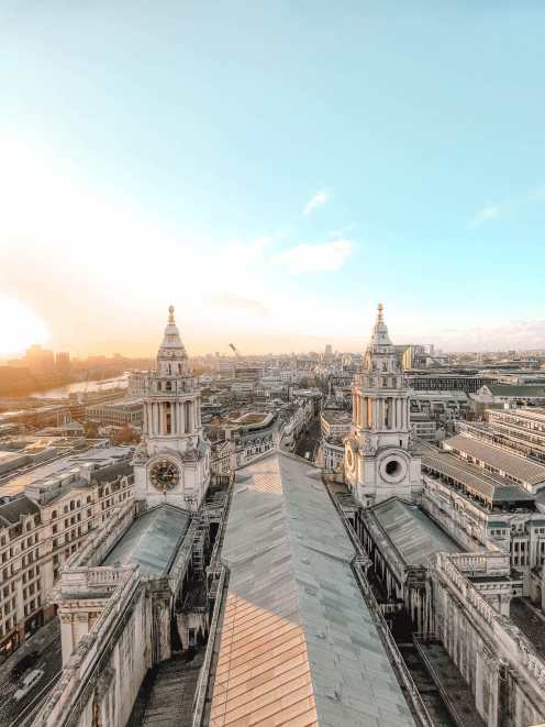
The Central London Circular is less of a rigid path and more of a conceptual framework designed to guide pedestrians through the dense network of the city’s most famous landmarks. It encapsulates the area surrounding St Paul’s Cathedral, the Royal Exchange, and the Sky Garden. The walk serves a dual purpose: it offers access to iconic architecture while providing a practical route through the narrow, historic alleyways that define the City of London.

Analysis of tourist movement patterns shows that visitors who utilize this circular route tend to spend 40% more time in local businesses and restaurants compared to those who remain within the confines of public transport transit hubs. This suggests that pedestrian-focused infrastructure has a measurable positive impact on local economic activity.

4. The Thames Path: A National Trail within a Global City
The Thames Path is a 185-mile long-distance trail, but the portion traversing London is perhaps the most diverse segment. Starting in Greenwich, the path offers a unique perspective on the city’s maritime past, including the Royal Naval College and the Cutty Sark. As the path moves west toward Battersea, it showcases the massive investment in riverside infrastructure, most notably the redevelopment of the Battersea Power Station.

The implications of this route are significant; the path acts as a vital link between the historic east and the affluent west, effectively erasing the perceived "boundaries" that once separated different social and economic classes within the capital. Experts in urban geography note that the Thames Path is a primary example of how environmental policy and public access initiatives can successfully integrate natural features into a hyper-dense urban environment.

5. The Line: Integrating Art and Public Space
The Line is a relatively new, ambitious walking route in East London that focuses on contemporary art installations. Unlike the historical-focused walks, The Line is a deliberate effort to use public art as a catalyst for urban development in the areas surrounding the O2 Arena and the Queen Elizabeth Olympic Park.

The route showcases how the legacy of the 2012 Olympic Games has been maintained through the creation of new museums and cultural centers, such as the V&A East Storehouse. The inclusion of these institutions along the route has drawn a new demographic of visitors to East London, diversifying the tourism economy away from the saturated central areas.
6. The Capital Ring: Exploring the Outer Boroughs
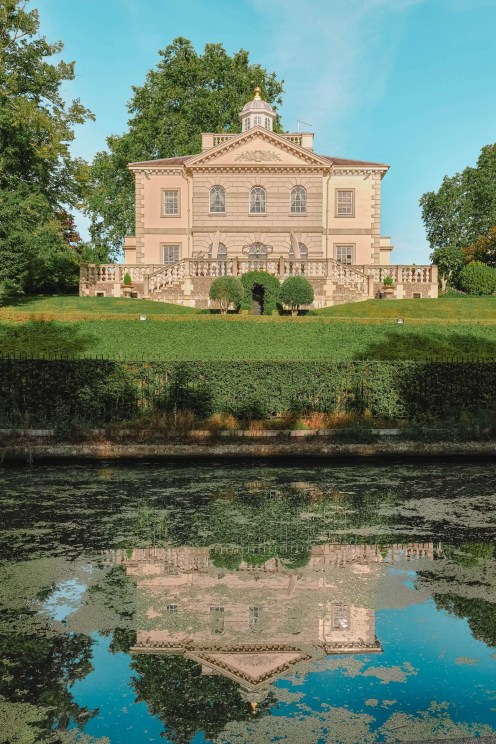
For those seeking to understand the sheer scale of London, the 78-mile Capital Ring offers an alternative to the crowded city center. This route circumnavigates the city, passing through suburban woodland, parks, and protected green belts. It serves as a reminder that London is one of the world’s "greenest" cities, with over 47% of its total area consisting of green space.

The route is segmented by TfL into smaller, manageable sections, allowing visitors to explore areas like Crystal Palace or the Thames Barrier at their own pace. The implication of this route is the decentralization of tourism; by providing well-mapped paths in the outer boroughs, the city aims to reduce the strain on central transit infrastructure while promoting local tourism in lesser-known areas.
7. The Green Link: Connecting North and South
The Green Link Walk acts as a cross-city connector, running from the northern reaches of Epping Forest down to the southern district of Peckham. This route is designed to highlight the "green corridors" that thread through the city, often overlooked by visitors focused on high-density landmarks.

By linking London Fields with Burgess Park, the route provides a unique view of the city’s residential neighborhoods. The, at times, stark contrast between these green spaces and the urban density of the central districts provides a holistic view of London’s complex urban fabric.

8. The Jubilee Walkway: A Legacy of Commemoration
Established to commemorate the Silver Jubilee of Queen Elizabeth II in 1977, the Jubilee Walkway is a 15-mile route that focuses heavily on royal and civic history. It acts as a permanent record of the city’s pageantry, connecting the Tower of London to Buckingham Palace.

The significance of this route lies in its curation; it is designed to be accessible to those with limited time who still wish to see the most iconic aspects of London’s royal history. The path is meticulously signposted, reflecting a long-standing commitment by the city to maintain its historical narratives within the modern streetscape.

Broader Implications and Future Outlook
The increasing popularity of these walking routes suggests a permanent shift in how London is consumed by its visitors. As global travel trends move toward more sustainable and experiential tourism, these walks provide a framework for a lower-carbon, more engaging way to see the city.

The economic implications are clear: walkable cities foster greater interaction with local markets and independent businesses. Furthermore, the focus on these routes allows for better crowd management, as visitors are naturally distributed across a wider geographical area rather than being concentrated at a few major bottlenecks.

As the city continues to invest in pedestrian infrastructure, the integration of these walking routes into standard tourism marketing will likely increase. This development represents a maturing of London’s tourism sector, moving away from purely destination-based travel to a model that emphasizes the journey as much as the destination itself. By providing clear, safe, and historically rich pathways, London is effectively re-branding itself not just as a city of monuments, but as a city of streets, squares, and green spaces, each offering a unique window into the life of the capital.