Urban Escapes: A Comprehensive Guide to Europe’s Best City-Adjacent Hiking Trails

For urban dwellers and international travelers alike, the juxtaposition of dense metropolitan centers and untamed wilderness remains one of Europe’s most defining characteristics. While many global capitals prioritize industrial growth and infrastructure, several European cities maintain a unique synergy with their surrounding topography, offering world-class hiking trails within minutes of their historic cores. This proximity allows for a unique intersection of leisure, exercise, and environmental immersion, catering to a growing demographic of eco-conscious tourists and active residents.
Sörmlandsleden: The Wilderness at Stockholm’s Doorstep
The Sörmland Trail, or Sörmlandsleden, represents a significant achievement in urban planning and conservation. Spanning over 600 miles (approximately 1,000 kilometers) across the Södermanland province, the trail network is uniquely accessible, with entry points located as close as the Björkhagen metro station in Stockholm.
The trail’s history dates back to its official establishment in 1973, when local outdoor enthusiasts sought to create a continuous path through the region’s diverse landscape of lakes, forests, and coastal cliffs. The system is divided into nearly 100 individual stages, ranging from one to 13 miles, allowing for both brief day trips and multi-day trekking excursions. According to trail organizers, the maintenance of the network relies heavily on a combination of regional municipal funding and volunteer stewardship. The implication for hikers is clear: while the trail offers deep-forest solitude, it is serviced by a network of rudimentary shelters, though the Swedish "Allemansrätten" (Right of Public Access) encourages responsible wild camping, provided hikers adhere to strict leave-no-trace protocols.
The Zurich Planet Trail: An Educational Odyssey
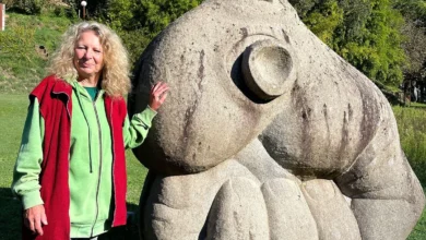
In Switzerland, the intersection of urban lifestyle and outdoor recreation is exemplified by the Planet Trail, which runs along the ridge of the Uetliberg mountain. This trail, managed by the Zurich transit authority and scientific partners, serves as a scale model of our solar system.
The trail represents a 1:1,000,000,000 scale model, where every meter walked corresponds to one million kilometers in space. Stretching from the Uetliberg summit to the Felsenegg vantage point, the hike is approximately 3.5 miles long. From a planning perspective, this trail offers a low-intensity, family-friendly experience that emphasizes pedagogical engagement. Data from local tourism offices indicates that the trail experiences peak traffic during the spring and autumn months, serving as a vital artery for the region’s weekend recreational tourism.
Arthur’s Seat: The Geological Sentinel of Edinburgh
Edinburgh’s skyline is dominated by Arthur’s Seat, an extinct volcano that rises 823 feet above sea level. Situated within Holyrood Park, this site provides a rare, direct connection between the city’s medieval history and its geological origins. Archaeological surveys suggest that the hill has been a site of human activity for at least 2,000 years, with evidence of early iron-age fortifications still visible on the summit.
The site is currently managed by Historic Environment Scotland. Due to the high volume of foot traffic—estimated in the hundreds of thousands annually—the park service has implemented rigorous trail maintenance programs to prevent erosion. The climb is classified as moderate to steep, with the Salisbury Crags providing a dramatic, albeit challenging, approach for experienced hikers. The park’s proximity to the Royal Mile underscores the integration of the Scottish capital with its natural surroundings.
Mount Parnitha: Athens’ Ancient Refuge
Located roughly 20 miles north of Athens, Mount Parnitha National Park provides a critical ecological buffer for the Greek capital. The mountain is home to a vast biodiversity, including red deer, which have seen a population resurgence due to protected status programs initiated in the late 20th century.
The park features 12 primary marked trails, ranging in difficulty and length. These paths lead to two prominent refuges, Bafi and Flambouri, which serve as essential hubs for hikers seeking rest. Historically, these refuges have functioned as both emergency shelters and social centers, reinforcing a local culture of mountain hospitality. Given the increasing frequency of heatwaves in the Mediterranean, the forest canopy of Parnitha provides a necessary cooling effect for the region, highlighting the environmental importance of protecting such peri-urban wild spaces.
The Dublin Mountains Way: Ireland’s Strategic Connectivity
The Dublin Mountains Way, a 25-mile trail system inaugurated in 2010, was designed to bridge the gap between urban Dublin and the Wicklow Mountains. The project was a collaborative effort between the Dublin Mountains Partnership—a group including the National Parks and Wildlife Service, Coillte (the Irish Forestry Board), and local councils.
The trail is segmented into three distinct sections: Shankill to Three Rock, Three Rock to the Hell Fire Club, and the Hell Fire Club to Tallaght. Analysis of the trail’s usage patterns suggests that it has significantly reduced the carbon footprint of outdoor enthusiasts by providing accessible trailheads via public transit. The "Fairy Castle" peak, the highest point on the route, remains the most popular destination, offering panoramic views of the Irish Sea and the city of Dublin.
Medvednica: The Alpine Lung of Zagreb
Zagreb’s relationship with Mount Medvednica is foundational to the city’s identity. As a protected nature park, the mountain serves as a hub for both summer hiking and winter skiing. The trail system is extensive, featuring well-marked paths that cater to various fitness levels, such as the Leustek trail.
A unique feature of the Medvednica experience is the presence of traditional mountain lodges, or "planinarski dom," which provide essential services, including hot meals and overnight accommodations. This infrastructure has been credited with maintaining the mountain’s popularity across generations. The accessibility of the peak, Sljeme, via road and public transport, ensures that the mountain remains a vital recreational resource for the city’s nearly 800,000 residents.
Barlindåsen Ridge: Oslo’s Accessible Peak
Norway’s capital is synonymous with outdoor culture, and the Barlindåsen Ridge hike is a testament to this ethos. Located 30 minutes from Oslo’s city center, the 3.5-mile loop is characterized by its moderate incline and high reward-to-effort ratio.
From a seasonal perspective, the trail is most active between May and October. During the late summer, the presence of wild blueberries, which are free for public foraging, adds an agricultural dimension to the hiking experience. The Norwegian Trekking Association (DNT) emphasizes that the trail’s maintenance is essential for preserving the local ecosystem, particularly as climate change alters the growth patterns of the surrounding vegetation.
The Goetheweg: Alpine Access in Innsbruck
Innsbruck stands as a premier example of high-altitude accessibility. The Nordkettenbahn cable car system, which originates in the city’s historic Altstadt, transports visitors to an elevation of 7,657 feet in less than 20 minutes.
The Goetheweg ridge trail offers an alpine experience that would otherwise require hours of strenuous ascent. However, the descent back into the city, which involves an elevation drop of over 5,000 feet, poses a significant physiological challenge. Local medical professionals and mountain guides frequently advise the use of trekking poles to mitigate the impact of such a steep, sustained descent on the joints. This trail illustrates the technical requirements of high-alpine hiking and the necessity of appropriate gear, even when starting from a city center.
The Peninha Trail: Lisbon’s Coastal History
Lisbon’s proximity to the Sintra-Cascais Natural Park allows for a unique blend of cultural tourism and coastal trekking. The trail network, which connects the train station in Sintra to the westernmost point of continental Europe, Cabo da Roca, spans approximately 10 miles.
The trail passes through significant historical sites, including the Moorish Castelo dos Mouros and the 19th-century Pena Palace. This combination of protected natural land and UNESCO World Heritage sites presents a complex management challenge. The Sintra-Cascais Natural Park Authority has implemented strict conservation measures to mitigate the environmental impact of heavy tourism. Hikers are encouraged to remain on marked paths, as the shifting Atlantic weather and the fragility of the coastal cliffs necessitate a cautious and disciplined approach to exploration.
Conclusion: The Future of Urban Hiking
The integration of these trails into the urban fabric of Europe’s capitals is not merely a convenience; it is a strategic asset for public health and environmental education. As cities continue to expand, the preservation of these peri-urban green belts will become increasingly vital. The evidence suggests that providing citizens with direct, low-barrier access to nature fosters a stronger commitment to environmental stewardship and provides a necessary counterbalance to the stresses of modern metropolitan life. Whether through the historic paths of Athens or the geological marvels of Edinburgh, the connection between city and trail remains a cornerstone of the European urban experience.
Related posts: