Beyond the Crowds: Discovering the Unspoiled Trails and Coastal Wilderness of San Luis Obispo County

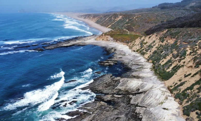
When travelers envision a California hiking expedition, iconic destinations such as Yosemite National Park, the towering redwood forests of the north, or the dramatic cliffs of Big Sur invariably dominate the conversation. These world-renowned landscapes attract millions of domestic and international visitors annually, cementing their status as crown jewels of the American West. However, this immense popularity often comes with severe logistical challenges, including bumper-to-bumper traffic along scenic corridors, fiercely competitive reservation systems for campgrounds, and packed trailheads where solitude is virtually impossible to find. For outdoor enthusiasts seeking an alternative that balances breathtaking natural beauty with tranquility, the less congested coastline of San Luis Obispo County offers a compelling Pacific Coast escape.
Stretching along a diverse and remarkably preserved section of Highway 1, the San Luis Obispo (SLO) coast provides access to scores of meticulously maintained trails, uncrowded public wilderness lands, and panoramic vistas that rival its more famous northern neighbors. Far from the frantic pace of major metropolitan tourist hubs, this region invites visitors to experience rolling hills blanketed in golden spring wildflowers, observe marine mammals thriving in protected coastal reserves, and explore a versatile network of short- and long-distance routes. These outdoor adventures seamlessly integrate with a classic California road trip, offering a harmonious blend of rugged wilderness exploration, culinary sophistication, and accessible coastal lodging.
Geological History and Environmental Significance of the SLO Coast
The unique topography of San Luis Obispo County is the product of millions of years of complex tectonic activity, marine sedimentation, and volcanic processes. Situated within the Central Coast region of California, the area acts as a transitional ecological zone where northern and southern flora and fauna overlap. The defining geological features of the coastline—including dramatic headnotes, marine terraces, and offshore sea stacks—were forged by the relentless wave action of the Pacific Ocean acting against ancient, uplifted sea floors.
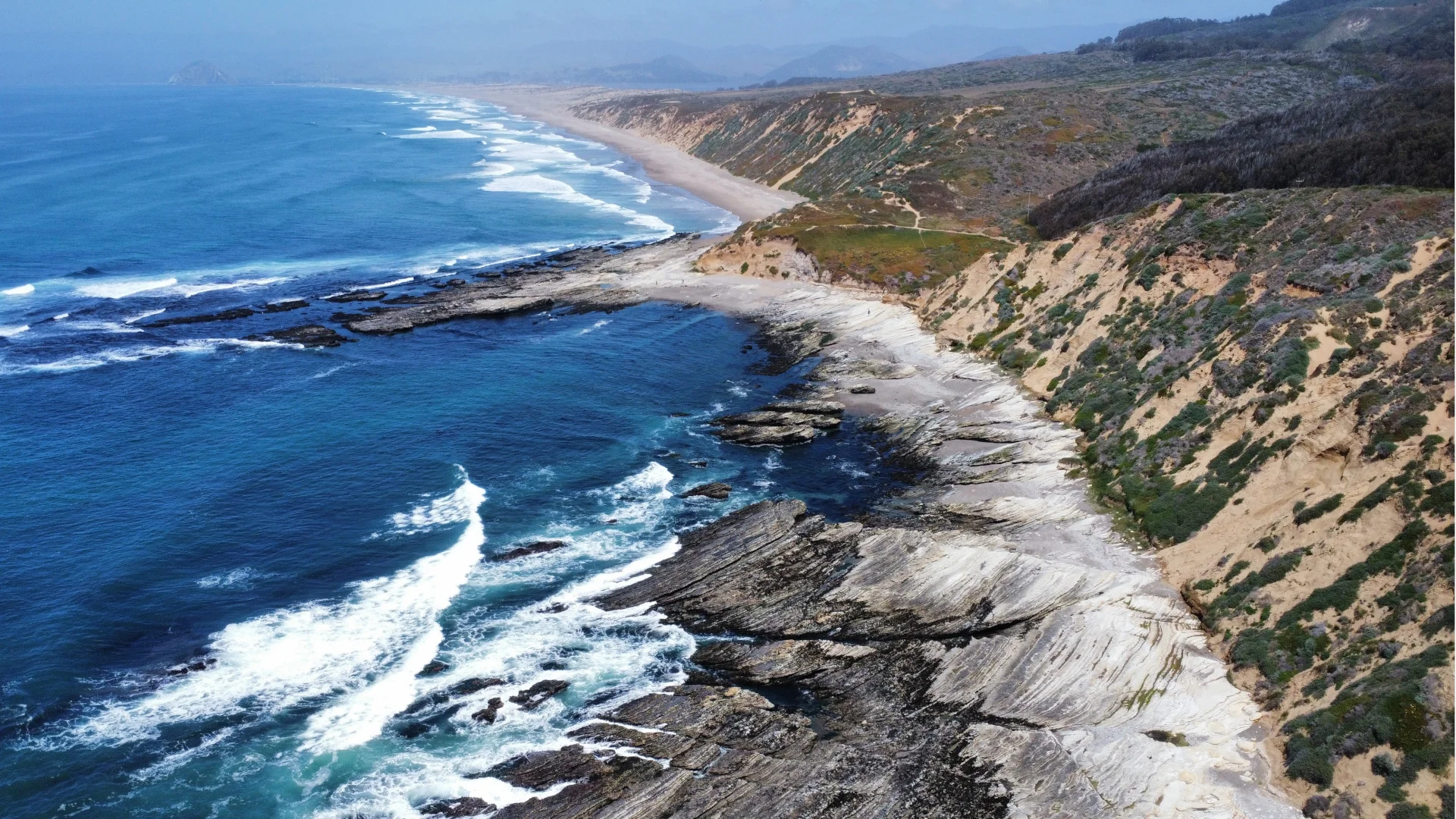
Inland, the landscape is heavily influenced by the Santa Lucia Range, a rugged sub-range of the California Coast Ranges. These mountains run parallel to the coast, trapping marine fog that nourishes coastal scrub, dense riparian corridors, and rare maritime chaparral communities. Furthermore, the region features distinct volcanic remnants known as the Morro Seven Sisters, a chain of ancient volcanic plugs that stretch from the city of San Luis Obispo out to the iconic Morro Rock in Morro Bay. This geological diversity has created a mosaic of microclimates, supporting an extraordinary biodiversity that includes hundreds of resident and migratory bird species traveling along the Pacific Flyway, as well as endangered species such as the western snowy plover.
Traversing Montaña de Oro State Park via Hazard Peak
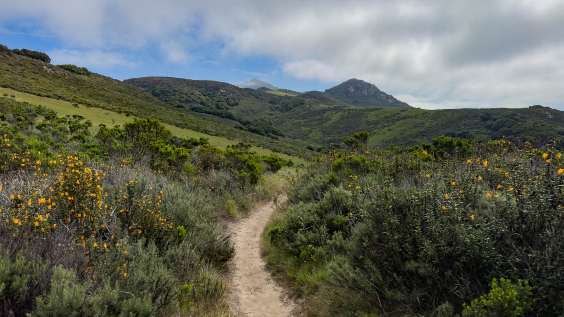
Among the crown jewels of the SLO coast is Montaña de Oro State Park, located in Los Osos. Spanning over 8,000 acres of rugged cliffs, secluded sandy beaches, and canyons, the park derives its name—meaning "Mountain of Gold"—from the vibrant display of yellow wildflowers, including California poppies, deerbrush, and wild mustard, that paint the hillsides every spring.
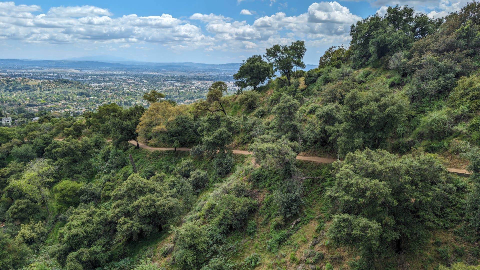
For hikers seeking a comprehensive overview of the park’s diverse ecosystems, the Hazard Peak Trail offers a premier 6.1-mile reverse lollipop route. Beginning at the Hazard Peak Trailhead off Pecho Valley Road, the trail ascends steadily through coastal scrub and riparian woodlands toward Hazard Peak. From this vantage point, hikers are treated to sweeping views of the Morro Bay estuary and the open ocean.
Rather than executing a simple out-and-back trek, route planners can descend via the Canyon View Trail, navigating a series of short switchbacks that intersect with Islay Creek Road. This configuration deposits hikers just a short distance from the original trailhead. For those desiring a more strenuous physical challenge, an extended 11-mile loop variant encompasses the entirety of the Hazard Peak trail system, testing endurance while maximizing scenic exposure.
Ascending Duna Vista in the Lopez Lake Recreation Area
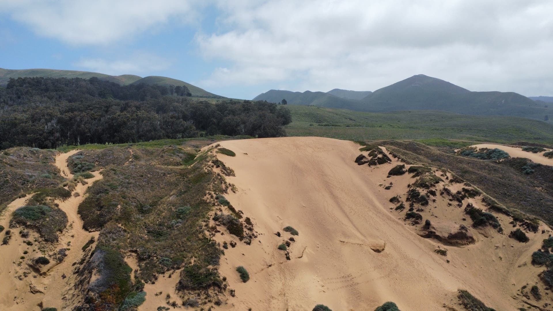
Moving inland toward the foothills of Arroyo Grande, the Lopez Lake Recreation Area provides an entirely different perspective on the region’s topography. The Duna Vista Trail, an 8.9-mile split out-and-back route, challenges hikers with a demanding climb along the western ridge of the county park.
The journey commences on the Wittenberg Trail near the terminus of Lopez Drive, eventually transitioning onto the Duna Vista Loop Trail. As hikers progress, the surrounding environment shifts from oak-studded rolling hills to a more exposed ridge line. Wildlife encounters are a frequent occurrence in this habitat, with mule deer, various raptors, and occasional black bears navigating the dense brush.
The climax of the hike involves a steep, determined push up the Duna Vista Spur Trail to the peak. The physical exertion is rewarded with expansive 360-degree panoramas. To the west, visitors can observe the shifting sands of the Oceano Dunes and the vast expanse of the Pacific Ocean; to the east, the rugged horizons of the Santa Lucia, Caliente, and Sierra Madre mountains unfold. Park authorities require a $12 per-vehicle day-use fee to access the recreation area, funds that directly support trail maintenance and wildlife conservation efforts.
Coastal Immersion Along the Estero Bluffs Trail
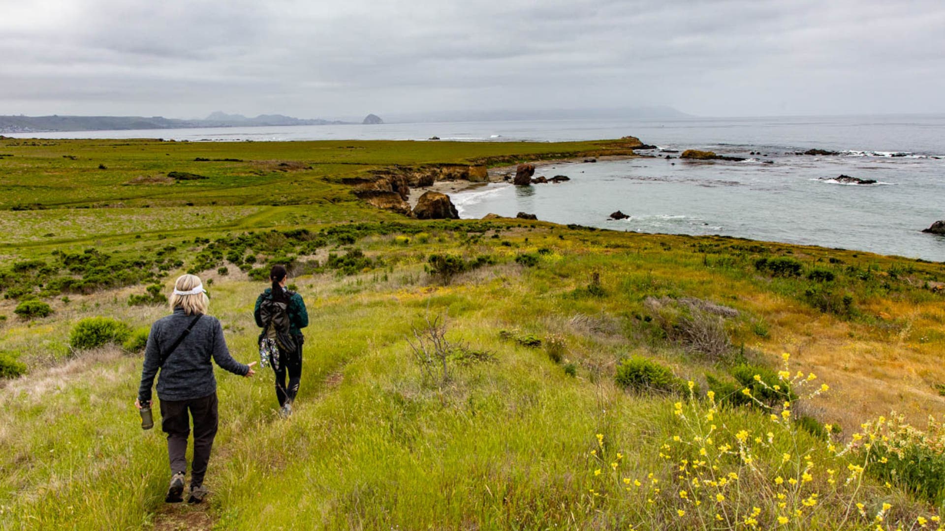
For travelers prioritizing marine wildlife observation and historical coastal landscapes over grueling elevation gains, the Estero Bluffs State Park provides an ideal excursion. Located near the community of Cayucos, the Estero Bluffs Trail is a relatively flat, 7-mile out-and-back walk that hugs the shoreline.
Beginning at the North Ocean parking lot, the trail meanders along marine terraces carved by ancient sea levels. Because the route offers constant proximity to the water, conservation officials recommend allocating ample time to explore the intertidal zones during low tide, when tide pools reveal vibrant marine organisms. The bluffs serve as a reliable haul-out site for harbor seals and sea lions, while the adjacent sandy beaches and wetlands provide critical nesting habitat for the threatened western snowy plover. Equipping oneself with binoculars is essential for avian observation without disturbing sensitive wildlife populations.
Exploring Volcanic Vistas in Morro Bay State Park
Morro Bay State Park offers a synthesis of estuarine ecology and volcanic geology through its Quarry and Live Oak Loop. Spanning approximately 4.7 miles, this loop trail guides visitors across rolling hills that overlook the expansive Morro Bay estuary and the striking silhouette of Morro Rock, a 581-foot volcanic plug that serves as a navigational landmark for mariners and a protected sanctuary for peregrine falcons.
The route begins at the designated parking area on South Bay Boulevard, utilizing the Quarry Trail before connecting sequentially to the Canet, Chumash, Crespi, Park Ridge, and Live Oak trails. This configuration leads hikers through a transitional landscape that shifts rapidly from exposed coastal scrub to shaded groves of coast live oaks.
To tailor the hike to specific fitness levels, visitors can incorporate side routes, such as an optional ascent to the Portola Trail summit, which introduces an additional mile of walking and heightens the panoramic reward. A standard California State Park day-use fee of $8 is required for vehicle entry, contributing to the upkeep of the park’s extensive interpretive trail network.
Venturing Deep into the Santa Lucia Wilderness
Hikers seeking a more remote, backcountry experience can look inland to the Santa Lucia Wilderness, a federally protected area contained within the Los Padres National Forest. The Big Falls Trail presents a rugged, 5.4-mile out-and-back journey that culminates at an 80-foot seasonal waterfall spilling into a clear, shaded pool.
Access to the trailhead begins via Upper Lopez Canyon Road, a route notorious for its unpaved, rough conditions that necessitate high-clearance four-wheel-drive vehicles. Once on foot, the trail winds gently through a dense riparian canyon defined by bigleaf maples, bay laurels, and coast live oaks. As hikers advance past the initial series of lower cascades toward the primary waterfall, the terrain becomes steeper and more demanding. Pushing beyond the falls rewards travelers with elevated vistas looking out over the densely folded ridges of the southern Coast Ranges.
Culinary Arts and Agritourism in San Luis Obispo County
Beyond the trailheads, the SLO coast has cultivated a thriving culinary and agricultural scene that emphasizes sustainability, local sourcing, and regional terroir. The region’s agricultural heritage is deeply intertwined with its winemaking industry, particularly in micro-appellations like the Edna Valley. Winemakers in the area have increasingly embraced organic and regenerative farming practices to preserve the watershed and soil health, drawing oenophiles from around the globe to vineyards such as Chamisal Vineyards.
Dining options mirror this farm-to-table ethos. Establishments like Gardens of Avila, situated within the Sycamore Mineral Springs Resort and Spa, incorporate homegrown herbs and regionally sourced produce into contemporary menus, providing patrons with an immersive dining experience complemented by surrounding garden pathways.
Furthermore, the distinct character of the coastal communities enhances the visitor experience. Los Osos functions as a quiet hub for local artists, independent coffee roasters, and artisan boutiques. Avila Beach offers a quintessential sunny waterfront atmosphere, while Cayucos retains the nostalgic charm of a historic 19th-century coastal town complete with vintage boardwalks, antique shops, and local bakeries.
Infrastructure, Regulations, and Lodging Accommodations
Managing tourism along the fragile Highway 1 corridor requires a delicate balance between public access and environmental protection. State and local park authorities have established clear guidelines regarding overnight stays and camping to mitigate human impact on sensitive coastal and mountain ecosystems.
Developed campgrounds are available within several state park units, including Montaña de Oro, Morro Bay, and Estero Bluffs. However, due to high demand and seasonal closures during the winter months, securing reservations well in advance is critical. For travelers seeking alternative options, dispersed camping is strictly prohibited along the immediate Highway 1 corridor. Visitors must utilize designated mountain zones for dispersed camping, such as specific corridors within the Los Padres National Forest, TV Tower Road, Carrizo Plain National Monument, or the Williams Hill Recreation Area.
For those preferring permanent lodging over outdoor camping, San Luis Obispo and its surrounding municipalities offer a diverse array of accommodations, ranging from historic boutique hotels to bed-and-breakfasts. Among the notable properties is La Lomita Ranch, a repurposed historic equestrian estate featuring traditional terracotta tilework, courtyards, and active stables, exemplifying the distinct architectural and cultural heritage of California’s Central Coast.