The Tiltrock Loop: Pennsylvania and Maryland Debut a Brand-New 300-Mile Thru-Hike Across Five Historic Trails


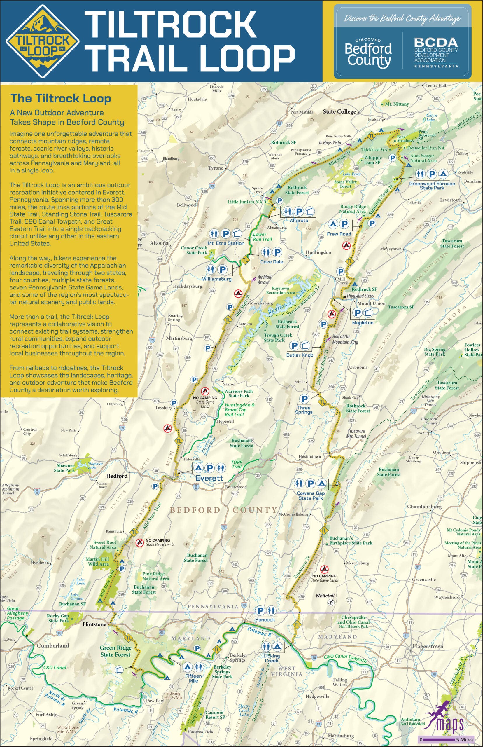
Thru-hikers seeking a fresh challenge beyond the well-worn paths of the Appalachian Trail now have a sweeping new destination. Spanning 300 miles across the rocky ridgelines and deep forest canopies of south-central Pennsylvania and northern Maryland, the newly minted Tiltrock Loop offers an ambitious continuous-circuit backpacking route. Officially unveiled to the public, the trail weaves together segments of five established pathways—the Great Eastern Trail, the Mid State Trail, the Tuscarora Trail, the Standing Stone Trail, and the C&O Canal Towpath—creating an entirely integrated journey that has yet to be officially conquered from end to end.
Designed to appeal to backpackers looking for a rigorous expedition without the multi-month commitment required for transcontinental routes like the Appalachian Trail or the Pacific Crest Trail, the Tiltrock Loop bridges rugged wilderness with accessible logistics. Best of all, because the trail is entirely brand new, the first person to complete a thru-hike will instantly lay claim to the Fastest Known Time (FKT) for the route.

Genesis of a Route: How the Tiltrock Loop Was Formed
The creation of the Tiltrock Loop is rooted in grassroots observation and inter-agency collaboration. The project began when local hiker Mike Teeter identified a logistical quirk in the regional trail network. A recent rerouting of the expansive 1,800-mile Great Eastern Trail had inadvertently aligned with several intersecting regional paths, forming a natural geographical circuit.
To the west, the route leverages the C&O Canal and Mid State trails; to the east, it utilizes the Tuscarora and Standing Stone trails. Recognizing the potential to showcase the dramatic geography of the Allegheny Mountains, Teeter brought his vision to the Bedford County Outdoor Recreation Alliance. What followed was a rare alignment of interests among regional stakeholders, conservation groups, and state agencies.
Jennifer Marsh, head of the Bedford County Development Association, highlighted the unprecedented speed with which the project gained consensus. In a region where trail maintenance and route planning typically involve prolonged bureaucratic negotiations, securing the cooperation of five distinct trail associations was remarkably swift. According to Marsh, the universal enthusiasm from local organizations set a benchmark for regional outdoor recreation development.

Anatomy of the Trail: Terrain, Elevation, and Highlights
Named after the distinctively slanted Allegheny ridgelines that define the topography of south-central Pennsylvania, the Tiltrock Loop presents a demanding physical profile. According to official route data, the 300-mile loop accumulates a staggering 33,372 feet of total elevation gain, topping out at a maximum elevation of 2,727 feet.
The terrain varies dramatically, taking hikers across exposed, rocky ridgelines, through dense, secluded forests, and down into historic river valleys. Along the way, the trail serves as an open-air museum of the region’s industrial past. Thru-hikers will encounter remnants of 19th- and 20th-century mining operations, as well as abandoned engineering infrastructure from a never-completed railroad project that cuts through the mountains.
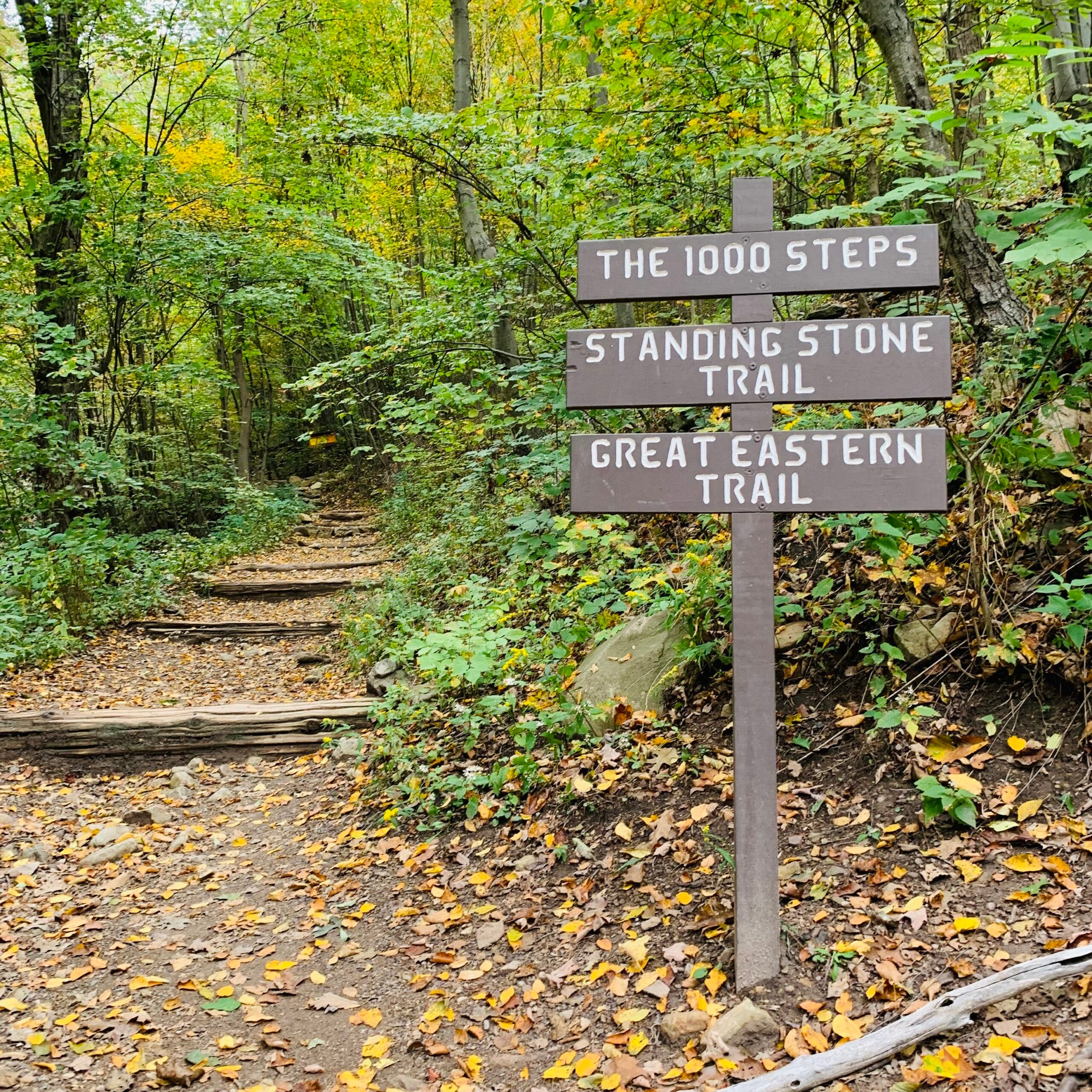
Notable landmarks along the route include the famous Thousand Steps on the Standing Stone Trail, expansive overlooks along the Standing Stone ridgelines, and the historic towpaths flanking regional waterways. To help navigators safely traverse the changing landscape, the Bedford County Outdoor Recreation Alliance partnered with Purple Lizard Maps. The Pennsylvania-based cartography firm has integrated its signature mapping markers into the official guide, identifying critical resources such as reliable water sources, designated campsites, and resupply waypoints.
Logistical Realities and Preparation for Thru-Hikers
While the loop format eliminates the complex, expensive vehicle shuttling required for linear trails like the Appalachian Trail, tackling the Tiltrock Loop requires careful preparation. Trail associations and mapmakers advise backpackers to approach the 30-day journey with self-reliance in mind.
Water availability along the ridgelines fluctuates significantly depending on seasonal rainfall and weather patterns. Consequently, organizers recommend that hikers carry a minimum of three liters of water per day and maintain a food supply capable of sustaining them for three to five days between resupply points.
Accommodations along the route vary, offering a mix of established backcountry shelters, primitive campsites, and designated wilderness areas. Because parts of the loop cross Pennsylvania State Game Lands and public conservation areas, hikers must strictly adhere to local camping regulations and seasonal restrictions clearly marked on the official Purple Lizard map.
Economic Impact and the Rise of Everett as a Trail Town
Beyond its wilderness appeal, the Tiltrock Loop is engineered to foster a symbiotic relationship between outdoor recreation and local economic development. Municipal leaders deliberately structured the route to draw visitors directly into regional communities rather than bypassing them.
Brooke Kelly, executive director of Discover Bedford County, emphasized the intentionality behind the route design. The goal, Kelly noted, was not merely to encourage motorists to drive through the county, but to invite travelers to experience the landscape and local culture mile by mile. By anchoring the loop around the growing trail town of Everett, Pennsylvania, the route provides a functional gateway for both thru-hikers and weekend segment-hikers.
Situated remotely along the Mid State Trail, Everett has transformed into a critical sanctuary for long-distance backpackers. The town offers essential amenities that can be difficult to find in rural stretches, including family-owned restaurants, lodging, grocery supplies, ice-cold trailside refreshments, and laundromats. Furthermore, Everett serves as an ideal base camp for visitors seeking shorter excursions, such as the local Everett Ridge section or the family-friendly Tenley Park Loop.

Broader Implications and Future Outlook
The launch of the Tiltrock Loop arrives at a time of rising demand for diversified outdoor recreation opportunities in the Mid-Atlantic region. As traditional long-distance trails experience increasing congestion, regional loops like Tiltrock offer a sustainable alternative that distributes foot traffic across a wider geographic footprint.
Furthermore, the collaborative framework used to establish the trail serves as a potential model for future multi-jurisdictional outdoor initiatives. By uniting five separate trail maintenance organizations—each with its own governance, volunteer base, and operational priorities—under a single unified banner, the creators of the Tiltrock Loop have demonstrated the viability of large-scale regional trail integration.
As the trail enters its inaugural season, anticipation is building within the national hiking community. With no recorded thru-hikes yet logged, the route stands as one of the last great frontier challenges in Eastern long-distance backpacking. For the first intrepid soul to complete the circuit, the reward will extend far beyond the scenic vistas of Bedford County—they will cement their name in the history of American trail sports by establishing the very first Fastest Known Time on the Tiltrock Loop.