
The California Central Coast: A Comprehensive Guide to the 350-Mile Journey from Ventura to Monterey Bay
The California Central Coast represents one of the most iconic stretches of coastline in the world, spanning approximately 350 miles from Point Mugu in Ventura County to the southern edge of Monterey Bay. Positioned strategically between the global hubs of Los Angeles and San Francisco, this region serves as a vital corridor for both domestic tourism and international travelers seeking the quintessential "Golden State" experience. Predominantly navigated via California State Route 1—popularly known as Highway 1 or the Pacific Coast Highway—the Central Coast is characterized by a diverse tapestry of marine sanctuaries, agricultural heartlands, historic Spanish missions, and rugged coastal cliffs.
For decades, the region has been a focal point for conservation and tourism development. While many visitors approach the drive as a singular "bucket-list" road trip, the geography of the Central Coast allows for a segmented exploration of distinct micro-regions, each offering a unique set of ecological and cultural characteristics. The following report provides an in-depth analysis of the logistics, attractions, and socio-economic significance of this coastal expanse.
Infrastructure and Logistics: The Lifeline of Highway 1
Traveling the Central Coast necessitates a personal vehicle, as public transit options between the rural and coastal townships are limited. The infrastructure is anchored by Highway 1, a feat of engineering that frequently hugs the edge of the Pacific Ocean. Logistically, tourism experts and regional transit authorities often recommend a north-to-south trajectory—traveling from San Francisco toward Los Angeles. This orientation places the vehicle in the lane closest to the ocean, providing unobstructed views and easier access to the numerous "turn-outs" or scenic overlooks designed for photography and wildlife observation.
The maintenance of this corridor is a significant undertaking for Caltrans (the California Department of Transportation). The region is geologically active and prone to landslides, particularly in the Big Sur sector. Recent infrastructure projects have focused on restoring full access to Highway 1 following significant winter storm damage in 2023 and early 2024. The reopening of these segments has been a critical milestone for the regional economy, which relies heavily on the steady flow of road-trip traffic.
Regional Analysis: The Southern Gateway – Ventura and the Channel Islands
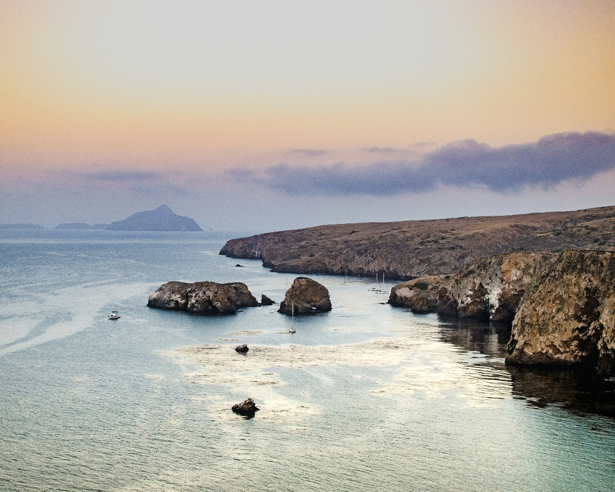
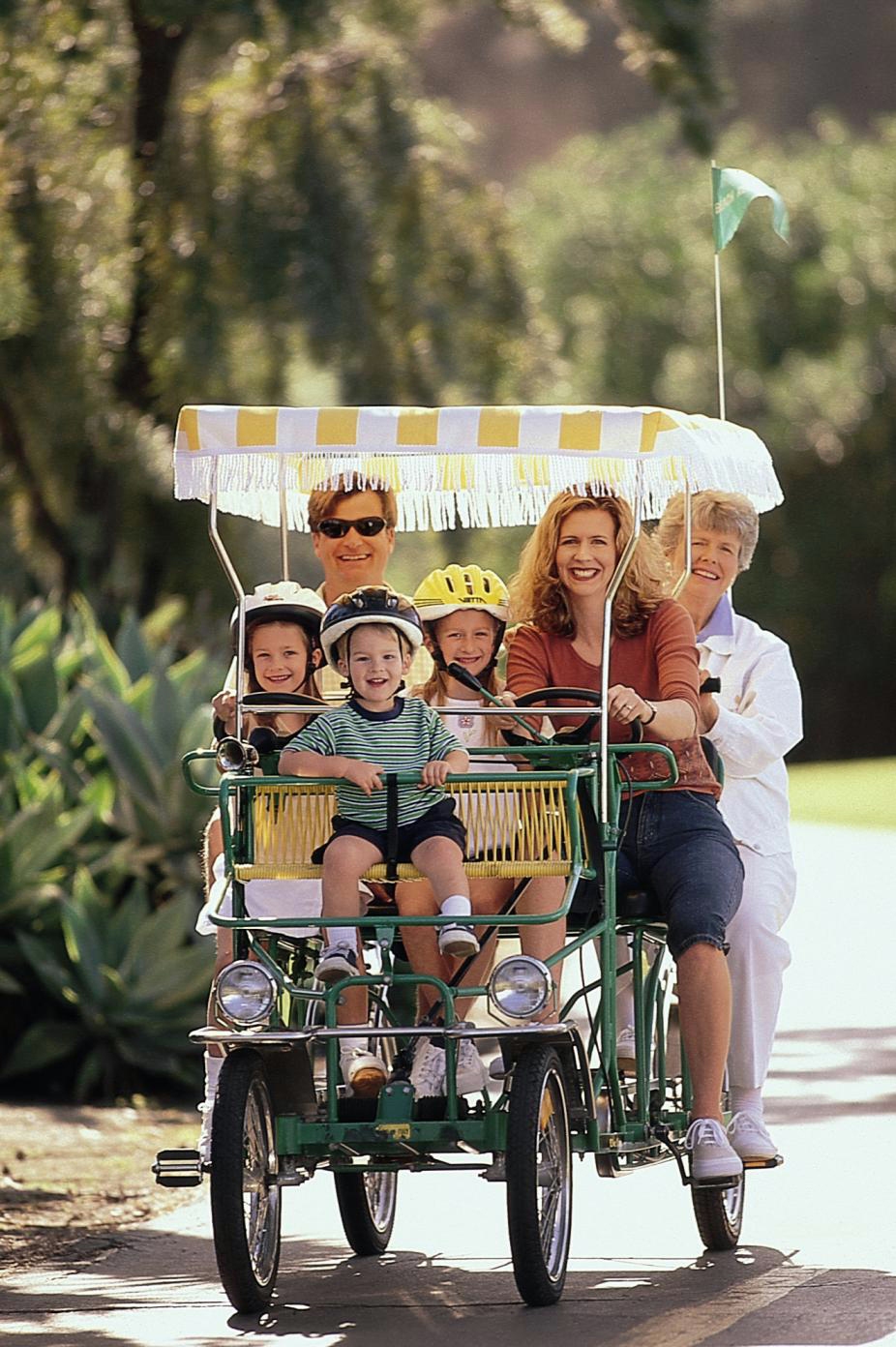
The southern terminus of the Central Coast begins in Ventura, located roughly 70 miles northwest of Los Angeles. Traditionally a surf-centric city, Ventura has evolved into a primary gateway for ecological tourism due to its proximity to the Channel Islands National Park. Often referred to as the "Galapagos of North America," the archipelago is comprised of five islands that host 145 species found nowhere else on Earth, including the island fox and the island scrub-jay.
The waters surrounding the islands are designated as a National Marine Sanctuary, providing a habitat for blue whales, humpback whales, and a massive population of California sea lions. From a historical perspective, Ventura also houses the Mission Basilica San Buenaventura, established in 1782. This site serves as a reminder of the Spanish colonial influence that shaped the early urban planning and architecture of the California coast.
The American Riviera: Santa Barbara and the Santa Ynez Valley
Moving northward, Santa Barbara—frequently termed the "American Riviera"—represents the intersection of luxury tourism and educational enrichment. Following a devastating earthquake in 1925, the city was rebuilt in a cohesive Spanish Colonial Revival style, which remains strictly enforced by local architectural boards today. This aesthetic consistency has made Santa Barbara one of the most photographed cities in the United States.
Key educational and cultural institutions in the area include:
- The MOXI Museum: A LEED Gold-certified facility focused on Science, Technology, Engineering, and Math (STEM), reflecting California’s broader emphasis on interactive education.
- The Santa Barbara Zoo: Consistently ranked as one of the premier small zoos in the nation, focusing on conservation and species survival plans.
- The Santa Ynez Valley: Located just over the San Marcos Pass, this region comprises six distinct towns (Solvang, Santa Ynez, Los Olivos, Buellton, Ballard, and Solvang).
The Santa Ynez Valley is a critical component of California’s multi-billion-dollar wine industry. Solvang, in particular, offers a unique cultural study; founded by Danish immigrants in 1911, the town maintains a distinct Nordic identity through its architecture, windmills, and traditional bakeries, contributing significantly to the county’s "heritage tourism" revenue.
Central Hub: San Luis Obispo County and the Heritage Coast
San Luis Obispo (SLO) County serves as the midpoint of the Central Coast journey. The region is defined by a "slow-growth" urban planning philosophy that has preserved its rural charm despite increasing development pressures. The city of San Luis Obispo is frequently cited in quality-of-life indices as one of the "happiest" cities in America, a factor attributed to its walkable downtown and extensive greenbelts.
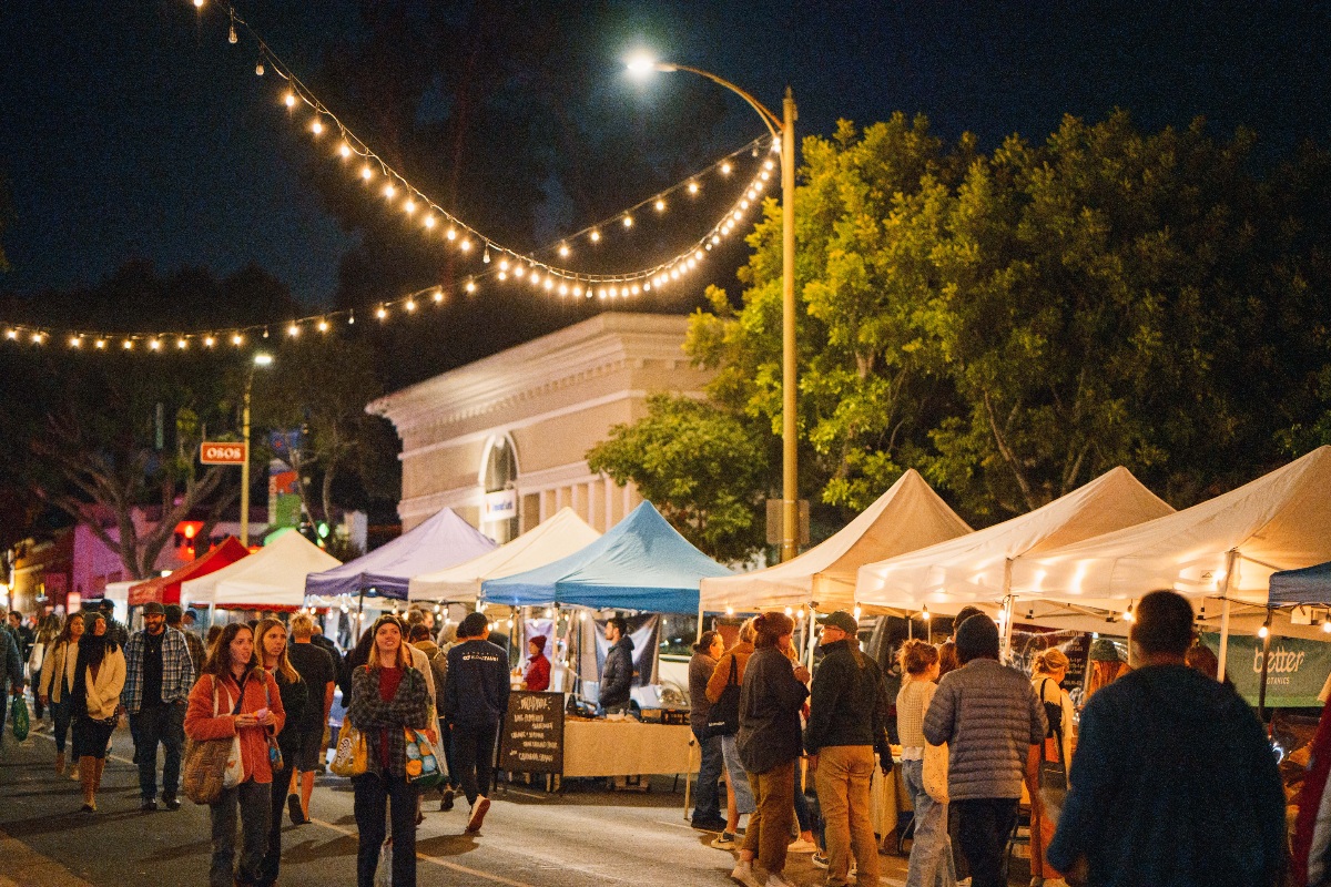
One of the county’s primary economic drivers is the Thursday Night Farmers Market, which spans several blocks and attracts thousands of visitors weekly. This event serves as a vital marketplace for local agriculture and a platform for community engagement.
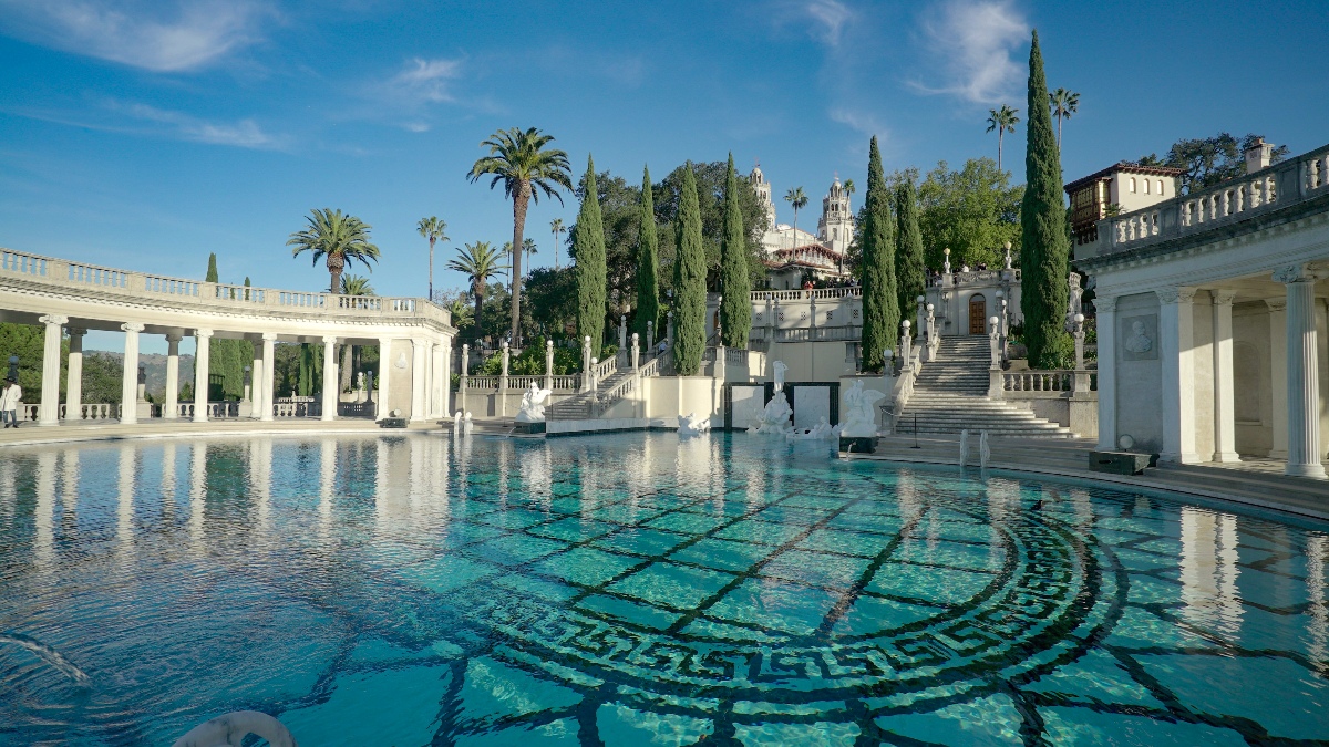
Further north in the county lies Cambria and the San Simeon coastline, home to Hearst Castle. Designed by Julia Morgan—the first woman to be granted an architect’s license in California—for publishing tycoon William Randolph Hearst, the estate is now a National Historic Landmark and a California State Park. The castle’s preservation provides a tangible link to the "Golden Age of Hollywood" and serves as a major employer for the northern part of the county.
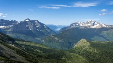
The Northern Apex: Big Sur, Monterey, and Carmel
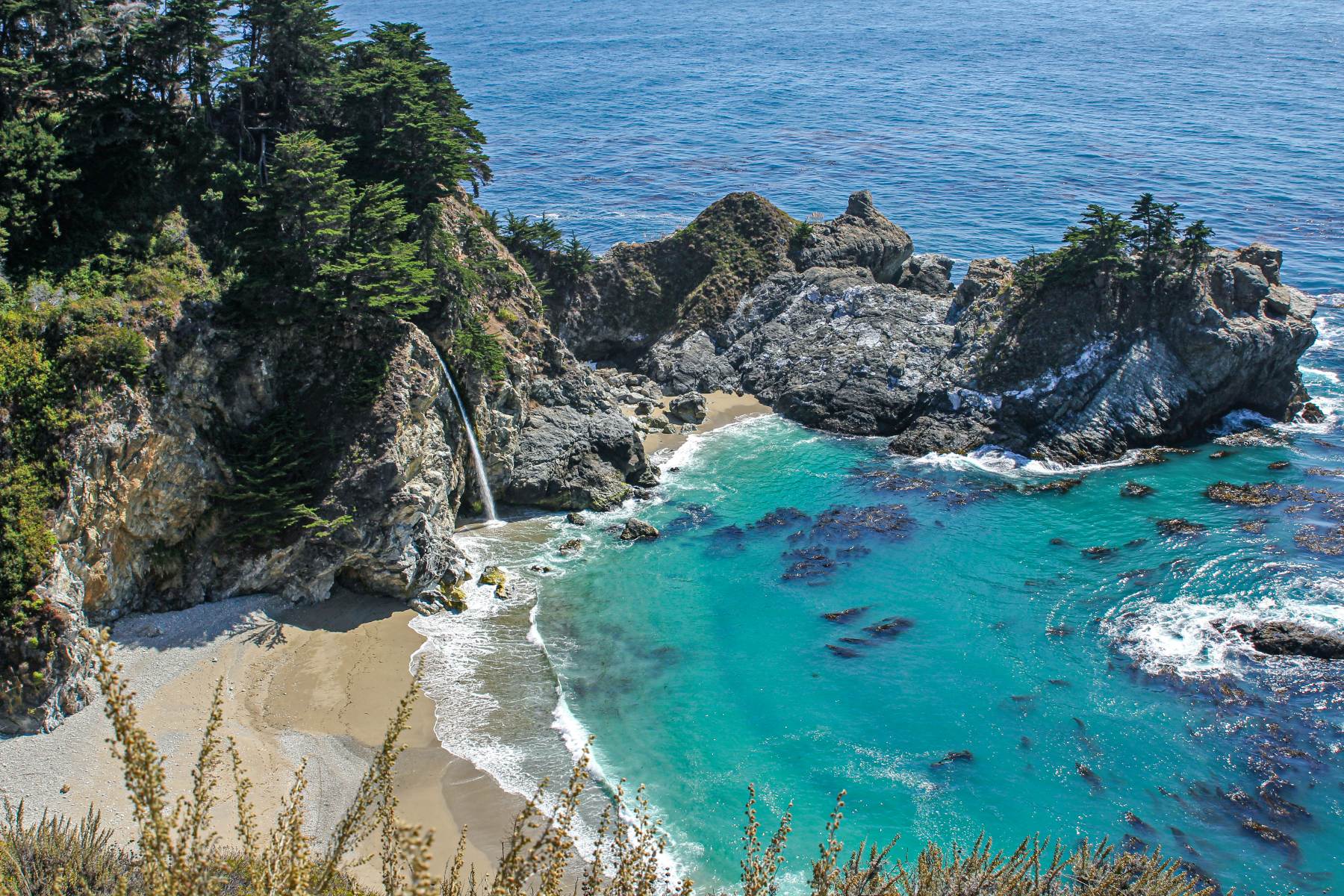
The final 100-mile stretch of the Central Coast is perhaps the most dramatic. Big Sur is defined by the Santa Lucia Mountains rising abruptly from the Pacific. This area is a cornerstone of California’s environmental protection efforts. Point Lobos State Natural Reserve, often described by landscape artists as "the greatest meeting of land and water in the world," operates under strict visitor quotas to protect its fragile headlands and kelp forests.
In the Monterey Peninsula, the focus shifts toward marine science and literary history:
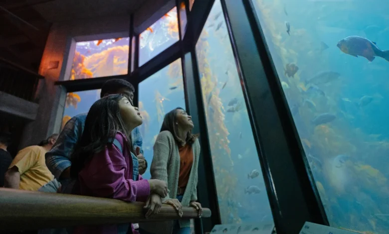
- The Monterey Bay Aquarium: Located on the site of a former sardine cannery, this institution is a global leader in ocean conservation and research. Unlike many aquariums that focus on exotic tropical species, the Monterey facility focuses on the local "Kelp Forest" and "Open Sea" ecosystems.
- Cannery Row: Once the center of a booming fishing industry immortalized by novelist John Steinbeck, the area has been successfully repurposed into a high-density tourist district.
- Carmel-by-the-Sea: Known for its artistic roots and fairy-tale cottages, Carmel maintains a strictly residential feel with no street addresses or neon signs, a testament to the region’s commitment to preserving its historical character.
Socio-Economic Impact and Environmental Considerations
The Central Coast is not merely a scenic route; it is a significant economic engine for California. According to data from Visit California, tourism spending in the Central Coast region accounts for billions of dollars annually, supporting over 100,000 jobs in hospitality, agriculture, and retail.
However, the region faces ongoing challenges related to environmental sustainability. The "30×30" initiative—a goal to conserve 30% of California’s lands and coastal waters by 2030—heavily involves the Central Coast. Issues such as coastal erosion, rising sea levels, and the management of "overtourism" in sensitive areas like Big Sur require a delicate balance between economic development and ecological stewardship.
Chronological Development of the Central Coast Experience
The evolution of the Central Coast from a series of isolated missions and ranchos to a world-class travel destination followed a specific timeline:
- 1769–1823: The establishment of the California Mission chain creates the first land-based transit route (El Camino Real).
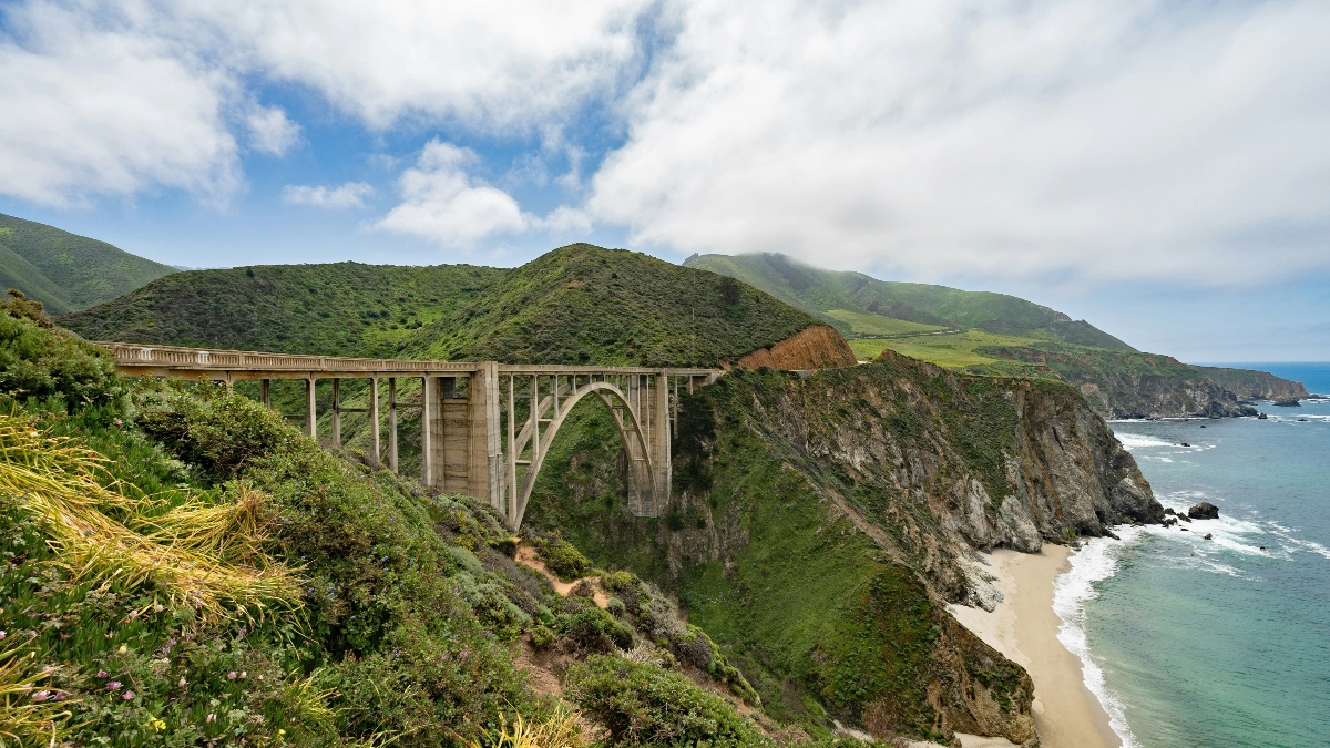
- 1919–1937: Construction of the "Carmel-San Simeon Highway" (the original Highway 1), which utilized convict labor to carve the road into the cliffs of Big Sur.
- 1984: Opening of the Monterey Bay Aquarium, shifting the region’s focus from resource extraction (fishing) to marine education and conservation.
- 2020–Present: A shift toward "regenerative travel," where tourism boards encourage visitors to engage in activities that support local ecosystems and small-scale farmers.
Conclusion and Future Outlook
The California Central Coast remains a resilient and essential part of the state’s identity. From the tech-integrated museums of Santa Barbara to the silent redwood canyons of Big Sur, the region offers a diverse array of experiences that cater to a wide demographic. As infrastructure continues to adapt to the realities of climate change and as local economies transition toward more sustainable models, the Central Coast is poised to remain a premier destination for those seeking to understand the intersection of natural beauty and California’s complex cultural history.
For travelers, the region offers an array of high-tier accommodations, from the beachfront luxury of the Rosewood Miramar Beach in Montecito to the rustic elegance of Carmel Valley Ranch. These establishments, alongside the myriad of state parks and local businesses, ensure that the 350-mile journey remains a cornerstone of the American travel experience.


