
The Essential Guide to Rhodes Town Navigating the Medieval Majesty and Modern Charm of Greece’s Dodecanese Capital
Rhodes Town, the capital of the eponymous island in the Dodecanese archipelago, serves as one of the Mediterranean’s most significant cultural and economic hubs, blending over two millennia of history with a robust modern tourism infrastructure. As a premier destination for international travelers, cruise passengers, and history enthusiasts, the city is uniquely bifurcated into two distinct zones: the UNESCO World Heritage-listed Old Town, a fortified medieval masterpiece, and Neohóri, the cosmopolitan New Town characterized by modern commerce, luxury resorts, and administrative centers. This dual identity allows Rhodes Town to operate as both a living museum and a thriving 21st-century urban center, though the sheer density of its historical sites and seasonal tourist influx necessitates a strategic approach for visitors and local administrators alike.
A Chronology of Influence: From Antiquity to the Knights Hospitaller
The historical significance of Rhodes Town is rooted in its strategic maritime position between the Aegean Sea and the Levant. Founded in 408 BCE, the city was designed by the famed urban planner Hippodamus of Miletus. Its most legendary era in antiquity was marked by the construction of the Colossus of Rhodes, a 33-meter bronze statue of the sun god Helios, completed in 280 BCE. Though toppled by an earthquake in 226 BCE, the site of the Colossus—widely believed to be the mouth of Mandraki Harbour—remains a focal point for modern historical inquiry.
The city’s current architectural character, however, is most heavily defined by the occupation of the Knights of St. John (Knights Hospitaller) from 1309 to 1522. During this period, the Knights transformed the city into a formidable fortress, constructing the massive walls and the Palace of the Grand Master. Following a protracted siege by the Ottoman Empire in 1522, the island transitioned to Turkish rule for nearly four centuries, followed by Italian occupation in 1912. The Italians were responsible for significant restoration projects within the Old Town, though some scholars note that these efforts occasionally prioritized aesthetic grandeur over historical accuracy. In 1948, Rhodes was officially incorporated into the modern Greek state, cementing its role as the administrative heart of the Dodecanese.
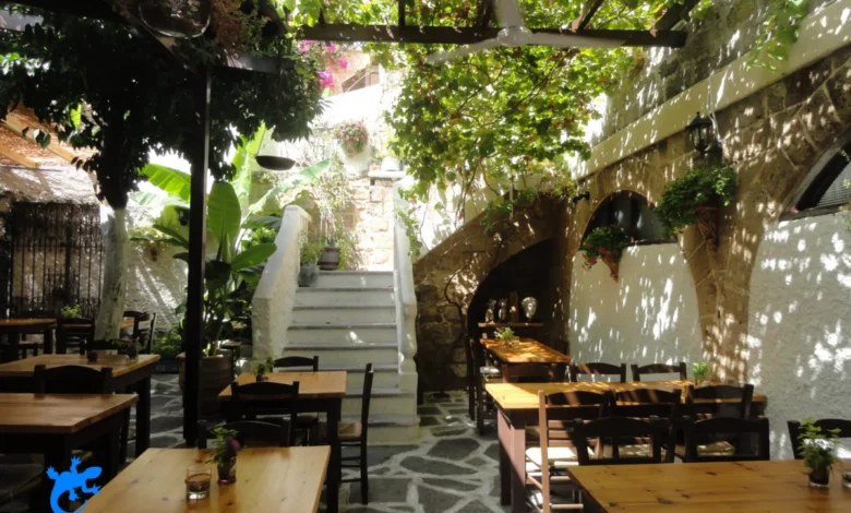
The Old Town: A UNESCO-Recognized Medieval Enclave
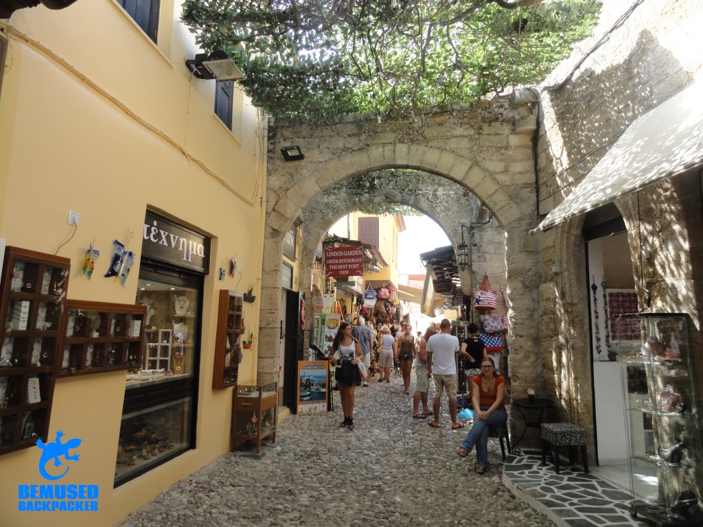
The Old Town of Rhodes is recognized by UNESCO as one of the best-preserved medieval walled cities in Europe. Enclosed within a four-kilometer circuit of fortifications, the area is a labyrinth of cobbled lanes, hidden courtyards, and monumental architecture.
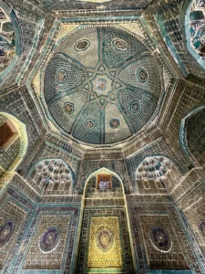
The Knights’ Quarter and the Palace of the Grand Master
The northern section of the Old Town, known as the Collachium, was the administrative and residential heart of the Knights of St. John. The centerpiece is the Palace of the Grand Master, a 14th-century citadel that served as the order’s headquarters. While the exterior retains its original Gothic severity, the interior features extensive Italian-era restorations, including intricate floor mosaics relocated from the island of Kos. Adjacent to the palace is the Street of the Knights (Ippoton), a remarkably preserved thoroughfare lined with the "Inns of the Tongues," where knights of different nationalities once resided.
Cultural and Religious Pluralism
Reflecting the island’s diverse history, the Old Town houses a variety of religious and cultural landmarks. The Archaeological Museum, housed in the former Hospital of the Knights, contains significant Hellenistic sculptures, including the Aphrodite of Rhodes. Nearby, the presence of the Sulemaniye Mosque and the Byzantine-era Church of the Virgin of the Burgh highlights the layers of religious transition the city has undergone.
Neohóri: The Modern Pulse of Rhodes
Outside the medieval walls lies the New Town, or Neohóri, which developed primarily during the Italian occupation and the post-WWII tourism boom. This sector serves as the commercial engine of the island, featuring high-end boutiques, the island’s administrative buildings, and the majority of its urban hotel capacity.
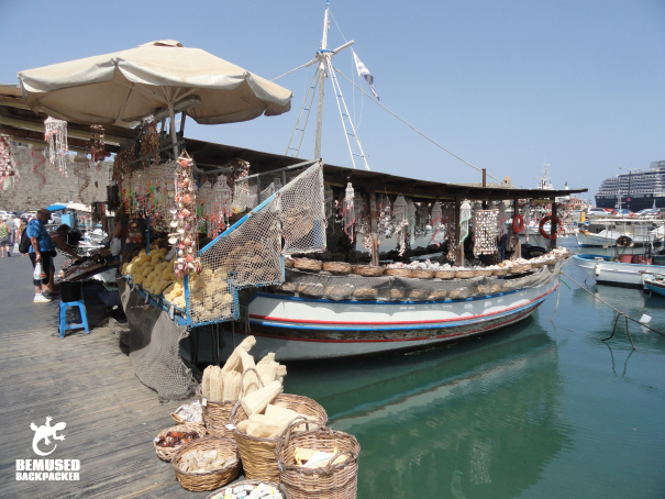
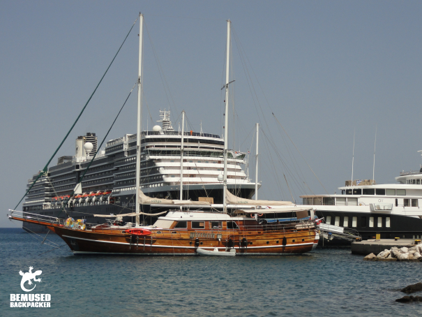
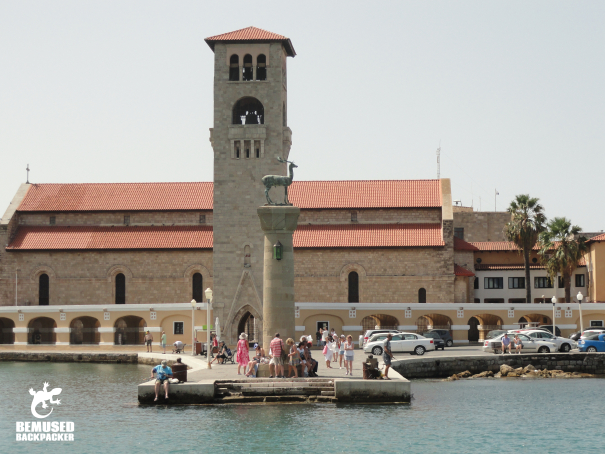
Mandraki Harbour and Industrial Heritage
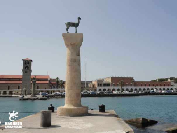
Mandraki Harbour remains the primary gateway for maritime traffic, including ferries from neighboring Turkey and private yachts. The harbor is flanked by three iconic medieval windmills, once used to grind grain brought by merchant ships. Guarding the entrance are the "Elefos" and "Elafina" statues—two bronze fallow deer that have become the official symbols of the island.
The Acropolis of Rhodes and Monte Smith
Located approximately two kilometers from the city center on the hill of St. Stephen (popularly known as Monte Smith), the Acropolis of Rhodes offers a glimpse into the city’s Hellenistic past. Unlike many other acropolises in Greece, this site was not fortified. Ongoing archaeological efforts have restored the 2nd-century BCE Olympic Stadium and the neighboring marble theater, which once hosted lectures by noted figures such as Julius Caesar and Cicero. The Temple of Apollo Pythios stands as the site’s most prominent ruin, providing panoramic views of the Aegean.
Economic Data and Tourism Management
Rhodes is a cornerstone of the Greek tourism economy. According to data from the South Aegean Region, the island frequently sees over 2.3 million international arrivals annually, with Rhodes Town serving as the primary transit point.
Seasonal Strategy and Sustainable Tourism
Local authorities and travel experts emphasize the importance of "shoulder season" travel—typically May, June, September, and October. During the peak months of July and August, the city faces significant pressure on its infrastructure, with temperatures frequently exceeding 35°C (95°F). Official tourism boards have recently focused on diversifying the "Sun and Sea" model by promoting the city’s historical and cultural assets to encourage year-round visitation.
Regional Connectivity
The proximity of Rhodes to the Turkish coast (approximately 18 kilometers) creates a unique cross-border economic corridor. Regular ferry services connect Rhodes Town to Marmaris and Fethiye. Travelers are advised to manage currency requirements carefully, as Rhodes operates within the Eurozone, while Turkey utilizes the Lira. Customs and immigration processing at Mandraki Harbour are high-traffic areas, particularly for day-trippers.
Public Safety and Consumer Awareness
While Rhodes is statistically one of the safest major tourist destinations in Europe, the high concentration of visitors in Rhodes Town has necessitated specific public safety measures.
Consumer Protection
Local law enforcement and tourism associations have issued advisories regarding common street-level scams. These typically involve "gift" solicitations, such as the unsolicited tying of leather bracelets or the offering of flowers, followed by aggressive demands for payment. Authorities recommend that visitors ignore these solicitations and report persistent issues to the Tourist Police.
Health and Infrastructure
The urban environment of the Old Town, with its narrow streets and lack of shade, poses risks of heat exhaustion. Public health officials stress the necessity of high-SPF sun protection and consistent hydration. Furthermore, while the city offers a bus network connecting the capital to eastern resorts like Faliraki and Lindos, the service is often operating at capacity during peak hours. Fixed-price taxi stands are available at major hubs, and passengers are encouraged to confirm rates before departure to ensure transparency.
Cultural Preservation and Future Outlook
The management of Rhodes Town involves a delicate balance between preserving a UNESCO site and maintaining a functional modern city. The Palace of the Grand Master and the medieval walls require constant structural monitoring and restoration funded by both national and European Union grants.
The Modern Greek Art Museum, located in the New Town, represents a significant effort to showcase the nation’s 20th-century artistic evolution, housing works by masters such as Katsikas and Bouzianis. This institution, along with the Rhodes Aquarium (the Hydrobiological Station of Rhodes), serves as a reminder that the city’s value extends beyond its medieval fortifications into the realms of science and contemporary culture.
As Rhodes Town looks toward the future, the integration of "smart city" technologies to manage traffic and tourist flow is under discussion. The goal is to ensure that the "Colossus Odyssey"—the journey through the island’s massive historical narrative—remains accessible without compromising the integrity of the sites or the quality of life for the city’s permanent residents.
Broader Implications for Mediterranean Heritage
The case of Rhodes Town is a microcosm of the challenges facing historical Mediterranean port cities. The city’s ability to maintain its medieval character while accommodating the demands of the global cruise industry and the "all-inclusive" resort model is a subject of ongoing study by urban planners. For the traveler, Rhodes Town remains an essential destination not merely for its beaches, but for its role as a crossroad of civilizations. Whether exploring the Hellenistic ruins of the Acropolis or the Gothic halls of the Knights, visitors are engaging with a site that has, for over 2,400 years, stood as a sentinel of the eastern Mediterranean.


