Devastating Southwest Colorado Floods Deal Severe Blow to the Colorado Trail and Continental Divide Trail

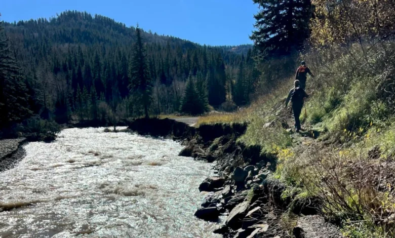
In the wake of back-to-back catastrophic flooding events that struck southwestern Colorado within a span of just over a week, the region’s outdoor recreation infrastructure is facing an unprecedented reckoning. While initial emergency response efforts focused heavily on safeguarding residents, residential properties, and local businesses in mountain towns, land managers and trail advocacy organizations are now coming to terms with the catastrophic toll the floods have taken on two of America’s most celebrated long-distance hiking paths: the Colorado Trail (CT) and the Continental Divide Trail (CDT).
Portions of both routes have suffered what local authorities, the U.S. Forest Service (USFS), and trail foundations are characterizing as "extensive" and "severe" damage. Due to ongoing inaccessibility, blocked access roads, and stretched emergency services, a comprehensive assessment of the destruction remains weeks away. However, preliminary reports, aerial imagery, and ground-level footage indicate that a monumental rebuilding effort—spanning months, if not years—will be required to restore these arteries of backcountry travel.
A Timeline of Crisis: Back-to-Back Weather Anomalies
The disaster unfolded rapidly in late October and early November 2026, catching communities and land management agencies off guard with unseasonable and torrential precipitation.
On October 23, the Continental Divide Trail Coalition (CDTC) issued its first major advisory to the outdoor community, warning that severe flooding had made travel to and from the critical CDT trailhead at Wolf Creek Pass entirely impossible. The organization urged long-distance hikers and day-visitors to formulate alternate itineraries to bypass the stricken southern Colorado corridor.
By late October, the atmospheric conditions culminated in what the San Juan National Forest would formally designate as record-setting, catastrophic flooding across the southwestern quadrant of the state. Rivers breached their banks, sweeping away foundational civil infrastructure, erasing footbridges, and depositing massive boulders and organic debris across valleys and mountain passes.
On November 2, the CDTC updated its guidance, emphasizing that the full scope of damage to the CDT, its critical access arteries, and gateway mountain communities remained largely unknown due to impassable terrain.
On November 5, Paul Talley, executive director of the Colorado Trail Foundation (CTF), released a formal update detailing the grim reality facing the southern terminus and surrounding feeder trails. Talley confirmed that rebuilding these vital segments would be a prolonged, technically challenging, and financially demanding endeavor. By November 6, federal and state agencies, including the USFS and San Juan National Forest officials, released harrowing visual evidence—including drone footage of newly formed waterfalls cascading over destroyed mountain roads—cementing the severity of the disaster.
Anatomy of the Destruction: The Colorado Trail
The Colorado Trail, a 567-mile premier backcountry route stretching from the outskirts of Denver to outside Durango, took a direct hit at its southernmost terminus along Junction Creek.
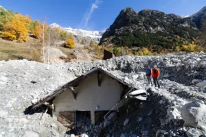
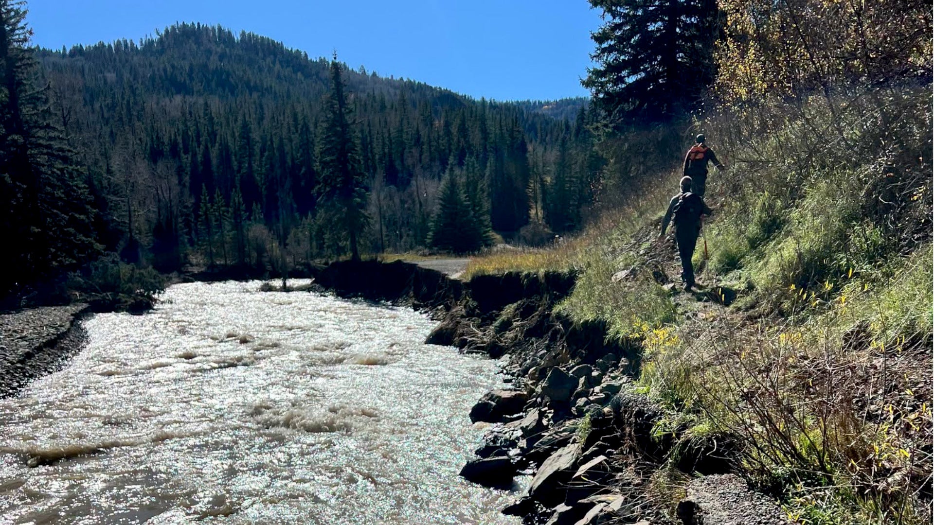
The Junction Creek Trail, serving as the CT’s 19-mile southern gateway, has been severely compromised. According to official conditions reports published by the U.S. Forest Service, a massive wall of rock and heavy debris is currently blocking the path a mere half-mile from the official trailhead. Further up the route, near Gudy’s Rest, community-shared video footage shows that vital footbridges spanning the creek have been entirely obliterated, washed away by the sheer velocity of the floodwaters.
Visual documentation from the San Juan National Forest highlights the unprecedented geological force of the event. A widely circulated USFS video features the access road to Junction Creek transformed by floodwaters into a twenty-foot waterfall crashing over the edge of a completely collapsed roadbed. Additionally, iconic landmarks familiar to thousands of thru-hikers have been structurally altered; photographs posted to social media show the iconic Colorado Trail southern terminus sign standing precariously at the exact edge of a newly carved, debris-choked wash.
In response to the hazards, the San Juan National Forest administration issued strict safety directives, sternly advising the public against attempting to access any regional trails.
"Record flooding across Southwest Colorado has left San Juan National Forest roads, trails, and other infrastructure inaccessible, severely damaged, and, in many cases, impassable," forest officials stated in an official release. "Don’t become a statistic — rescue will not be readily available due to the current demand for search and rescue services."
Uncertainty Along the Continental Divide Trail
While data from the Colorado Trail is slowly emerging through localized inspections, information regarding the Continental Divide Trail remains remarkably sparse. The CDT, which traverses roughly 3,100 miles from the Mexican border to Canada, intersects the same volatile mountain geography in southwestern Colorado that bore the brunt of the atmospheric deluge.
The Continental Divide Trail Coalition has maintained active communication channels, pointing out via interactive mapping tools and social media advisories that while official closures are being logged dynamically, hikers must exercise extreme caution. Because access roads leading to high-elevation trailheads like Wolf Creek Pass remain compromised, field assessments by rangers and trail crews have been severely delayed.
Backpacker and other outdoor journalism outlets have sought comprehensive damage statements from the CDTC, though administrative bandwidth remains heavily committed to immediate safety advisories and coordination with federal land management partners.
Official Responses and Collaborative Recovery Framework
The path toward recovery is daunting, requiring unprecedented cooperation between federal agencies, state governments, non-profit organizations, and citizen volunteers. Because winter weather patterns in the southern Rockies traditionally bring heavy snow and freezing temperatures, physical repair work cannot begin immediately.
Paul Talley of the Colorado Trail Foundation outlined the multi-phase strategy moving forward. During the winter months, the CTF will collaborate closely with the USFS, local municipalities, and regional stakeholders to formulate precise project timelines and cost estimates.
"It will be months before we can better understand what the next steps need to be on the sections damaged by climate events this season," Talley noted in his November 5 address.
Despite the grim outlook, leadership across all involved organizations has expressed unwavering commitment to restoration. The recovery effort will rely heavily on an organized mobilization of public support, philanthropic funding, and boots-on-the-ground volunteer labor once the snow melts in mid-to-late 2027.
"While we do not yet know what it will take to rebuild, we do know what we will need," Talley emphasized. "We will need our supporters, we will need our dedicated volunteers, and we will need that community spirit that makes the CT so special."
Broader Implications for Regional Economy and Backcountry Recreation
The destruction of infrastructure along the Colorado Trail and Continental Divide Trail carries significant implications that extend far beyond the immediate physical damage to dirt paths and timber bridges.
Economically, gateway communities such as Durango, Silverton, and Pagosa Springs rely heavily on the influx of outdoor recreationists, thru-hikers, and mountain bikers. The temporary closure or compromised accessibility of world-class long-distance trails threatens local outfitters, lodging providers, shuttle services, and hospitality businesses that cater to the adventure tourism market.
Furthermore, the disaster underscores a growing vulnerability within America’s public lands infrastructure. As extreme weather events increase in frequency and intensity due to broader climatic shifts, federal and non-profit trail organizations are increasingly forced to divert critical funding away from routine trail maintenance toward emergency reconstruction and climate-resilient engineering.
For the immediate future, authorities urge the public to respect all closures, stay clear of unstable mountain corridors, and monitor official agency portals for updates as the region prepares for a lengthy and complex recovery process.