The Ultimate Expedition to Colombia’s Ciudad Perdida: A Comprehensive Journalistic Guide to the Lost City Trek

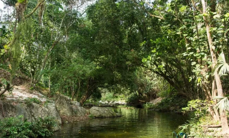
The Sierra Nevada de Santa Marta mountain range in northern Colombia hides one of South America’s most profound archaeological treasures: Teyuna, widely known as La Ciudad Perdida or the Lost City. Spanning a demanding 46-kilometer (28-mile) round-trip trek through dense tropical rainforests, steep river valleys, and indigenous territories, this expedition offers travelers a rare combination of physical endurance, biological diversity, and deep historical immersion. Originally constructed around 800 A.D. by the ancient Tayrona civilization—predating Peru’s Machu Picchu by roughly six centuries—the site serves as a vital monument to pre-Columbian urban planning and indigenous heritage.

Historical Background and Rediscovery
Built along the steep slopes of the Buritaca River valley, Teyuna was once a thriving political and economic center for the Tayrona people, housing an estimated 2,000 to 8,000 inhabitants at its peak. The urban layout features approximately 169 stone-paved terraces, circular plazas, and interconnected staircases carved directly into the mountainside.

In the late 16th century, as Spanish conquistadors advanced through northern Colombia, the Tayrona chose to abandon the city rather than submit to colonial rule. The jungle systematically reclaimed the stone terraces, effectively hiding the metropolis from outsiders for hundreds of years. Local indigenous shamans from the surviving Wiwa, Kogi, Arhuaco, and Kankuamo communities—who consider themselves the "elder brothers" tasked with maintaining global equilibrium—never truly lost track of the sacred site, utilizing it periodically for ancestral ceremonies.

The outside world remained unaware of Teyuna’s existence until the early 1970s, when local looters stumbling upon the stone staircases began unearthing gold figurines, ceramic urns, and polished beads. The widespread plundering eventually attracted the attention of government authorities and archaeologists. In 1976, an official state-led expedition cataloged the ruins, prompting preservation efforts and the establishment of strict tourism regulations to protect the fragile cultural landscape.

Expedition Chronology and Day-by-Day Itinerary
Navigating the Lost City trail requires careful physical preparation and adherence to strict itineraries mandated by authorized tour operators. Because independent trekking is prohibited, travelers must join guided groups, which typically span four to five days.

Day 1: Trailhead to the First Valley Campsite
The journey officially begins in the coastal city of Santa Marta, where transport vehicles transfer hikers inland via a 45-minute drive along the highway before transitioning onto rugged mountain dirt tracks. Following a safety briefing and lunch at the trailhead community of Machete, hikers embark on the initial leg of the trek. The terrain immediately introduces participants to the topography of the Sierra Nevada: a mix of steep ascents, refreshing natural swimming holes, and deep descents leading to the first evening’s campsite situated in the river valley.

Day 2: Journey Deeper into the Indigenous Territory
The second day presents a rigorous physical challenge, particularly for those completing the standard four-day itinerary, pushing deeper through tropical rainforests and crossing the Buritaca River multiple times. Depending on water levels, crossings are executed either on foot or via suspended cable cars. Along the route, hikers pass traditional Kogi settlements, gaining firsthand perspective on contemporary indigenous life before reaching the upper valley camps near the base of the ancient ruins.

Day 3: Ascent to the Lost City (Ciudad Perdida)
Trekkers typically depart before dawn to ascend the infamous 1,200 moss-covered stone steps leading to Teyuna. Reaching the lower and upper terraces requires steady pacing and careful footing, particularly during wet conditions. Upon arrival, indigenous guides lead groups through the archaeological complex, detailing the symbolic architecture, agricultural terrace systems, and the spiritual significance of the sacred stones. Following the morning tour, groups retrace their steps down the mountain to an intermediate campsite for the night.

Day 4 and 5: Return Trek and Departure
The final days involve steady descents back toward the trailhead at Machete. Because much of this lower section is exposed to direct sunlight, early morning departures are standard to mitigate heat exhaustion. Upon reaching the trailhead, return transfers transport travelers back to Santa Marta for hot showers, gear retrieval, and post-trek debriefing.

Environmental Conditions, Logistics, and Difficulty
Classified as a medium-high difficulty trek, the route does not require technical mountaineering equipment, but it demands a strong baseline of cardiovascular fitness and resilience against environmental stressors.

Climate and Terrain
The Sierra Nevada de Santa Marta operates within a tropical rainforest climate, characterized by high temperatures and intense humidity year-round. While the dry season typically spans from December through March—often regarded as the optimal window for hiking—the rainy season between May and September brings frequent afternoon downpours and muddy trails. The trail itself is characterized by relentless elevation changes; hikers experience continuous steep climbs and descents with very few flat segments.

Health, Safety, and Wildlife
Biological hazards along the trail include persistent mosquitoes, ticks, and variable camp sanitation conditions. Public health recommendations advise comprehensive vaccination updates, liberal use of insect repellents containing DEET, and rigorous tick checks following jungle excursions. Campsites are equipped with basic bunk facilities, hammocks with mosquito nets, cold-water showers, and flush toilets, though continuous dampness prevents clothing from drying overnight.

Regulatory Framework and Indigenous Partnership
Tourism management in the Sierra Nevada operates under a cooperative model involving the Colombian government, regional tour operators, and indigenous councils. Authorized operators—such as G Adventures and other licensed agencies—are mandated to employ local guides from the Wiwa and Kogi communities. This policy ensures that economic benefits directly support indigenous families while preserving accurate cultural narratives regarding the stewardship of the sacred mountains.

The route is subject to temporary closures—most notably during the month of September—allowing ecological recovery, archaeological maintenance, and traditional indigenous cleansing rituals to take place without tourist interference. Prospective visitors are advised to coordinate directly with certified operators well in advance to secure permits, verify seasonal trail accessibility, and review comprehensive gear packing lists designed to minimize pack weight during the demanding multi-day ascent.