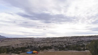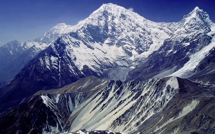
The catastrophic flooding event that originated on the slopes of Langtang Lirung on August 26, 2026, and subsequently decimated the Kyirong Valley, has left thousands dead and a historic landscape irrevocably altered. While the physical toll of the debris flow is staggering, the disaster also marks the tragic destruction of a region that has served as a cultural, spiritual, and geopolitical bridge between Tibet and the Indian subcontinent for over a millennium. Ironically, the name Kyirong—or Gyirong, as it is often transliterated—translates from Tibetan as the Valley of Happiness, a title that stands in stark, painful contrast to the current state of ruin facing its residents.
A Crossroads of Civilization
Long before the valley was categorized by modern border protocols or administrative demarcations, Kyirong functioned as a vital trans-Himalayan corridor. Tibetan writer Tsering Woeser has noted that the valley served as a nexus for a diverse array of figures, including kings, itinerant merchants, pilgrims, and Buddhist scholars. Its geographical position on the southern fringe of the Tibetan Plateau made it a natural conduit for the exchange of goods and ideologies.
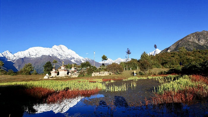
The valley’s spiritual significance is anchored in the legacy of the Jowo Wati Zangpo, a sacred statue representing the Bodhisattva of Compassion. Between the 13th and 17th centuries, Kyirong was the heart of a flourishing Tibetan kingdom, benefiting from its role as a premier Himalayan trade hub. It was here that the legendary Indian Buddhist master Atisha, credited with the profound restoration of Buddhism in Tibet, conducted his teachings. These historical layers highlight that the valley was never merely a transit point, but a repository of Himalayan heritage.
A Chronology of Conflict and Commerce
The history of Kyirong is defined by shifting political tides and human movement. The late 18th century saw the valley serve as a theater for military clashes, reflecting the high-stakes power dynamics between the Qing Dynasty and the Gorkha Kingdom of Nepal. As geopolitical boundaries hardened in the 20th century, the nature of the valley shifted from an open corridor to a tightly controlled border zone.
- 1959: Political upheavals in the region led to the migration of monks who carried the Jowo Wati Zangpo statue into India, removing a central cultural pillar from the valley.
- 1961: The People’s Republic of China established a formal customs post in the valley, marking the beginning of state-regulated transit.
- 2003: A pivotal moment for local demographics occurred when the Chinese government granted citizenship to descendants of Gorkha soldiers who had resided on the Tibetan side for generations.
- 2010s: The valley was modernized into a primary border crossing, intended to facilitate increased trade and logistics between China and Nepal.
Before these modern borders solidified, the residents of Kyirong and northern Nepal operated within a singular, fluid social ecosystem. Families moved freely across the border, and even today, many households in the Langtang region of Nepal trace their ancestral roots directly to the Kyirong Valley. The disaster has not only destroyed property but has fractured these deep-seated communal ties, making the region increasingly inaccessible to those who still hold ancestral connections to the land.

The Harrer and Aufschnaiter Legacy
The valley’s prominence in Western literature is largely attributed to the extraordinary survival story of two Austrians, Heinrich Harrer and Peter Aufschnaiter. Following the outbreak of World War II, both men were interned by the British in India as enemy aliens. Their 1944 escape across the Himalayas led them to Kyirong in January 1945.
Despite initial attempts by local authorities to deport them to Nepal, the pair managed to reside in the valley for ten months. Harrer’s seminal work, Seven Years in Tibet, paints an idyllic portrait of the region, which he famously dubbed the Village of Happiness. His writing captured a sense of peace that was starkly different from the global carnage of the era. Simultaneously, Aufschnaiter’s meticulous cartography provided an invaluable record of the valley’s topography and social structure. He documented 26 distinct monasteries and temples, many of which would later be lost during the Cultural Revolution, underscoring the valley’s status as a site of immense historical and architectural loss long before the 2026 floods.
The Geological Peril of Langtang Lirung
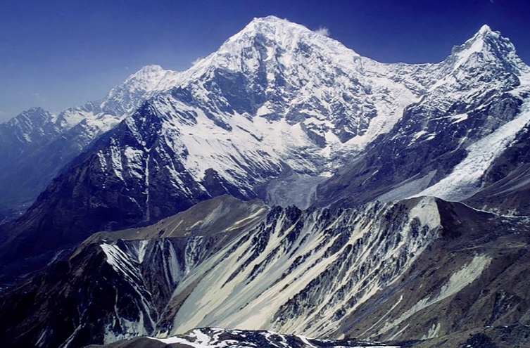
The geography of the Langtang Lirung massif is as dangerous as it is majestic. Rising approximately 5,500 meters above the Trisuli River within a span of just 16 kilometers, the mountain is defined by steep, unstable gradients and massive hanging glaciers. These ice formations, situated above the Langtang Valley and the Kyirong-Rasuwa trench, have historically acted as a ticking time bomb for the communities below.
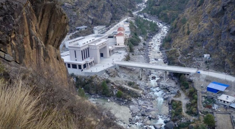
The 2026 flood was not an isolated incident but part of a recurring pattern of catastrophic events tied to the region’s volatile cryosphere. The 2015 Gorkha earthquake serves as a primary case study, where seismic activity triggered an ice and rock avalanche that obliterated the village of Langtang, resulting in a death toll of nearly 300. Following the closure of the Zhangmu border crossing after the 2015 earthquake, Kyirong became the primary route for international mountaineering expeditions heading toward the 8,000-meter peak of Shisha Pangma, effectively concentrating human activity in a region already prone to geological instability.
Mountaineering and Human Cost
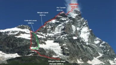
The history of climbing on Langtang Lirung is marked by isolation, extreme difficulty, and a high mortality rate. After H.W. Tilman’s initial survey in 1949, the northern access was restricted for decades. When ascents resumed, they were almost exclusively from the Nepalese side. The East Ridge was finally summited in 1978, followed by a winter ascent in 1988, but the peak remained largely unconquered for long stretches.
The most recent tragedy on the mountain occurred on October 30, 2024, when Czech climber Marek Holecek and Slovakian climber Ondrej Huserka completed the first ascent of the East Face. The triumph turned to tragedy within 24 hours when Huserka fell into a crevasse during the descent. This event, combined with the catastrophic flooding less than two years later, has led to calls from the mountaineering community for a reevaluation of safety protocols in the Langtang massif. Experts suggest that the combination of climate-driven glacial melt and increased seismic activity has fundamentally altered the risk profile of the entire range.
Implications of the 2026 Disaster
The total destruction of the Kyirong border infrastructure in the August 26, 2026, flood poses significant geopolitical and humanitarian challenges. For the regional economy, the loss of the border post disrupts one of the most critical land routes for trade between China and South Asia. For the local population, the disaster represents a total loss of livelihoods and a potential displacement that may be permanent.
Observers note that while immediate disaster relief is the priority, the long-term implications involve the viability of human habitation in high-altitude zones impacted by climate change. Scientists monitoring the region have noted that the rapid retreat of Himalayan glaciers, coupled with increased monsoon intensity, is creating conditions where traditional habitation patterns are no longer sustainable.
The loss of the Kyirong Valley is a multifaceted tragedy. It is a humanitarian crisis of immense scale, a cultural disaster involving the erasure of ancient heritage sites, and a stark warning regarding the future of the Himalayas in a warming world. As rescue efforts conclude and the process of assessing the wreckage begins, the legacy of the Valley of Happiness remains, for now, buried under layers of debris, waiting for a future that remains uncertain. The events of August 26 serve as a grim reminder of the volatility inherent in the world’s highest mountain range, where the beauty of the landscape is inextricably linked to its capacity for sudden and devastating destruction.