Two Salt Lake City Hikers Rescued From Mt. Shasta After Missing Turnaround and Enduring Freezing Overnight Ordeal

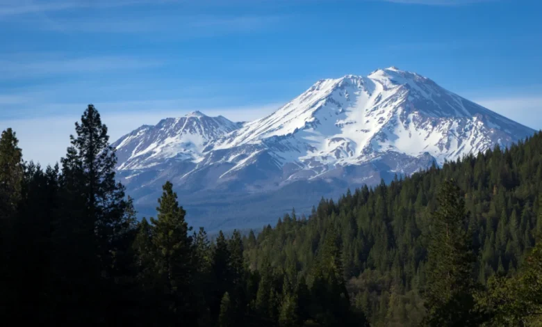
What was intended to be a routine, albeit ambitious, day hike on California’s iconic Mt. Shasta rapidly deteriorated into a high-stakes survival situation earlier this week, forcing local emergency services into a complex, multi-agency rescue operation. The incident, which highlights the unforgiving nature of alpine environments during transitional weather seasons, left two young hikers from Utah stranded at high elevation without adequate gear to combat temperatures that plummeted to 15 degrees Fahrenheit.
The Siskiyou County Sheriff’s Office, alongside the U.S. Forest Service climbing rangers and California Highway Patrol (CHP) aviation units, orchestrated the coordinated effort to locate and extract the stranded pair. While both hikers ultimately escaped the ordeal without major physical injuries, the rescue underscores a growing concern among regional authorities regarding mountain preparedness, adherence to established safety advisories, and the increasing frequency of avoidable backcountry emergencies on Cascade Range volcanoes.
Anatomy of a Miscalculated Ascent
The sequence of events began in the pre-dawn hours of Monday, October 12, 2026. A trio of hikers—comprising a 19-year-old male, a 20-year-old female, both from Salt Lake City, and a third male companion—departed from the Bunny Flat Trailhead at approximately 4:00 a.m. According to authorities, the group’s initial intentions were fractured from the outset. While the third companion possessed explicit plans to pursue a full summit bid, the younger pair allegedly set out with no official intention of reaching the peak.
Despite this, the duo accompanied their partner up the notorious Avalanche Gulch route, a path known for its severe topographical hazards. Without the stabilizing presence of seasonal snow and ice packs, Avalanche Gulch transforms into a treacherous expanse of loose, terraced scree and crumbly rock ramps. Navigating this terrain requires specialized footwear, trekking poles, and meticulous foot placement to avoid destabilizing loose debris or triggering rockfalls.
Compounding the inherent physical dangers, the hikers elected to ignore critical safety parameters established by park officials. Most notably, they disregarded a strictly enforced, posted turnaround time at the trailhead. Standard mountain safety protocols for Mt. Shasta strongly dictate a strict noon turnaround to ensure climbers can descend below hazardous elevations before afternoon thermal shifts, rockfall risks, and fatigue set in.
Records indicate that instead of turning back at midday, the two hikers pushed relentlessly upward. They ultimately reached their highest elevation of the day—the Red Banks formation, sitting at a staggering 12,800 feet—at approximately 5:00 p.m. This arrival time placed them a full five hours past the recommended safety threshold, virtually guaranteeing that they would be forced to navigate the technical descent in complete darkness.
The Chronology of an Alpine Emergency
As daylight faded, the situation deteriorated rapidly. Separated from their summit-bound companion, the two hikers realized they were dangerously underequipped for the dropping temperatures at high altitude. At 10:20 p.m., the Siskiyou County Sheriff’s Office received the initial distress call. The callers reported that they were stranded approximately 11,000 feet up Avalanche Gulch and lacked the proper insulation, bivouac gear, or warm clothing required to survive a sub-freezing mountain night.
Dispatchers immediately instructed the pair to initiate a slow, continuous descent if physically possible, explaining that movement was vital to generating internal body heat and staving off hypothermia.
At 2:00 a.m. on Tuesday, October 13, emergency services received a final, brief update from the hikers. They reported having successfully descended to Helen Lake, a well-known landmark situated at approximately 10,400 feet. Shortly after transmitting this location, the batteries on their mobile devices died, severing direct communication with dispatchers and plunging search coordinators into a race against time.
A Multi-Agency Ground and Air Search
First light brought the launch of a comprehensive search and rescue (SAR) operation. The deployment involved ground searchers from the local sheriff’s office and U.S. Forest Service, supported from the air by CHP Air Operations.
Initially, rescue coordinators concentrated their efforts on the upper elevations of Avalanche Canyon, suspecting the hikers might be trapped higher up the mountain. Around 9:00 a.m., aerial crews and ground spotters located two individuals in the upper zone. However, these hikers were quickly confirmed to be unrelated to the emergency call and were in good condition, requiring no assistance.
Pivoting their strategy, ground crews initiated a secondary sweep from a lower elevation. Rescuers deployed from Horse Camp—a historic stone cabin and staging area positioned at 7,880 feet along a heavily trafficked trail that the missing pair had previously traversed during their ascent. From Horse Camp, searchers descended into adjacent Cascade Gulch.
Nick Meyers, program manager for the U.S. Forest Service’s Mt. Shasta climbing rangers and avalanche center, noted that searching Cascade Gulch was a calculated longshot driven purely by procedural thoroughness rather than high probability.
"Cascade Gulch is a common place for people to end up if they get lost on Avalanche, but it’s usually only when the trails are covered [by snow]," Meyers explained. "When trails are exposed like they are now, you can just follow the main drainage to hit any of the trails back to Bunny Flat."
Despite the low statistical probability of locating the pair in that specific drainage, the decision proved decisive. At approximately 4:00 p.m. on Tuesday—nearly 36 hours after they had first set foot on the trail—rescuers patrolling Cascade Gulch heard distant shouting. Within minutes, they made visual and physical contact with the two Salt Lake City residents.
Miraculously, medical evaluations revealed that both hikers were uninjured, having avoided severe hypothermia despite enduring exposed 15-degree temperatures overnight. Rescuers provided food, water, and warm layers before escorting them safely off the mountain.
Persistent Mysteries and Operational Head-Scratching
While the rescue ended without tragedy, professional mountain guides and law enforcement officers remain baffled by the navigational errors that led to the prolonged ordeal.
Debriefing interviews with the rescued hikers confirmed that they had successfully passed Horse Camp on their descent. Beyond that landmark, however, their pathfinding broke down entirely. Search officials expressed bewilderment as to how two individuals could lose the trail on a route as prominent as the standard Bunny Flat corridor.
"The trail from the cabin to Bunny Flats is a superhighway," Meyers remarked. "It’s the baseline recommended day hike for anyone of any experience level on that area of the mountain, so it’s really well-marked and very wide. We’re still scratching our heads about how they missed it."
It remains unconfirmed whether the two hikers re-established contact with their third companion, who successfully completed his summit attempt and descended the mountain independently without incident.
A Troubling Trend on Northern California Peaks
This incident is far from an isolated event on Mt. Shasta, highlighting a broader, increasingly volatile trend in backcountry tourism. Over the past month, regional rescue teams have been stretched thin responding to a succession of preventable accidents and miscalculations on the volcano’s slopes.
On September 11, a hiker sustained severe injuries after attempting an unauthorized high-altitude glissade—sliding down a snowfield without proper braking tools—resulting in severe trauma to his feet. Unable to walk, the injured climber was forced to crawl down the majority of Avalanche Gulch before being successfully airlifted from Horse Camp by rescue teams.
Earlier in September, another high-profile rescue unfolded when three young hikers required a protracted extraction after utilizing an artificial intelligence chatbot to plan their summit bid via the less-traveled Clear Creek route. Search and rescue officials noted at the time that relying on unverified generative AI for mountaineering logistics often fails to account for real-time weather shifts, localized topography, and seasonal route degradation.
Implications for Future Mountain Safety
Emergency management officials and wilderness agencies are utilizing these successive incidents to reiterate foundational backcountry safety tenets. Mountain authorities consistently emphasize that successful alpine navigation relies on three core pillars: rigid adherence to turnaround times, comprehensive physical and psychological preparedness for sudden weather anomalies, and absolute reliance on verified, human-expert topographical resources rather than automated planning tools or optimistic assumptions.
As autumn transitions into winter across the Pacific Northwest and Northern California, the margin for error on peaks like Mt. Shasta shrinks dramatically. For the two Salt Lake City hikers, a poorly timed turnaround and a missed junction transformed a routine autumn outing into a frigid brush with disaster—serving as a stark reminder that even well-traveled mountains demand absolute respect and meticulous preparation.