Guatemala Travel Guide 2026: Essential Routes, Safety Updates, and Regional Logistics for Travelers

Guatemala continues to solidify its position as one of Central America’s most compelling destinations, drawing hundreds of thousands of international visitors annually to its volcanic highlands, colonial architecture, and deep jungle ruins. Following years of fluctuating tourism trends influenced by regional infrastructural developments and periodic volcanic activity, the country has emerged with updated entry protocols, improved road networks, and modernized digital connectivity for foreign travelers. Drawing from long-term expatriate residency and contemporary travel logistics, this comprehensive guide outlines the definitive current framework for navigating Guatemala’s primary tourism corridor, encompassing the colonial streets of Antigua, the breathtaking expanse of Lake Atitlán, the ancient Mayan citadel of Tikal, the cascading turquoise pools of Semuc Champey, and the biodiversity-rich waterways of Río Dulce.
Regulatory Framework and Regional Entry Protocols
International travelers arriving in Guatemala must navigate the stringent requirements of the Central America-4 (CA-4) Border Control Agreement. Under this regional treaty, established between Guatemala, Honduras, El Salvador, and Nicaragua, a tourist’s initial 90-day visa-free stay is shared across all four member nations. Crossing an internal land border within the CA-4 zone does not reset the 90-day allotment, a frequent point of confusion for backpackers and multi-country tourists.

Visitors holding United States, Canadian, and European Union passports are routinely granted entry without a pre-arranged visa, provided their travel documents maintain a minimum validity of six months beyond the date of arrival. Travelers wishing to extend their stay beyond the initial 90 days may apply for a single 90-day extension through the Dirección General de Migración located in Zone 4 of Guatemala City, subject to a standard administrative fee of approximately $25 USD.
Financially, the Guatemalan quetzal (GTQ) has maintained a stable exchange rate hovering between Q7.60 and Q7.80 per United States dollar for several consecutive years. Despite the widespread acceptance of credit cards in major metropolitan hubs like Antigua and Guatemala City, the country’s regional tourism infrastructure relies heavily on physical cash. Essential transit nodes, such as rural park gates, public boat docks, and indigenous artisan markets, operate strictly on quetzales. Furthermore, infrastructural gaps remain in remote eco-tourism destinations; notably, the popular destination of Lanquín and the adjacent Semuc Champey national monument lack operational automated teller machines (ATMs), requiring travelers to secure sufficient local currency prior to departure from urban centers.
Security Assessments and Travel Advisories
The United States Department of State maintains a Level 3 advisory for Guatemala, categorized as "Reconsider travel," citing localized crime and security challenges. However, the federal assessment delineates specific high-risk jurisdictions assigned a Level 4 ("Do not travel") rating, which include the departments of San Marcos and Huehuetenango, as well as Zone 18 and Villa Nueva within the Guatemala City metropolitan area.

Tourism authorities emphasize that these restricted zones remain entirely detached from the established national tourist circuit. The primary transit corridor—linking La Aurora International Airport in Guatemala City directly to Antigua, Lake Atitlán, and the northern Petén region—remains heavily monitored and broadly secure for international visitors. Recommended safety protocols for foreign nationals include utilizing verified private tourist shuttles or pre-arranged hotel transfers upon arrival, avoiding inter-city highway travel after dark, and maintaining situational awareness in crowded public spaces.
Climatic conditions dictate the viability of the tourism calendar. The definitive dry season spans from November through April, offering optimal weather conditions for high-altitude volcano ascents and jungle expeditions. The rainy season, extending from May through October, introduces severe precipitation that routinely causes structural mudslides, compromises rural road integrity, and alters the visual clarity of natural aquatic features such as the limestone pools at Semuc Champey.
Antigua Guatemala: Colonial Heritage and Volcanic Monitoring
Situated approximately 40 kilometers west of Guatemala City, Antigua serves as the primary gateway for international arrivals. Depending on traffic congestion along the route, the vehicular journey from La Aurora International Airport ranges from a standard 45-minute off-peak drive to a protracted two-to-three-hour transit during peak morning and evening rush hours. Shared shuttle services generally range from $15 to $20 per passenger, private transfers command $40 to $60, and local public transit (commonly referred to as "chicken buses") operates for approximately Q25.

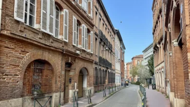
Founded in 1542 after catastrophic mudslides destroyed the original capital at Ciudad Vieja, Santiago de Guatemala (now Antigua) functioned as the colonial administrative center of Central America until a series of devastating earthquakes in 1773 prompted the relocation of the capital to modern-day Guatemala City. Today, Antigua’s municipal architecture preserves its UNESCO World Heritage status, characterized by cobblestone grid layouts, conserved monastic ruins, and multi-colored facades set against the looming backdrop of three major stratovolcanoes: Agua, Fuego, and Acatenango.
Among regional expeditions, the overnight trek of Volcan Acatenango has gained preeminence as a premier adventure tourism offering. Adjacent neighbor Volcán Fuego has remained in a state of near-continuous strombolian eruption since 2002, expelling incandescent lava fragments at regular intervals throughout the night. Climbers establish base camps along the ridges of Acatenango at elevations approaching 3,750 meters to observe these geological events.
Recent volcanic events underscore the necessity of strict regulatory compliance. Following a significant 50-hour paroxysmal eruption phase exhibited by Fuego, the municipal park systems implemented temporary closures of regional climbing routes to ensure public safety. Official regulations mandate that all visitors undertaking overnight ascents must be accompanied by certified local guides. Industry bodies strongly advise verifying that tour operators maintain direct communication lines with the Instituto Nacional de Sismología, Vulcanología, Meteorología e Hidrología (INSIVUMEH) for real-time seismic bulletins prior to departure.

Lago Atitlán: Lacustrine Geography and Indigenous Villages
Occupying a massive volcanic caldera formed by the collapse of a prehistoric magma chamber, Lake Atitlán is framed by three towering cones: San Pedro, Tolimán, and Atitlán. The lake basin supports a diverse network of shoreline communities, each maintaining distinct cultural identities, linguistic traditions, and economic specializations. Panajachel functions as the primary commercial arrival point and transport hub, while neighboring settlements such as San Marcos La Laguna, Santa Cruz La Laguna, and Santiago Atitlán attract varying demographics ranging from wellness practitioners to anthropological researchers.
Public water transit relies on a network of motorized wooden vessels known as lanchas. These water taxis operate on a fill-and-depart schedule from municipal docks, with standard inter-village fares fixed at approximately Q25 per passenger. Standard operating hours run continuously from 7:00 AM to 5:00 PM; however, evening transit options diminish rapidly after nightfall, necessitating advance logistical planning for travelers moving between isolated properties.
Tikal National Park: Mayan Archaeology in the Petén Jungle
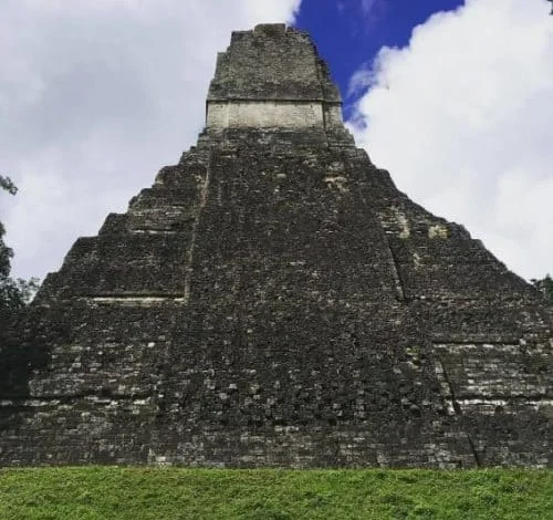
Located in the northern lowlands of the Petén department, the archaeological site of Tikal represents one of the largest urban centers and architectural achievements of the pre-Columbian Maya civilization. Surrounding by dense tropical rainforest that serves as a protected biosphere reserve, Tikal features monumental limestone pyramids, expansive ceremonial plazas, and elevated causeways constructed over a millennium ago. Notably, Temple IV stands as the tallest surviving pre-Columbian structure in the Americas, measuring approximately 70 meters in height and offering panoramic views above the jungle canopy.

The archaeological zone supports a high concentration of indigenous fauna, including howler monkeys, spider monkeys, white-nosed coatis, and numerous avian species. Admission protocols for foreign visitors require the acquisition of official entry vouchers through the Ministry of Culture and Sports portal or via cash transactions at park gates, priced at Q150 per foreign adult for a standard single-day pass. Specialized sunrise admissions (effective from 4:00 AM to 6:00 AM) or sunset entries incur an additional fee of Q100 and mandate the presence of an authorized onsite guide. While most visitors base their accommodations on the nearby island city of Flores on Lake Petén Itzá—located roughly an hour from the park gates—alternative lodging options are available closer to the ruins in El Remate.
Semuc Champey and Río Dulce: Aquatic Ecosystems and Subterranean Rivers
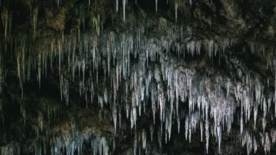
Deep within the limestone hills of the Alta Verapaz department near the indigenous Q’eqchi’ town of Lanquín lies Semuc Champey, a natural limestone bridge measuring 300 meters long beneath which the Cahabón River flows underground. The terraced surface of the bridge features a series of cascading turquoise pools fed by natural springs.
Logistical access to the site has improved significantly following regional infrastructure upgrades, including the complete paving of the access road connecting Lanquín to Semuc Champey, which reduced typical transit times to approximately 15 minutes. Foreign visitor fees are set at Q50, though travelers are advised to carry sufficient cash reserves in quetzales, as regional banking infrastructure remains limited.

Further southeast, near the Caribbean coastline, the Río Dulce corridor connects Lake Izabal to Amatique Bay. The river cuts through dramatic 300-foot limestone canyons blanketed by dense tropical rainforests displaying biodiversity levels comparable to the Amazon basin. Because extensive portions of the riverbanks—including the transit corridor between the lakeside hub of Fronteras and the Garifuna coastal town of Livingston—lack road infrastructure, travel is conducted exclusively via watercraft, isolating the ecosystem from vehicular noise and modern electrical grids while preserving a distinct ecological environment.