West Virginia Unveils Statewide Waterfall Trail Network to Boost Outdoor Recreation and Conservation Tourism


West Virginia—the nation’s only entirely mountainous state, whose ridges and peaks if flattened would sprawl across a geographic area larger than Texas—is cementing its status as an premier destination for freshwater exploration. Home to one of the highest densities of freshwater streams in the United States, the state has officially launched and expanded a comprehensive, statewide network of waterfall trails designed to grant structured public access to its most breathtaking cascades.
The initiative, spearheaded by the West Virginia Department of Tourism in close collaboration with conservation nonprofits, municipal leaders, and state and federal land-management agencies, transforms the region’s natural hydrology into an organized, accessible recreational asset. By pairing rugged wilderness with upgraded infrastructure, the Mountain State is bridging the gap between remote backcountry exploration and sustainable economic development.
Chronology and Development of the Aquatic Passport
The groundwork for this ambitious tourism and conservation initiative was formally laid in 2022. Recognizing the economic potential and ecological value of West Virginia’s countless waterways, the state tourism group initiated a multi-agency partnership to address the lack of standardized access and visitor infrastructure around many of the region’s premier natural water features.
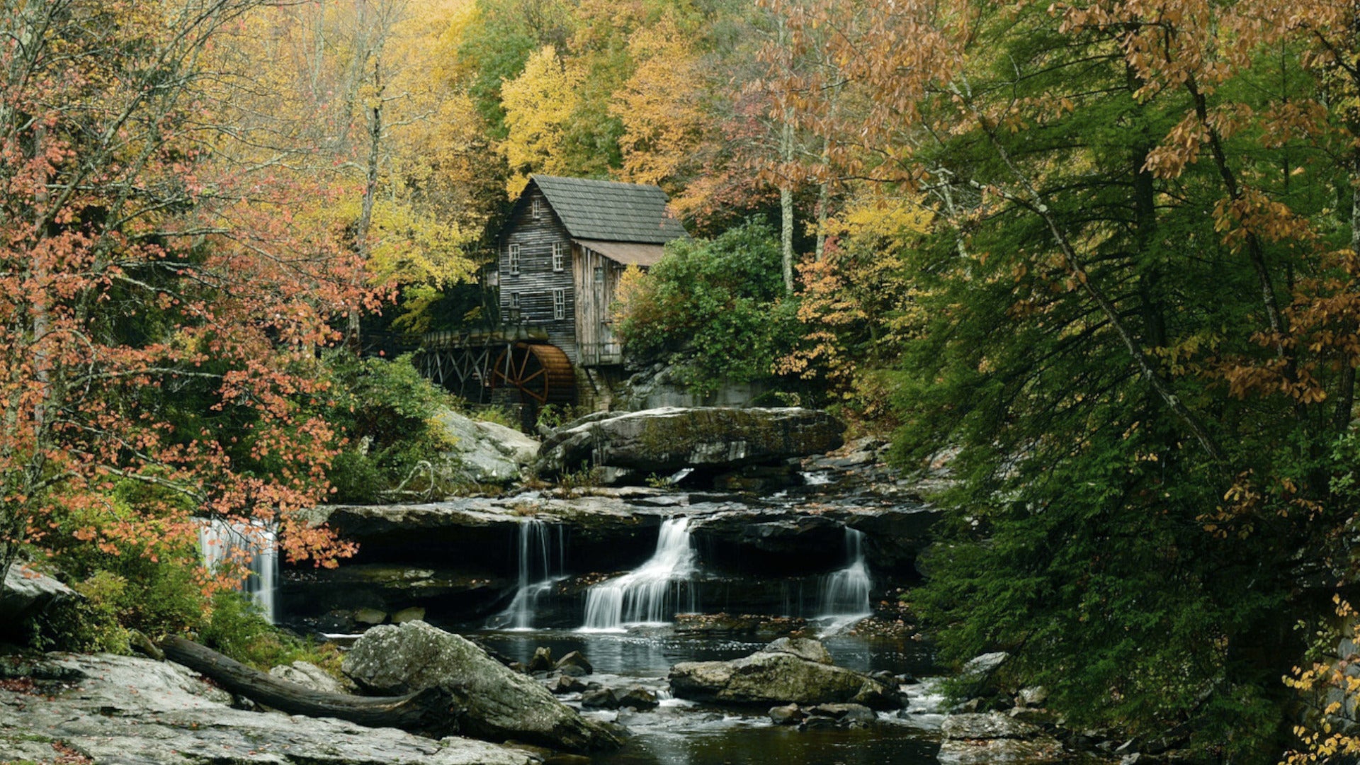
Between 2022 and 2026, the coalition directed substantial capital toward outdoor recreation infrastructure. The ongoing development includes the construction of expanded parking lots, improved footpaths, informational kiosks, clear trail signage, and elevated viewing platforms designed to protect sensitive riparian ecosystems while accommodating growing visitor numbers. These enhancements culminated in the establishment of a flagship Waterfall Trail system, which currently encompasses 43 distinct destinations linked by scenic byways and regional roadways.
To guide travelers through this sprawling network, the state launched a dedicated digital aquatic passport. Accessible via the official West Virginia tourism portal, the platform provides interactive maps, real-time trail condition updates, and curated recommendations for dining, lodging, and cultural attractions in nearby rural communities. The entries are strategically distributed across heavily protected federal and state lands, including the Monongahela National Forest and the New River Gorge National Park and Preserve. While a select few cascades are visible directly from the road, the majority require varying degrees of hiking, ranging from brief boardwalk strolls to demanding multi-mile backcountry excursions.
Spotlight on Flagship Destinations: Engineering and Ecology
The 43-stop trail network features a diverse array of geological formations, ranging from broad shelf-like river drops to towering subterranean plunges. Several standout locations illustrate the geological diversity and ecological richness of the state’s protected public lands.
Sandstone Falls and the New River Gorge
Spanning an impressive 1,500 feet across the width of the New River, Sandstone Falls is widely recognized as a premier geographic feature of the New River Gorge National Park and Preserve. Historically a focal point for whitewater paddlers, the site has been adapted for pedestrian access through a complex of wooden boardwalks and bridges linking two large, wooded islands.
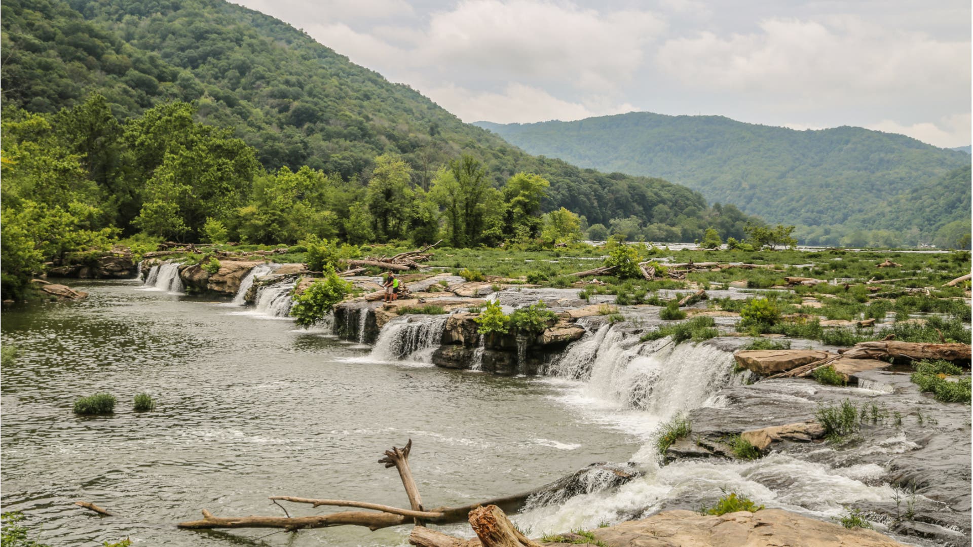
A moderate 0.5- to 1-mile loop trail guides visitors to elevated gravel bars and viewing platforms, offering direct sightlines of shelfy falls ranging between 10 and 25 feet in height. Beyond its geological appeal, the location supports a vital montane riparian ecosystem. Ornithologists and conservationists frequently cite the area for its diverse avian populations, including nesting sites for the northern parula, golden-crowned kinglet, and the federally endangered cerulean warbler. The approach via the historic railroad town of Hinton offers travelers one of the park’s few dedicated riverside drives.
Falls of Hills Creek: Verticality in the Monongahela National Forest
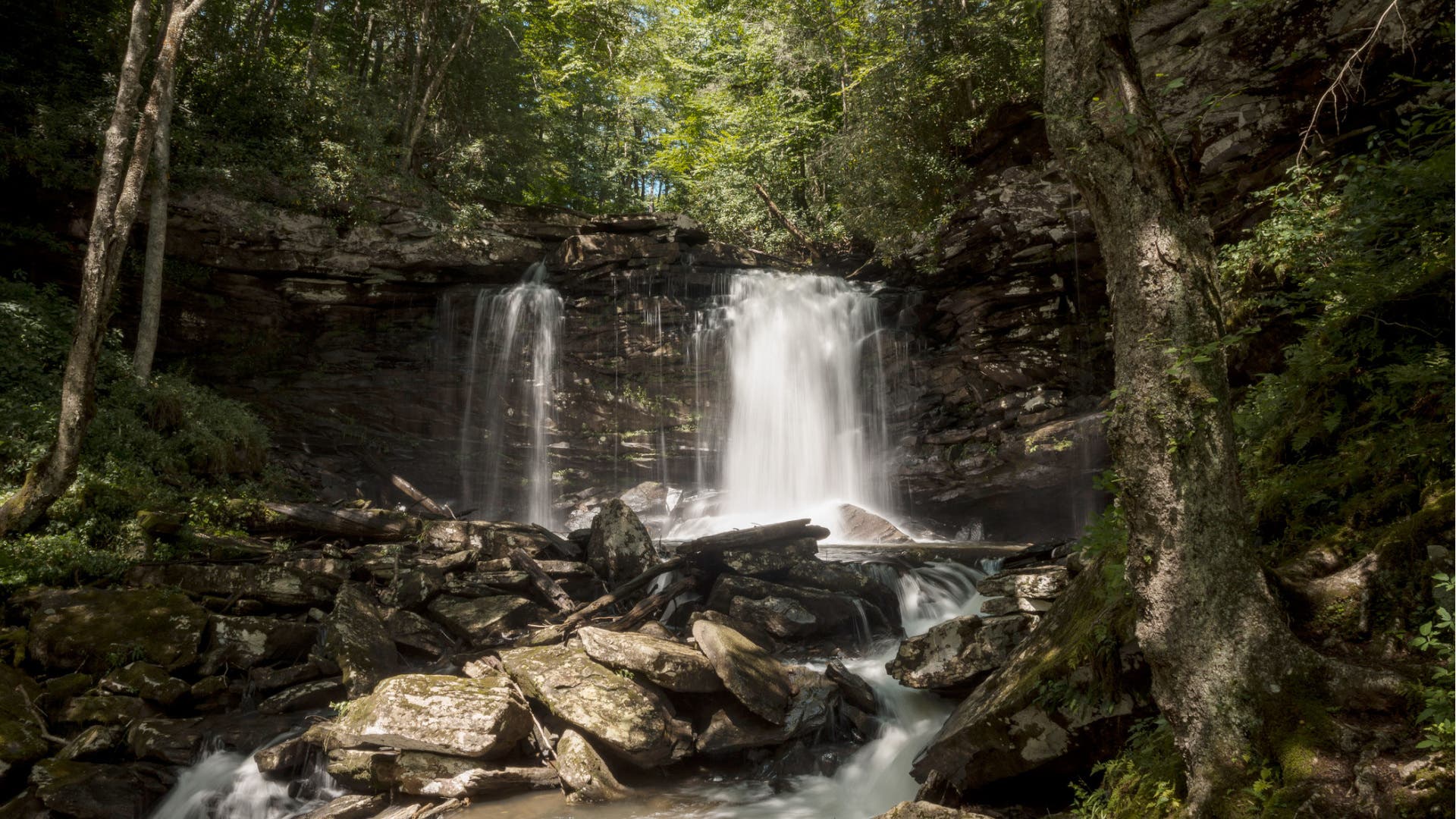
Located approximately 12 miles west of Hillsboro within the Monongahela National Forest, the Falls of Hills Creek represent the tallest plunge system in the state. The 1.4-mile out-and-back trail originates from a gravel trailhead off state Route 39, descending 0.7 miles into a steep, narrow gorge framed by 4,000-foot mountain peaks.
The route traverses a damp, moss-covered hemlock forest and dense rhododendron thickets that parallel a boulder-strewn stream. The waterway descends through three progressively dramatic cascades known as the Upper, Middle, and Lower Falls. Infrastructure investments are particularly evident here, where more than 400 wooden stairs and cantilevered viewing platforms provide safe passage down a 297-foot vertical descent. The grand finale—the Lower Falls—plunges roughly 65 feet from a narrow chute into a deep, bowled pool. During periods of heavy spring snowmelt or winter deep freezes, the volume and ice formations create a dramatic visual spectacle.
Blackwater Falls and Mountain Top Recreation
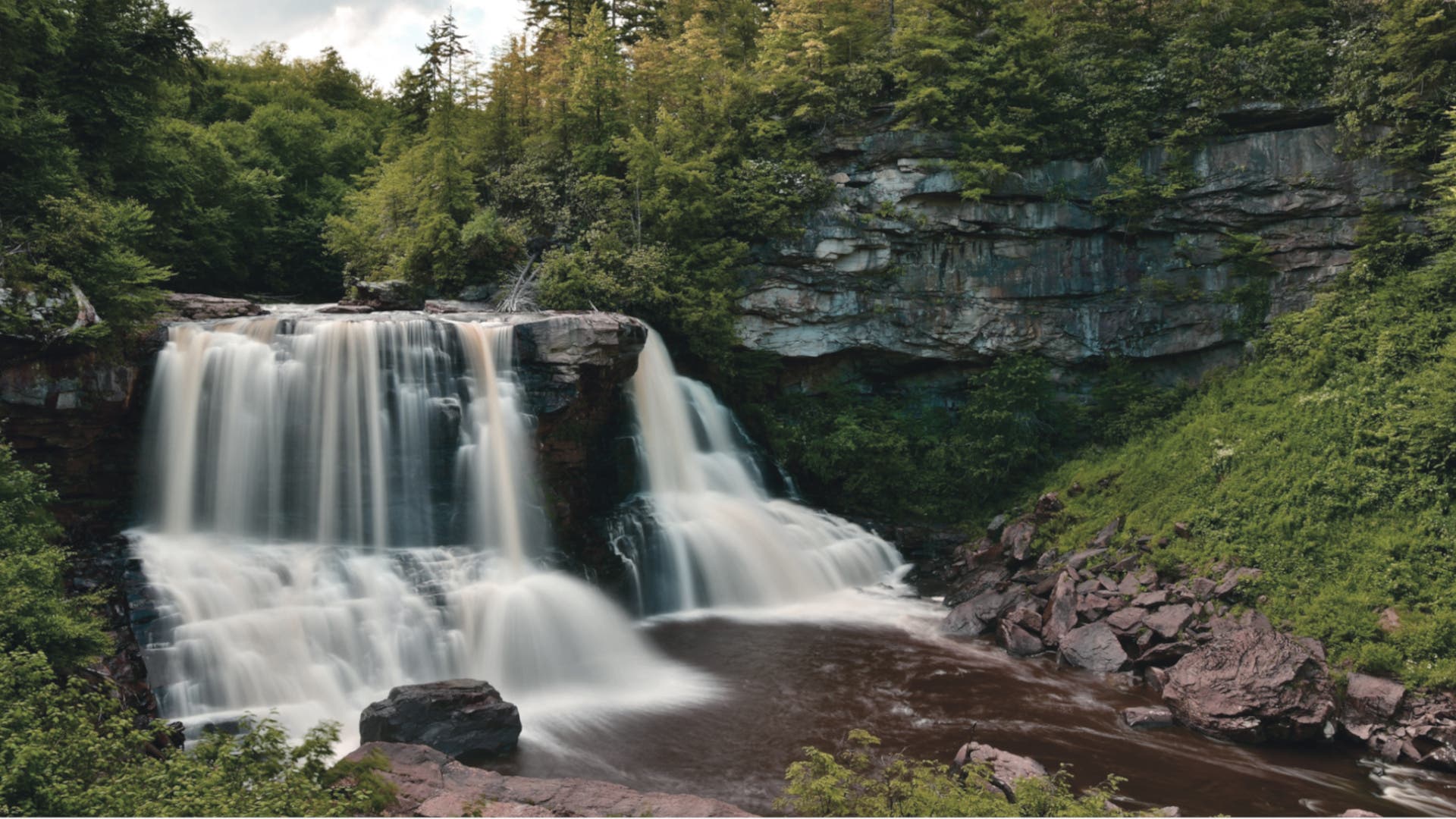
Situated on the edge of the mountain community of Davis within Blackwater Falls State Park, the eponymous 60-foot cascade is among the most photographed natural landmarks in the Mid-Atlantic region. The park maintains two complementary trail systems to provide contrasting perspectives of the amber-colored river—dyed naturally by tannic acid from fallen hemlock and red spruce needles.
The primary access point features a 0.4-mile accessible boardwalk descending from a visitor complex to a viewing deck situated near the base of the cascade. Here, the river divides around a 50-foot-wide sandstone formation characterized by stair-like weather erosion. A secondary parking area across the gorge leads to an observation deck suspended approximately 200 feet above the canyon floor. From this trailhead, hikers can connect to the Yellow Birch Trail, traversing a mile of rare Southern Appalachian spruce-fir forest to reach the mountaintop lodge, which features panoramic bar views of the Blackwater Gorge from an elevation of 3,200 feet.
Butcher Branch Falls and the New River Gorge Preserve
Within the expansive 70,000-acre New River Gorge National Park and Preserve, Butcher Branch Falls serves as a hidden geological feature just outside the municipality of Fayetteville. The 0.8-mile trail begins near a turn-of-the-century coal-mining camp site, traversing a high forested ridge that offers intermittent vistas of the gorge floor 1,000 feet below.
The path eventually descends into a secluded ravine, circling a 120-foot sandstone monolith frequented by regional rock climbers. The 45-foot cascade is characterized by a series of fluted rock slabs enclosed by dense rhododendron canopies. Park planners have integrated this path with the broader Long Point Trail network, allowing hikers to extend their journey by 1.6 miles one way to reach a stone promontory overlooking the New River as it passes beneath the New River Gorge Bridge—the longest steel span of its kind in the Western Hemisphere.
Cathedral Falls and Extended Wilderness Routes
For travelers seeking accessibility without sacrificing scale, Cathedral Falls offers a roadside experience via a 0.1-mile walk off U.S. Route 60. The trail enters a rocky, amphitheater-like hollow defined by layered shale and sandstone escarpments covered in moss, ferns, and mature timber.
For those looking to expand beyond day hikes, the trail network integrates extended backcountry routes. The path to Seneca Creek Falls, situated near the base of the state’s highest peak, Spruce Knob, offers a rigorous 10-mile out-and-back trek, or can be incorporated into a multi-day 17.3-mile backpacking itinerary across high-elevation wilderness zones.
Official Responses and Strategic Implications
State officials and tourism directors emphasize that the rollout of the Waterfall Trail network is part of a broader economic diversification strategy. As West Virginia transitions away from an economy historically reliant on heavy industry and fossil fuel extraction, outdoor recreation and sustainable tourism have emerged as primary economic drivers.
According to regional economic analyses, investments in outdoor infrastructure yield substantial returns by increasing visitor lengths of stay and driving traveler spending into rural communities that historically lacked tourism-based revenue streams. Concurrently, environmental agencies have praised the project for channeling tourist traffic onto hardened, engineered trails, thereby mitigating the ecological degradation, soil compaction, and stream bank erosion previously caused by unregulated foot traffic.
By combining rigorous conservation protocols with modern digital marketing and physical infrastructure, West Virginia’s Waterfall Trail serves as a model for rural economic revitalization through public-private stewardship of natural resources.