
The concept of the "babymoon"—a final vacation taken by expectant parents before the birth of a child—has undergone a significant transformation in recent years. While traditionally viewed as a romantic, couple-centric getaway designed for rest and intimacy, the rising trend of the "second babymoon" introduces a complex layer of logistics: the inclusion of a toddler. This shift from a duo-focused retreat to a family-oriented transition period reflects broader changes in modern parenting and the travel industry’s adaptation to multi-generational needs. As families expand, the priority of these trips often pivots from high-intensity exploration to strategic relaxation, ensuring that the firstborn child feels included before the household dynamic permanently shifts with the arrival of a sibling.
The Evolution of the Babymoon: From Romance to Family Transition
The babymoon phenomenon gained mainstream popularity in the early 2000s, primarily marketed as a luxury indulgence for first-time parents. However, travel industry data suggests a burgeoning niche for families expecting their second or third child. According to market research, the global family travel market is projected to grow significantly over the next decade, with a specific focus on "milestone" trips. The second babymoon fits this category, serving as a symbolic "last hurrah" for the family of three.

Unlike the first babymoon, which often involves international destinations or physically demanding itineraries, the second babymoon requires a pragmatic approach. Experts in family travel, such as Celine Brewer of Baby Can Travel, note that the physical demands of a second pregnancy, coupled with the high energy requirements of a toddler, necessitate a fundamental change in destination selection and activity planning. The goal shifts from "doing it all" to "doing what is manageable."
Comparative Case Studies: Shifting Logistical Requirements
A comparative analysis of travel styles highlights the stark differences between first and second babymoons. In many instances, first-time expectant parents opt for domestic road trips or nature-focused exploration. For example, a common first-order babymoon might involve a two-week excursion through regions like British Columbia, focusing on hiking, marine life observation in Tofino, and urban exploration in Victoria. At this stage, the lack of a child allows for a high degree of spontaneity and physical exertion, even into the third trimester.

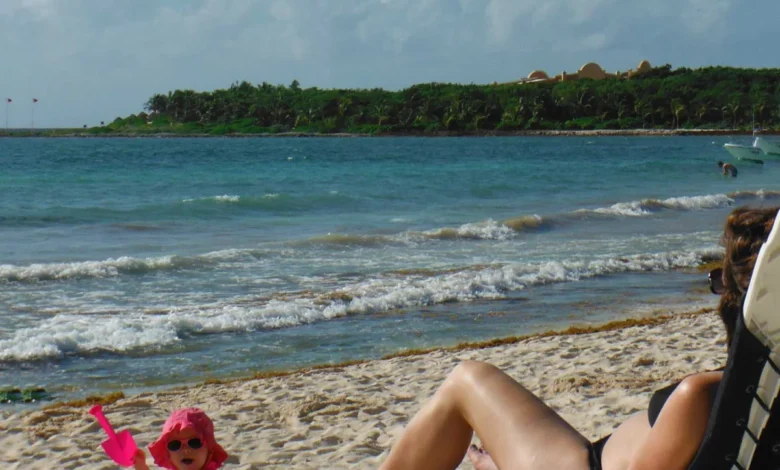
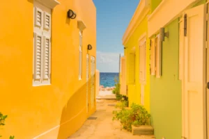
Conversely, the presence of a toddler during a second pregnancy often renders such active itineraries impractical. The physiological toll of a second pregnancy frequently differs from the first, often characterized by increased fatigue or more pronounced symptoms. When combined with a two-year-old’s need for naps, snacks, and early bedtimes, the "active" babymoon is typically replaced by the "stationary" babymoon. This is why all-inclusive resorts, particularly in family-friendly regions like Mexico or the Caribbean, have seen a surge in bookings from this demographic. These environments provide a controlled setting where meals, entertainment, and rest are all accessible within a single footprint, minimizing the logistical friction of travel.
Health and Safety Protocols for Pregnant Travelers
When planning a babymoon with a toddler, medical and safety considerations become paramount. The American College of Obstetricians and Gynecologists (ACOG) generally considers travel safe for pregnant women up to 36 weeks, provided there are no underlying complications. However, the second trimester (weeks 14 to 28) is widely cited by medical professionals as the "sweet spot" for travel. During this window, morning sickness has typically subsided, and the physical discomfort of the third trimester has not yet peaked.

Industry-standard safety protocols for second babymoons include:
- Air Travel Regulations: Most domestic airlines allow pregnant passengers to fly until the 36th week, while international carriers may have a cutoff as early as 28 or 32 weeks. It is increasingly common for airlines to require a medical certificate or "fit to fly" letter from an OB-GYN or midwife.
- Hydration and Circulation: On flights or long car rides, pregnant travelers are advised to wear compression stockings and move every hour to mitigate the risk of Deep Vein Thrombosis (DVT), a risk factor that is slightly elevated during pregnancy.
- Proximity to Care: Fact-based planning requires choosing destinations with reputable medical facilities. For international travel, many families now prioritize "easy" destinations—those with high standards of food and water safety and accessible healthcare—to avoid the risks associated with tropical diseases or gastrointestinal distress.
Strategic Planning: The "One Activity Per Day" Rule
To maintain the "vacation" aspect of a babymoon while managing a toddler, travel strategists recommend a shift in itinerary structure. The most successful family babymoons often follow a "one main activity per day" framework. This approach acknowledges the unpredictability of toddler behavior and the fluctuating energy levels of the pregnant parent.

Morning hours are typically the most productive for families with young children. Planning a visit to a local park, a short swim, or a brief sightseeing excursion before lunch allows the family to capitalize on peak energy. The afternoon is then reserved for "protected downtime," aligning with the toddler’s nap schedule. This period is crucial for the expectant mother to rest, which is often a primary objective of the trip.
Accommodation Selection: Prioritizing Functional Infrastructure
The criteria for choosing accommodations change drastically when a toddler is involved. While a boutique hotel in a city center might be ideal for a first babymoon, it often lacks the infrastructure required for a family of three. Key features now sought by babymooners include:

- Separate Sleeping Quarters: Suites or rentals with a separate bedroom allow parents to remain awake and active after the toddler’s 7:00 PM or 8:00 PM bedtime, preserving the "couple time" that defines the babymoon concept.
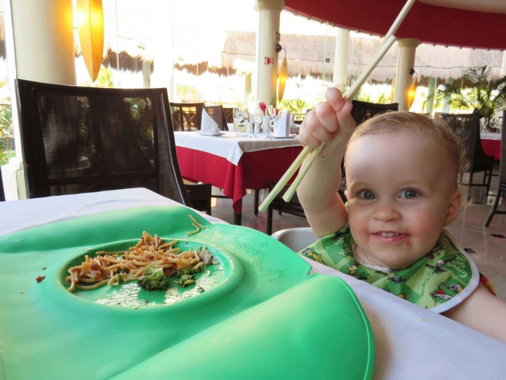
- Kitchenette Facilities: The ability to store milk, fresh fruit, and snacks is essential for managing toddler hunger cycles and pregnancy cravings or dietary needs.
- On-Site Amenities: Resorts that offer "splash pads" or shallow pools specifically designed for toddlers allow for safe play without the stress of navigating deep water or heavy surf.
The Psychological Impact on the Firstborn Child
Beyond the physical rest for the parents, the second babymoon serves a critical developmental purpose for the toddler. Child psychologists often emphasize the importance of "special time" during the transition to becoming a big sibling. The arrival of a new baby inevitably results in a division of parental attention; therefore, a dedicated trip focused on the first child can help reinforce their sense of security.
Activities such as playing in the sand, sharing a special meal, or simply having undivided attention from both parents can mitigate the potential jealousy or anxiety associated with a new family member. While the toddler may not grasp the full significance of the "babymoon," the positive associations with family travel can ease the emotional transition that occurs once the newborn arrives.

Industry Response: The Rise of "Toddler-Centric" Luxury
The travel industry has responded to this demographic shift by enhancing "toddler-centric" luxury offerings. Major resort brands in Mexico and the Caribbean have invested in certified childcare services, specialized toddler menus, and "baby concierge" programs that provide cribs, strollers, and bottle warmers upon arrival. This reduction in "gear lag"—the stress of packing and transporting bulky baby equipment—is a significant driver for families choosing all-inclusive options over traditional rentals.
Furthermore, travel insurance providers have seen an uptick in "cancel for any reason" (CFAR) policies among pregnant travelers. Given the dual unpredictability of pregnancy health and toddler illnesses, the financial protection offered by these policies has become a standard component of the babymoon planning process.

Broader Implications and Long-Term Trends
The trend of the second babymoon reflects a broader societal shift toward valuing experiential family bonding. As the "sandwich generation" of parents balances career demands with the complexities of raising young children, these trips represent a deliberate pause in an otherwise high-speed lifestyle.
Data indicates that families who travel successfully during the toddler years are more likely to continue traveling as a family of four. The second babymoon, therefore, is not just a final trip for the current family structure, but a training ground for future excursions. By choosing "easy over impressive" and prioritizing manageable logistics, parents set a sustainable precedent for family travel.
In conclusion, the modern babymoon with a toddler is a strategic exercise in balance. It requires acknowledging the physical limitations of pregnancy while catering to the developmental needs of a young child. Whether it is a quiet weekend at a nearby lake or a week at a coastal resort, the value lies in the intentionality of the time spent together. As the travel landscape continues to evolve, the focus on inclusive, low-stress, and family-oriented experiences is likely to remain the gold standard for those expecting their second child.


