The global tourism sector has experienced a profound structural shift over the past decade, moving away from rigid group excursions toward independent, self-directed itineraries. Industry data compiled by major travel associations reveals that solo travel inquiries have surged by more than 40% since 2020, with demographic shifts pointing toward a permanent lifestyle change rather than a passing trend. Despite this widespread adoption, a persistent cultural anxiety remains: the fear of chronic isolation. While structured group tours offer built-in social networks, independent solo travelers frequently confront skepticism regarding whether journeying entirely alone equates to being lonely.
For millions of solo adventurers, however, independent travel does not mean solitary confinement. In fact, seasoned travelers often report that navigating a foreign destination alone acts as a social catalyst, compelling individuals to step outside their comfort zones and engage with local populations in ways that packaged tours rarely permit. Psychological studies on travel behavior indicate that solo travelers are significantly more approachable to locals and fellow tourists than people traveling in pairs or groups, effectively breaking down social barriers. To demonstrate how independent wandering frequently leads to deep, unexpected human connections, a retrospective examination of five distinct encounters across the globe illustrates the reality of solo mobility.

The Psychological Mechanics of Solo Socialization
The transition from solitude to connection on the road is rarely accidental; it relies on subtle behavioral adjustments. Behavioral researchers note that solo travelers naturally adopt heightened situational awareness. Without the conversational safety net of a familiar companion, independent travelers must look outward, scanning their environment for engagement. This heightened state of observation often brings hidden cultural gems to the surface that group tourists miss entirely, shielded as they are within their traveling bubbles.
Introverted travelers, in particular, often master specialized techniques over years of independent transit. Simple actions—such as securing a single bar seat during peak dining hours, choosing public transit over private hires, or pausing in communal public squares—shift the probability of interaction heavily in favor of the traveler. Far from being a handicap, introversion often fosters active listening, transforming brief casual exchanges into profound cross-cultural dialogues.
Key West, Florida: Perspective and Resilience
The chronology of unexpected connections often begins in the most mundane tourist hubs. In Key West, Florida, a chance encounter on Mallory Square—the iconic waterfront plaza where crowds gather nightly to observe the sunset—demonstrated how a simple momentary pause can yield enduring life lessons. Navigating the dense mingling of cruise ship passengers and local artisans, a solo traveler sought the only available seating on a crowded bench next to an elderly man quietly observing the horizon.
A brief, polite smile served as the catalyst for an extensive conversation with Ron, a 70-year-old veteran. As the conversation unfolded, Ron’s life story emerged as a study in profound resilience. As the sole survivor among 14 siblings and a veteran of four distinct tours of duty in Vietnam—enduring multiple combat injuries that defied medical expectations—Ron embodied a philosophical outlook anchored by a simple personal maxim: "Positive thinkers go everywhere. Negative thinkers go nowhere." For an independent traveler, such encounters dismantle the artificial barriers of tourist-host dynamics, reframing travel as a seminar in human endurance.
Rishikesh and Pushkar, India: Calculated Risks and Cultural Nuance
Stepping outside familiar cultural frameworks often requires calculated risk, a dynamic vividly illustrated during an independent excursion through India. For many first-time solo travelers, choosing the Indian subcontinent as an inaugural destination appears counterintuitive. Tourism analytics frequently rank India among the more challenging destinations for unassisted novices due to sensory overload, complex transit networks, and distinct social norms.
However, calculated risks frequently yield exponential rewards. At an ashram in Rishikesh, two independent travelers crossed paths: one an experienced globetrotter, the other a first-time solo voyager celebrating her 40th birthday across a five-month itinerary. What began as a week-long shared accommodation at the spiritual retreat evolved into a two-week collaborative expedition through Rajasthan. Together, the pair navigated the complex Indian railway system, explored vibrant regional markets, and visited the Taj Mahal before amicably parting ways to resume their respective solo journeys.

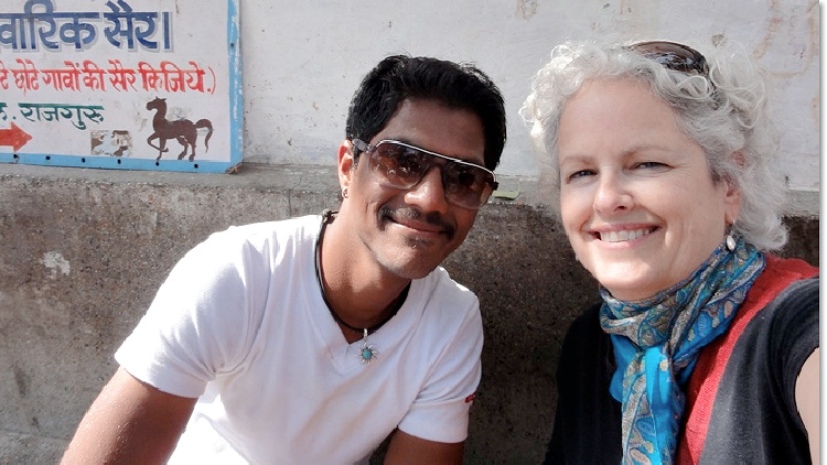
This immersive capacity extended further north to Pushkar, where another spontaneous interaction bridged cultural divides. Near a historic temple, a chance conversation with a local shoe-locker attendant named Baabush transformed an ordinary afternoon into an intensive cultural exchange. Discovering a shared command of the French language, the attendant took a brief work break to converse. Over the course of an hour, the discussion shifted from basic pleasantries to deep explorations of regional family structures, educational aspirations, and local socio-economic realities. Such spontaneous exchanges underscore a core tenet of solo travel: genuine cultural immersion is rarely found in guidebooks; it is accessed through linguistic bridges and open-ended curiosity.
Rochester, New York: Small-Town Hospitality and Urban Discovery
Independent travel is not restricted to exotic international destinations; domestic travel frequently yields parallel moments of serendipity. In Rochester, New York, a solo diner seeking supper at a bustling local establishment, The Hideaway, discovered the tangible economic and social benefits of traveling alone. Confronted with a packed house, the traveler secured the sole remaining seat at the end of the bar.
Within minutes, neighboring patrons Sandy and Mark initiated a conversation that traversed professional backgrounds, regional history, and travel philosophies. When their table became available, the couple extended an invitation for the solo traveler to join them. The evening expanded further with the arrival of Tom and Darlene, close friends of the couple, with Tom having recently retired as the restaurant’s long-time owner. The ensuing hours provided deep institutional knowledge of Rochester’s cultural landscape, punctuated by local hospitality that culminated in the hosts covering the traveler’s meal. Economic analysts of the hospitality sector note that independent diners are frequently the beneficiaries of local goodwill, as restaurant staff and patrons alike often feel a subtle social inclination to ensure solo guests feel welcomed.
St. Andrews, New Brunswick: Unlocking the Local Music Ecosystem
Small towns present distinct operational challenges and social rewards for the independent traveler. In smaller municipalities, cultural hubs are rarely advertised on major tourism platforms; they are preserved within informal networks overseen by local community figures. In St. Andrews, New Brunswick, unlocking these hidden cultural assets required a direct, systematic approach: simply asking a local retail worker to identify the town’s primary cultural connector.
That inquiry led directly to Jamie Steel, a prominent fixture in the regional music community whose encyclopedic knowledge of local artistic heritage defines the town’s cultural pulse. By engaging with local key informants, the solo traveler gained immediate access to an exclusive evening featuring performances by the Nashville String Band, which included several Grammy Award-winning musicians. This methodology highlights a broader structural advantage of solo travel: independence forces travelers to engage directly with residents, yielding access to authentic community experiences that remain entirely invisible to organized tour groups.
Economic and Sociological Implications of Solo Mobility
The cumulative evidence from these diverse encounters points to a broader transformation in modern tourism economics. The rise of the solo traveler has catalyzed the expansion of hospitality infrastructure designed to accommodate unattached guests, from communal dining formats and boutique hostels tailored to remote workers to digital travel networks that facilitate localized meetups.

Sociologists suggest that independent travel serves as a vital antidote to modern urban alienation. By stripping away the protective shell of a travel companion or structured tour group, the solo traveler is functionally required to practice vulnerability, active listening, and cross-cultural empathy. Far from experiencing chronic loneliness, the independent traveler often engages in a higher frequency of meaningful human contact than individuals traveling within insular pairs or families.
Ultimately, independent travel validates the premise that solitude and loneliness are fundamentally distinct states. While solitude offers the cognitive space necessary for personal reflection and self-reliance, the open road remains remarkably populated with individuals eager to share their stories, their hospitality, and their perspectives. For those willing to take the initial step—whether sitting next to a veteran in Key West, striking up a conversation outside an Indian temple, or asking a small-town shopkeeper for directions—the solo journey proves to be one of the most socially enriching endeavors available in the modern world.