Exploring the Labyrinth: A Comprehensive Guide to Backpacking Canyonlands National Park’s Needles District

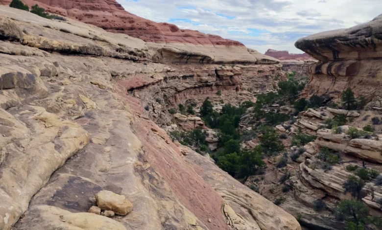
Canyonlands National Park remains one of the most geographically complex and visually striking protected natural areas in the United States. Spanning over 337,000 acres of southeastern Utah, the park is divided into four distinct districts: Island in the Sky, The Maze, the Rivers, and the Needles. While each section offers a unique perspective of the Colorado Plateau’s geologic history, the Needles District is particularly renowned for its dense concentration of colorful spires, sandstone fins, and intricate canyon networks.
A recent multi-day expedition undertaken by outdoor writers and veteran park visitors highlights a classic route through this remote sector: a loop combining Big Spring, Lost, and Wooden Shoe Canyons. Suitable either as a strenuous day hike or a relaxed two-night backpacking trip, the trail traverses high sandstone benches and deep arroyos choked with willow. This detailed overview examines the logistical requirements, geographical context, safety considerations, and broader ecological impacts associated with recreating in this heavily protected desert ecosystem.
Geological Context and Background of the Needles District
The dramatic topography of the Needles District was shaped over millions of years through the deposition and erosion of sedimentary layers. The prominent red and white spires that give the district its name are composed of Cedar Mesa Sandstone, deposited during the Permian period approximately 280 million years ago. Continuous weathering, wind erosion, and water movement along joints and fractures in the rock have carved out the deep, labyrinthine canyons that define the landscape today.
Unlike the broad vistas of the Island in the Sky district, the Needles forces visitors to experience the landscape from the ground up. Trails frequently alternate between exposed, elevated slickrock benches—offering sweeping panoramic views of the surrounding desert—and narrow, sandy-bottomed arroyos flanked by towering vertical walls. Vegetation in these drainages is sparse yet resilient, featuring dense thickets of willow, tamarisk, and scattered cottonwoods that depend on ephemeral water sources.
Logistical Framework and National Park Service Regulations
Managing visitor impact in an arid environment requires strict regulatory oversight. The National Park Service (NPS) enforces a mandatory permit system for all overnight stays within the backcountry of Canyonlands National Park. Because water and suitable camping locations are severely limited, overnight visitors must reserve designated campsites well in advance through Recreation.gov.
The standard entrance fee for the park is $30 per private vehicle, valid for seven days, though frequent visitors often utilize the America the Beautiful Interagency Annual Pass. Backcountry regulations are designed to protect both the natural landscape and the wilderness experience of other travelers. Campfires are strictly prohibited throughout the backcountry, and all solid human waste must be packed out or disposed of in accordance with current park guidelines, typically utilizing portable waste containment bags in sensitive slickrock zones.
Step-by-Step Route Description and Technical Cruxes
The route combining Wooden Shoe, Lost, and Big Spring Canyons provides a comprehensive cross-section of the Needles District’s varied terrain. Most hiking guidebooks and experienced rangers recommend traveling the loop in a clockwise direction to optimize water availability, manage sun exposure, and handle technical obstacles safely.
Starting at the Salt Flat Trailhead, hikers begin along the Wooden Shoe Canyon Trail, bearing left at the initial junction to maintain the loop’s trajectory. Approximately 1.3 miles into the trek, the route ascends a broad sandstone bench, bringing travelers to the technical crux of the hike: an eight-foot vertical ladder bolted into the rock face. This metal fixture assists hikers in negotiating a sheer pour-off, dropping them securely into the upper reaches of Lost Canyon.
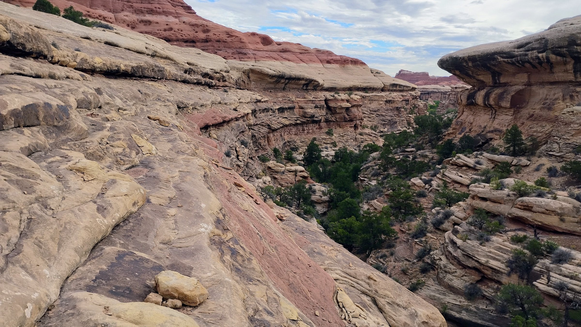
From this point, the trail follows the canyon floor, alternating between soft sand and packed slickrock arroyo bottoms as the gorge gradually narrows. Navigation requires careful attention to stone cairns placed by park staff and volunteers to guide travelers across sensitive rock surfaces and around obstacles.
After another short climb and descent out of Lost Canyon, hikers reach a junction at approximately mile 5.6, where they bear left onto the Wooden Shoe Canyon Trail. Continuing through Wooden Shoe Canyon, the route passes the intersection with the South Connector Trail at mile 6.6. A final strenuous climb over a slickrock col leads travelers out of Wooden Shoe and down into the wide expanse of Big Spring Canyon, which serves as the final corridor back to the Salt Flat Trailhead.
Hydrological Realities and Safety Protocols
Water management is the single most critical safety factor for anyone visiting the backcountry of southeastern Utah. Unlike mountainous regions crisscrossed by perennial streams, the Needles District is devoid of reliable, natural freshwater sources. Natural pools, potholes, and ephemeral puddles scatter the slickrock following precipitation events, but these sources are heavily contaminated with wildlife waste, sediment, and bacteria. Furthermore, they evaporate rapidly under the desert sun.
Park rangers consistently advise hikers to carry all necessary drinking water from the visitor center or established trailheads. Standard recommendations suggest a minimum of one gallon of water per person, per day, though strenuous conditions or high summer temperatures can significantly increase physiological requirements.
Flash flood hazards represent another persistent danger in canyon environments. Even when skies are clear at a hiker’s immediate location, severe thunderstorms miles away can funnel massive walls of water down narrow arroyos with little to no warning. Weather forecasts must be thoroughly reviewed prior to departure, and visitors should immediately evacuate canyon bottoms if dark clouds gather upstream or rain begins to fall.
Ecosystem Preservation and Biological Soil Crusts
Recreationists in Canyonlands National Park share the landscape with an ancient and highly fragile living ecosystem known as biological soil crust. Often appearing as dark, bumpy, or undulating black ridges on the soil surface, this community is composed of cyanobacteria, lichens, mosses, and fungi.
Biological soil crusts play a vital ecological role in the desert by stabilizing loose sand against wind and water erosion, fixing atmospheric nitrogen, and assisting in moisture retention for desert plants. Despite their tough appearance, these crusts are extremely brittle. A single footprint can crush decades of slow growth, leaving the underlying soil vulnerable to erosion and permanently altering the micro-habitat. Park authorities emphasize the critical importance of adhering strictly to established trails, walking on solid rock whenever possible, and avoiding all darkened soil surfaces.
Broader Economic and Regional Implications
The popularity of routes within the Needles District underscores broader economic trends across southeastern Utah, where outdoor recreation serves as a primary economic driver for gateway communities like Moab, Monticello, and Blanding. Local tourism boards and federal land managers continually balance the economic benefits of increased visitation with the pressing need for resource protection and infrastructure maintenance.
As visitation numbers across the National Park System continue to test the carrying capacity of delicate desert environments, federal agencies are increasingly turning to advanced reservation systems, educational campaigns, and targeted trail rehabilitations. For travelers, adherence to Leave No Trace principles and careful preparation are no longer just ethical recommendations—they are essential requirements to ensure that remote desert canyons like Lost Canyon remain pristine and accessible for future generations.