The Ultimate Guide to the Lost City Trek in Colombia’s Sierra Nevada Mountains

The archeological site of Teyuna, popularly known as Ciudad Perdida or the "Lost City," represents one of the most significant pre-Columbian urban centers in South America. Situated deep within the Sierra Nevada de Santa Marta mountains of northern Colombia, the site predates Peru’s Machu Picchu by approximately 650 years. Today, the trek to this ancient citadel has evolved into a cornerstone of Colombia’s adventure tourism sector, offering a 46-kilometer (28-mile) round-trip journey through dense tropical rainforests, steep river valleys, and indigenous territories. Managed under strict regulations by the Colombian Institute of Anthropology and History (ICANH), the site is accessible only via multi-day guided expeditions that emphasize both physical endurance and cultural immersion.

Historical Context and Archeological Significance
Founded around 800 A.D. by the Tayrona civilization, the Lost City served as a primary political and manufacturing hub for a network of villages in the Sierra Nevada mountains. At its peak, the city is estimated to have housed between 2,000 and 8,000 residents. The architecture is characterized by a series of 169 terraces carved into the mountainside, connected by a complex network of tiled roads and several small circular plazas.

The city was abandoned during the Spanish Conquest in the late 16th century, primarily due to the introduction of European diseases rather than direct military confrontation. While the site remained known to the local indigenous descendants—the Kogi, Wiwa, Arhuaco, and Kankuamo peoples—it was officially "lost" to the outside world for centuries. It was not until 1972 that "discovery" occurred when local treasure hunters, known as huaqueros, stumbled upon the stone steps while exploring the Buritaca River. Following a period of looting, the Colombian government intervened in 1975, initiating archeological excavations and establishing the site as a national park.

Chronology of the Expedition: The 46-Kilometer Journey
The modern expedition to Ciudad Perdida typically spans four to five days, departing from the coastal city of Santa Marta. The journey is categorized by high humidity, significant elevation changes, and the crossing of the Buritaca River.

Phase I: The Ascent from Machete Pelao
The trailhead begins in the small farming community of Machete Pelao. The initial stage of the trek involves a steep ascent through agricultural land and secondary forests. Trekkers encounter the first of several swimming holes, which serve as critical cooling points in the tropical heat. This phase introduces hikers to the logistical reality of the region, where all supplies, including food and bedding, are transported via mule trains.

Phase II: Indigenous Territories and the Tropical Jungle
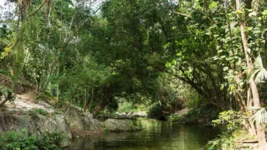
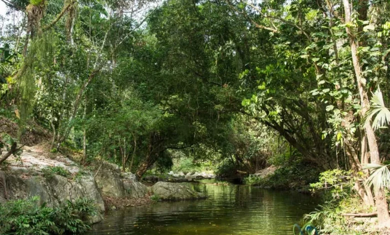
As the trail moves deeper into the mountains, it enters the ancestral lands of the Kogi and Wiwa communities. These groups are considered the "Elder Brothers" by their own tradition, tasked with maintaining the spiritual and ecological balance of the "Heart of the World" (the Sierra Nevada). The landscape transitions into primary rainforest, where the trail becomes a series of steep mud paths and river crossings. Campsites in this region, such as Wiwa Camp and El Paraíso, provide basic dormitory-style accommodations with hammocks or bunks protected by mosquito netting.

Phase III: The Final Climb to Teyuna
The approach to the Lost City requires the ascent of 1,200 narrow, moss-covered stone steps. This final climb is often performed at dawn to mitigate the effects of the midday heat. Upon reaching the terraces, visitors are presented with the iconic view of the central plazas. Archeological evidence suggests these terraces once supported wooden structures with thatched roofs. Indigenous guides often perform a brief ceremony or offer historical narratives, linking the ancient ruins to the living traditions of the contemporary Sierra Nevada tribes.

Phase IV: The Return Descent
The return journey follows the same path back to Machete Pelao. While the physical demand of climbing is reduced, the descent can be taxing on the joints, particularly during the rainy season when the trails become slick with mud. The trek concludes with a transfer back to Santa Marta, marking the end of a circuit that involves approximately 2,000 meters of cumulative elevation gain.

Logistical Data and Technical Difficulty
The Lost City Trek is rated as a medium-to-high difficulty excursion. While it does not require technical mountaineering skills, it demands a high level of cardiovascular fitness.

- Distance: 46 kilometers (28 miles) total.
- Maximum Altitude: Approximately 1,200 meters (3,937 feet) above sea level.
- Climate: Tropical rainforest; temperatures range from 25°C to 35°C (77°F to 95°F) during the day, with humidity levels often exceeding 80%.
- Infrastructure: Campsites are equipped with cold-water showers and flush toilets. Electricity is intermittent and often provided by small generators or solar panels.
Seasonal variations play a critical role in the trekking experience. The dry season, from December to March, offers firmer trails and lower river levels. Conversely, the rainy season (May to November) results in deep mud and more challenging river crossings, though the landscape is notably lusher. Notably, the park typically closes for the month of September. This closure allows for environmental recovery and gives the indigenous communities time to perform spiritual cleansing rituals without the presence of tourists.

Indigenous Stewardship and Official Regulations
A defining feature of the Ciudad Perdida experience is the partnership between tourism operators and the local indigenous populations. Under current Colombian law, the trek cannot be performed independently; visitors must join an expedition led by one of the few authorized agencies.

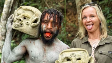
In recent years, there has been a concerted effort to shift the narrative of the trek toward "cultural trekking." This involves employing Wiwa and Kogi guides who provide a first-person perspective on the history of the Tayrona and the spiritual significance of the mountains. This model of community-based tourism ensures that a portion of the trekking fees is reinvested into local indigenous schools, healthcare, and infrastructure.

Official statements from the Colombian Institute of Anthropology and History (ICANH) emphasize that the site is a delicate archeological resource. Visitors are prohibited from climbing on certain walls or removing any artifacts. The presence of the Colombian National Army along the route provides a layer of security, a vestige of the region’s turbulent history that has transitioned into a period of relative stability and high-volume tourism.

Essential Equipment and Preparation
Success on the trail is largely dependent on proper gear selection. Due to the high humidity, clothes rarely dry overnight, necessitating a "wet and dry" packing strategy.

- Footwear: High-quality hiking boots with deep tread are essential for mud. Many trekkers also carry "river shoes" or sandals for campsite use and river crossings.
- Moisture Management: Synthetic, quick-dry fabrics are preferred over cotton.
- Insect Protection: The region is home to high concentrations of mosquitoes and sandflies. High-DEET repellents and long-sleeved clothing for the evenings are standard recommendations.
- Hydration: Trekkers are advised to consume 3-4 liters of water daily. Most agencies provide treated or boiled water at campsites.
Broader Impact and Economic Implications
The rise of the Lost City Trek has had a transformative impact on the regional economy of the Magdalena department. Adventure tourism has replaced illicit crop cultivation and small-scale logging as the primary source of income for many families in the Buritaca river valley.

According to industry analysis, the trek supports a diverse supply chain, including specialized mountain cooks, muleteers, jeep drivers, and administrative staff in Santa Marta. Furthermore, the global visibility of Ciudad Perdida has bolstered Colombia’s reputation as a destination for sustainable and archeological tourism, placing it in direct competition with more established sites in Peru and Guatemala.

However, the increase in foot traffic presents ongoing challenges for conservation. The ICANH and local indigenous councils continuously monitor the impact of tourism on the stone terraces and the surrounding ecosystem. Future management plans are expected to focus on limiting daily visitor caps and improving waste management systems at the remote campsites to ensure the long-term viability of the site.

In conclusion, the Lost City Trek is more than a physical challenge; it is a vital link between Colombia’s ancient past and its contemporary cultural identity. For the global traveler, it offers a rare opportunity to witness an active archeological site while engaging with the indigenous communities that have served as its guardians for over five centuries. Through regulated tourism and community involvement, Teyuna remains a testament to the resilience of the Tayrona civilization and the natural majesty of the Sierra Nevada de Santa Marta.