Navigating the Majestic Waters of Lake Superior: An In-Depth Look at the State Water Trail

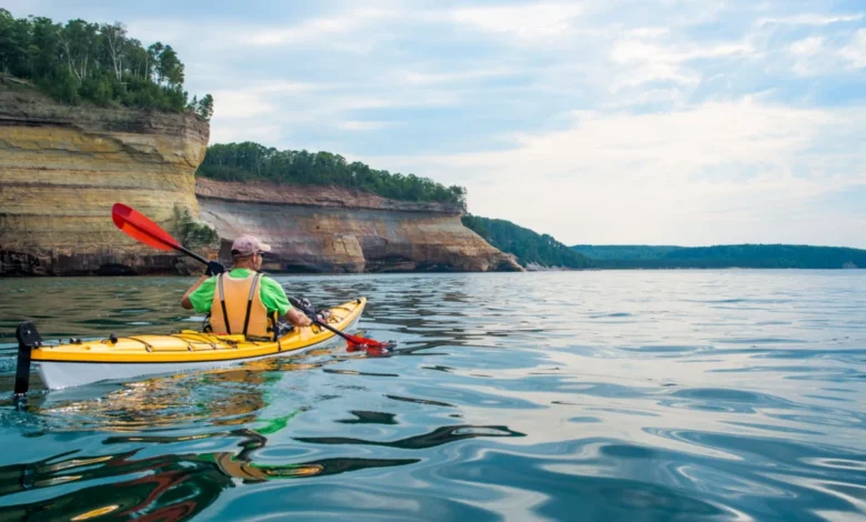
Published on July 18, 2026, Lake Superior, the world’s largest freshwater lake by surface area and third-largest by volume, continues to captivate with its immense scale and untamed beauty. Holding an astonishing ten percent of the Earth’s available fresh surface water, this inland sea is a force of nature so vast it generates its own distinct weather patterns, akin to the towering peaks of Denali or Mount Everest. Its expansive waters touch the shores of two nations—the United States, spanning the states of Minnesota, Wisconsin, and Michigan, and Canada, bordering the province of Ontario. Long before these modern political demarcations were conceived, the shoreline of Lake Superior served as the ancestral home and vital resource for numerous First Nations and Indigenous communities, whose ancient connection to these waters runs deep.
For those seeking an intimate and comprehensive encounter with this colossal body of water, few experiences rival paddling the entire length of the Lake Superior State Water Trail. This formidable 150-mile route charts a course from the St. Louis Bay in Duluth, Minnesota, tracing the rugged North Shore to its terminus at the Pigeon River, marking the international boundary with Canada. It offers an unparalleled perspective on one of North America’s most significant natural wonders.
"With its impressive basalt rock geology, sprawling ancient forests, and myriad secluded beaches, it is one of the best ways to explore the lake from a completely different, immersive perspective," states Abby Halom, an experienced paddling guide and co-founder of Day Tripper of Duluth. Halom, a veteran of over 17 years in guiding expeditions on Lake Superior, has personally traversed extensive sections of the trail. Her company, Day Tripper of Duluth, is renowned for leading custom itineraries and day trips along various segments of the Lake Superior Water Trail, providing crucial local expertise and support to adventurers. In an exclusive interview with Backpacker magazine, Halom detailed the diverse offerings of the trail for paddlers, hikers, and anyone drawn to experience this incredible lake up close and personal.
The Genesis and Significance of the Water Trail
The Lake Superior State Water Trail is not merely a recreational route; it represents a commitment to preserving and providing access to one of the planet’s most vital freshwater ecosystems. Established and maintained by the Minnesota Department of Natural Resources (DNR), the trail was developed to promote sustainable outdoor recreation, environmental stewardship, and a deeper appreciation for the North Shore’s unique landscape. Its creation involved extensive planning, mapping, and the establishment of a network of campsites and access points, ensuring a balance between wilderness experience and necessary infrastructure. The trail serves as a testament to the growing popularity of adventure tourism and the increasing demand for immersive wilderness experiences that connect individuals with nature. It is a key component of Minnesota’s broader State Water Trails system, which aims to make the state’s rivers and lakes more accessible for paddling.
Navigating a Trail of Water and Land: A Segmented Journey
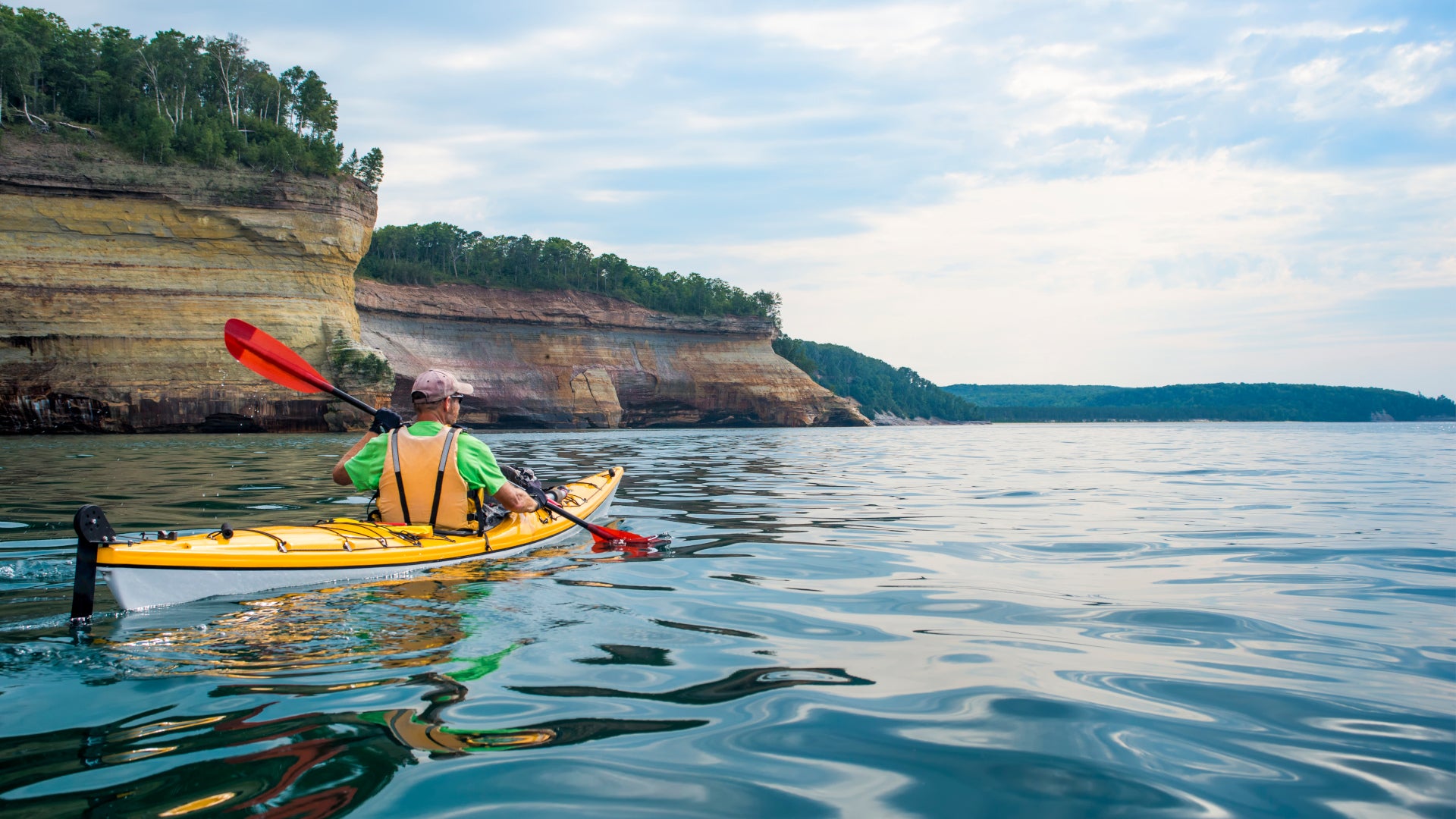
The Lake Superior State Water Trail is strategically divided into five distinct segments, each presenting its own challenges and rewards, and collectively painting a comprehensive picture of the North Shore’s varied topography. Due to the unpredictable nature and immense size of Lake Superior, sea kayaks are highly recommended for this journey, offering the stability and storage capacity necessary for extended wilderness travel. Paddlers embarking on this adventure should be prepared for multi-day excursions, with camping along much of the route being the primary accommodation. While a few towns along the way offer opportunities for hotel stays, these typically require pre-arranged kayak storage and transportation into town, adding logistical layers to the journey.
The first segment, spanning 27 miles, commences at Boy Scout Landing, strategically located near the Wisconsin-Minnesota border. This initial stretch leads paddlers northward to the Knife River Marina. A highlight of this segment is the passage through the St. Louis River estuary, a globally significant freshwater ecosystem. As the largest freshwater estuary in the world, it boasts an intricate maze of protected bays and wetlands, along with the world’s longest freshwater sandspit. These sheltered waters provide an ideal environment for beginner paddlers to acclimate to the conditions of Lake Superior, offering calm stretches amidst the grandeur of the lake. The estuary is a critical habitat for migratory birds and numerous fish species, making it an ecological marvel.
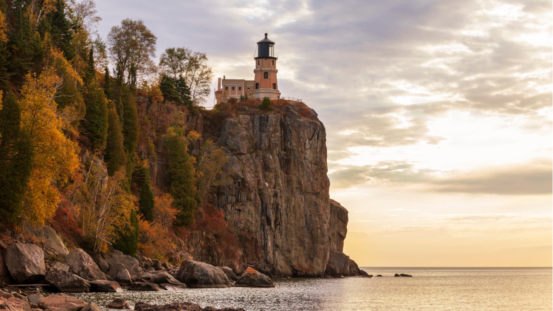
Continuing from Knife River, segment two extends for 30 miles, culminating at the iconic Split Rock Lighthouse State Park. This segment takes paddlers past the charming town of Two Harbors, which serves as a crucial resupply point. Two Harbors, with its historic iron ore docks and local amenities, provides an opportunity for paddlers to restock provisions, access services, and briefly reconnect with civilization before venturing further into the wilderness. The approach to Split Rock Lighthouse, perched dramatically atop a 130-foot cliff, is a visually stunning experience, offering a glimpse into the region’s rich maritime history.
The third segment, the longest at 41 miles, stretches all the way to Schroeder. This portion of the trail closely follows the dramatic shoreline, characterized by impressive basalt cliffs, ancient rock formations, and interspersed rocky beaches. The geology here tells a story billions of years in the making, with the exposed bedrock revealing volcanic activity and glacial sculpting that shaped the landscape. Paddlers will encounter striking examples of Lake Superior’s rugged beauty, often feeling a profound sense of solitude amidst the vastness of the lake and the towering cliffs.
As the journey progresses, the landscape undergoes a subtle but noticeable transformation in the fourth segment. This 33-mile stretch from Schroeder to Grand Marais offers increasingly distant and panoramic views of Minnesota’s renowned Sawtooth Mountains, a range carved by ancient glaciers. The shoreline transitions to a tapestry of dense boreal forests, dominated by fragrant pine, spruce, and fir trees. The air becomes crisp with the scent of pine, and the calls of loons and other wildlife often punctuate the silence, creating an immersive wilderness experience.
The fifth and final segment is a substantial 46-mile push, connecting the artistic hub of Grand Marais to Pigeon Point, located within the Grand Portage Indian Reservation and bordering Canada. This segment presents unique logistical challenges. Public access for camping is primarily limited to a few designated tent sites at the Grand Portage Lodge, necessitating prior reservations. Furthermore, as the trail concludes at the Canadian border, paddlers must be meticulously prepared with all necessary international travel documentation, including passports, to ensure legal entry into Canada if they plan to continue beyond the official trail end or disembark on the Canadian side. This cross-border aspect adds an element of international adventure to the trail’s conclusion.
Strategic Planning and Safety on Lake Superior
While the allure of completing the entire 150-mile trail in a swift few days might tempt highly experienced paddlers, Abby Halom strongly advises against such haste. Her recommendation is to allocate at least three weeks for a full "thru-paddle." This extended timeframe is crucial for several reasons, primarily due to Lake Superior’s notoriously unpredictable temperament. "While the water can seem flat as glass, Lake Superior is feisty and erratic, so always plan a ‘zero day’ during bad weather," Halom cautions. The lake is famous for its sudden, violent storms, which can whip up significant waves in a matter of minutes, transforming tranquil waters into a formidable, dangerous environment. "Plus, a lot of the shoreline is along cliffs, so there’s nowhere to pull out if the weather turns," she adds, emphasizing the critical safety implications of rapid weather changes. Halom’s practical rule of thumb is to aim for 10 to 15 miles of paddling per day, meticulously building in buffer days to accommodate adverse weather conditions or simply to allow for deeper exploration.
Fortunately, "zero days" necessitated by bad weather are far from wasted on the North Shore. The region is a treasure trove of inland hiking trails, weaving through numerous state parks and the vast expanse of the Superior National Forest. These trails offer a different perspective on the landscape, providing opportunities for forest bathing, wildlife viewing, and exploring waterfalls and ridges that are inaccessible from the water. This dual-sport capability significantly enhances the overall adventure, allowing paddlers to diversify their experience and remain active even when the lake demands respect.
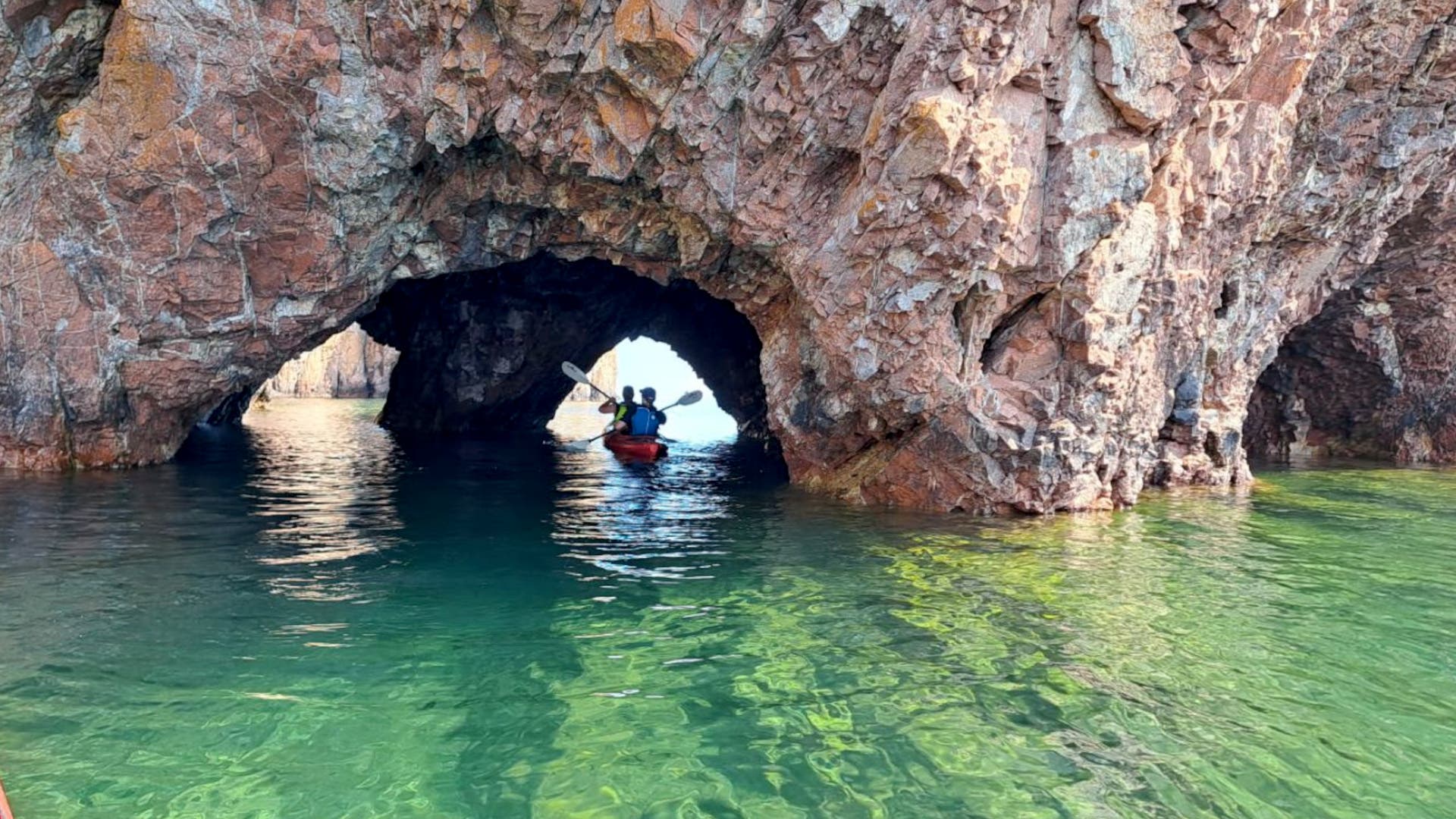
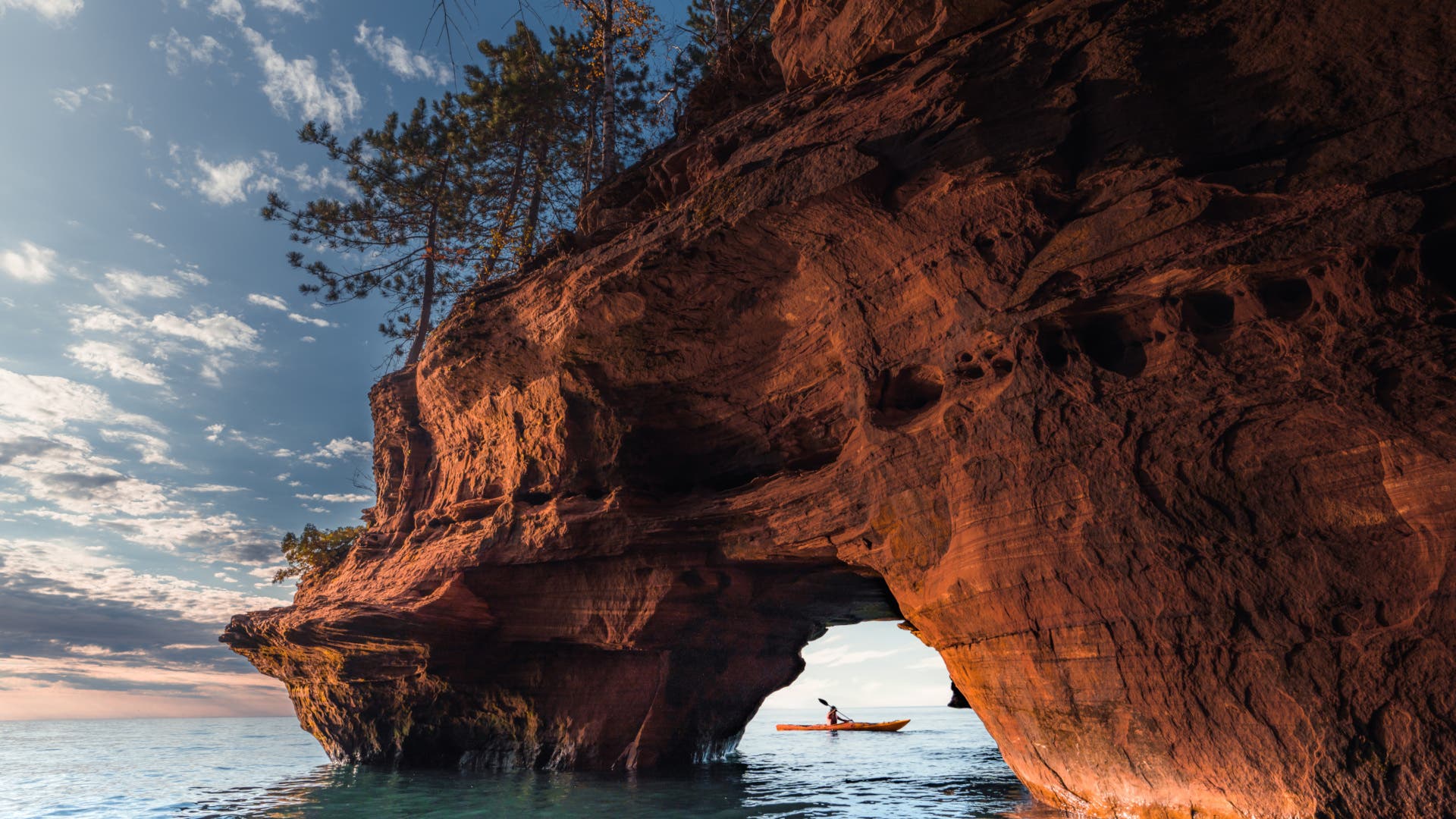
For those unable to commit to a three-week expedition, section paddling or selecting specific segments offers a flexible alternative. Halom particularly recommends the 15-mile stretch from Split Rock Lighthouse to Tettegouche State Park. This segment is celebrated for its dramatic cliffs, mysterious sea caves, and remnants of shipwrecks, offering a quintessential North Shore experience. "Or you can simply overnight anywhere north from Grand Marais for solitude and endless water views," she suggests, highlighting the increasing sense of remote wilderness as one ventures further north.
Logistics and Essential Support for the Journey
Restocking food and supplies along the Lake Superior State Water Trail presents a significant logistical challenge. The remote nature of much of the shoreline means that easily accessible towns or supply points are few and far between. Halom’s primary advice is to maximize the storage capacity of one’s sea kayak. "People are often surprised at just how much your sea kayak can hold, so fill her up with all your supplies, fresh and dehydrated food," she advises. Planning meals carefully and packing efficiently are paramount. Heading north from Duluth, paddlers can make a critical stop at the Super One Foods grocery store in Two Harbors to load up on provisions.
Further along the trail, Tofte offers a valuable resource in its backpacking outfitter, which stocks essential freeze-dried meals and other gear. As paddlers approach the final stretch towards Canada, Grand Marais emerges as a welcoming hub. This vibrant coastal town provides a range of restaurants and services, allowing adventurers to refuel and rejuvenate before the demanding final segment.
Camping along the water trail offers three distinct options, catering to different preferences and planning styles. Watercraft campsites are a popular choice, operating on a free, first-come, first-served basis. These primitive, self-sustaining sites are strictly water-access-only, lacking vehicle parking or potable drinking water, and are capped at a maximum of six paddlers for a single-night stay. They embody the true wilderness camping experience.
Alternatively, reservable backpack/kayak sites are available within the state parks located along the route, including popular destinations such as Gooseberry Falls, Split Rock Lighthouse, and Temperance River State Park. These sites offer the security of a guaranteed spot, eliminating the uncertainty of finding an open watercraft campsite, and often provide more amenities or proximity to park facilities.
The third option, inland fee-based campgrounds, can serve as strategic base camps for day trips, allowing paddlers to explore specific areas without the commitment of a full thru-paddle. Regardless of the chosen camping style, Halom emphasizes adherence to fundamental Leave No Trace principles: "The basic rules to follow are to camp in designated sites, respect private property along the rest of the shore, pack out trash, and bury waste well away from the water." These practices are crucial for preserving the pristine environment of the North Shore.
Beyond the Paddle: Notable Hikes and Terrestrial Exploration
The Lake Superior State Water Trail is not solely a paddler’s paradise; it seamlessly integrates with a network of land-based trails, offering abundant opportunities for hikers to explore the region’s diverse ecosystems on foot. Significant sections of the renowned Superior Hiking Trail run parallel to the Lake Superior shoreline, making them accessible for day trips and side excursions. "My favorite is the Split Rock Ridge trail inside Split Rock Lighthouse State Park," Halom shares, highlighting a prime example of this synergy. "Paddlers can pull in and hike five miles along the river past a series of small waterfalls and rock cliffs. It’s the kind of detour worth the time without derailing the day’s mileage." This demonstrates the thoughtful integration of water and land activities, enriching the overall adventure.
Further north, Judge C.R. Magney State Park offers a challenging yet rewarding hike up to the mystical Devil’s Kettle. Here, the Brule River performs a geological marvel, cascading over ancient volcanic rock formations and mysteriously splitting into two separate pools, with one half disappearing into a pothole and its ultimate destination remaining a captivating enigma. Halom advises integrating these hikes as part of a planned 10- to 15-mile paddle day rather than an unplanned add-on, emphasizing that "a detour on foot only works if there’s room left in your schedule to absorb it." This careful planning ensures that the terrestrial explorations enhance, rather than hinder, the primary paddling objective.
Economic Impact and Environmental Stewardship
The Lake Superior State Water Trail plays a significant role in the local economies of the North Shore communities. Towns like Duluth, Two Harbors, Schroeder, Tofte, and Grand Marais benefit directly from the influx of paddlers and outdoor enthusiasts. These visitors patronize local businesses—grocery stores, outfitters, restaurants, and accommodations—generating revenue and supporting jobs. The growing interest in adventure tourism along the North Shore has spurred local investment in infrastructure and services catering to outdoor recreationists, contributing to the sustainable economic development of the region.
Simultaneously, the trail underscores the critical importance of environmental stewardship. Lake Superior, while vast, is a delicate ecosystem facing challenges from climate change, pollution, and invasive species. The Minnesota DNR, in conjunction with local conservation groups and First Nations, actively works to protect the lake’s water quality, shorelines, and diverse wildlife. Education on Leave No Trace principles, responsible waste management, and respecting natural habitats are integral to the trail experience. Paddlers become de facto ambassadors for the lake, their presence fostering a deeper connection to nature and an increased commitment to its preservation.
Indigenous Heritage and Cultural Significance
The Lake Superior State Water Trail also offers a profound opportunity to connect with the rich Indigenous heritage of the region. For millennia, the Anishinaabeg (Ojibwe) people have lived along these shores, relying on Lake Superior for sustenance, transportation, and spiritual connection. Their knowledge of the lake, its weather patterns, and its resources is vast and historically invaluable. The Grand Portage Indian Reservation, at the northern terminus of the trail, is a testament to this enduring presence. The historic Grand Portage, a vital nine-mile portage route, was a crucial link in the fur trade, connecting Lake Superior to the interior waterways. Paddling this trail is not just an outdoor adventure; it is a journey through a landscape steeped in Indigenous history and culture, offering a chance to reflect on the deep human connection to this powerful lake that predates colonial settlement.
Conclusion: An Unpredictable, Unforgettable Odyssey
In conclusion, the Lake Superior State Water Trail, while presenting considerable logistical and environmental challenges, offers an unparalleled adventure that draws paddlers back repeatedly. The sheer scale and untamed nature of Lake Superior create an experience unlike any other. "Few places offer the chance to spend weeks traveling a coastline where the only sounds are waves breaking against billion-year-old rock formations and the call of gulls overhead," Halom eloquently states. This sentiment encapsulates the essence of the trail: an odyssey into the heart of wilderness, a profound connection with ancient landscapes, and a testament to the enduring allure of one of the world’s most magnificent freshwater seas. It is a journey that demands respect, meticulous preparation, and an open spirit, promising in return an unforgettable encounter with the majestic power and serene beauty of Lake Superior.