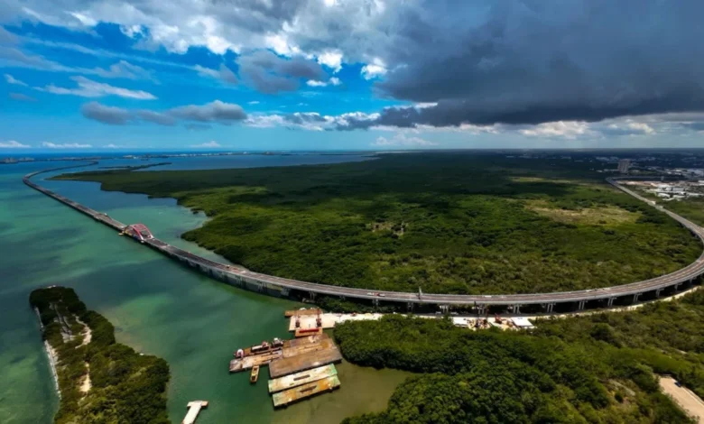
The completion of the Nichupté Bridge represents a watershed moment for the infrastructure landscape of the Mexican Caribbean, providing a vital artery that links downtown Cancún directly to the iconic Hotel Zone. For decades, the primary access to the resort strip—a single, narrow corridor—has served as a bottleneck for millions of international visitors and thousands of local workers alike. By spanning the Nichupté Lagoon, this infrastructure project fundamentally alters the logistical experience of one of the world’s most frequented tourism corridors, signaling a shift in how the region manages the massive influx of global travelers.
A Historical Bottleneck: The Need for Infrastructure
Since the inception of the Cancún master plan in the 1970s, the geography of the city has been defined by its separation from the coast. The Hotel Zone, a long, thin barrier island, was historically connected to the mainland via only two entry points at its northern and southern tips. As Cancún grew from a burgeoning resort project into a global tourism powerhouse, the pressure on these two access points reached a breaking point.
During peak tourism seasons, commuters and tourists frequently encountered traffic congestion that could extend journey times from the airport to the resorts to over two hours. The logistical friction of this transit—often characterized by idling in shuttle buses or private transfers—became a notable pain point in the traveler experience. The Nichupté Bridge was conceived not merely as a convenience, but as a mandatory expansion to support the projected growth of the Quintana Roo tourism sector, which contributes significantly to Mexico’s total GDP.
Timeline of the Project
The realization of the Nichupté Bridge followed a rigorous multi-year timeline of planning, environmental impact assessment, and construction.
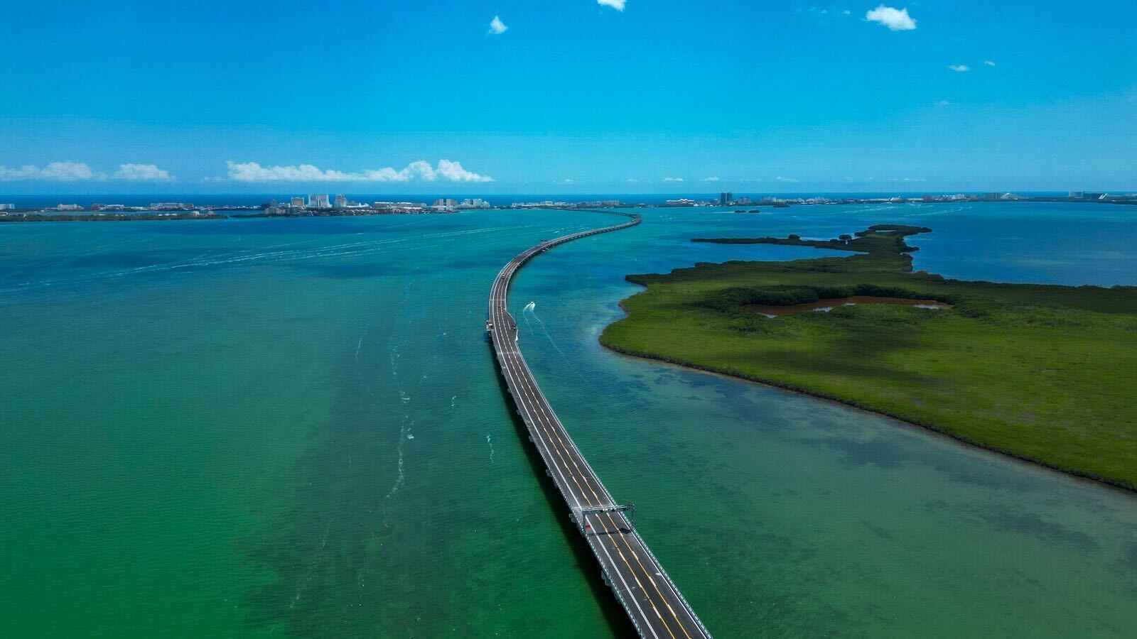
- 2020–2021: Preliminary studies were finalized, identifying the Nichupté Lagoon as the most viable route to alleviate pressure on the Kukulcán Boulevard and the Colosio Boulevard access points.
- 2022: Federal and state environmental agencies granted the necessary permits, following complex consultations regarding the protection of the fragile mangrove ecosystems surrounding the lagoon.
- 2023: Groundbreaking occurred, marking the start of a complex engineering feat involving the construction of support pilings within a protected marine environment.
- 2024–2025: Throughout the construction phase, the project faced challenges ranging from hurricane-season logistics to the continuous operation of the city’s primary tourism corridor.
- 2026: The bridge officially opened to traffic, coinciding with its formal recognition as a cornerstone of the regional development strategy at the EDGE 2026 conference in San Diego.
Engineering and Economic Significance
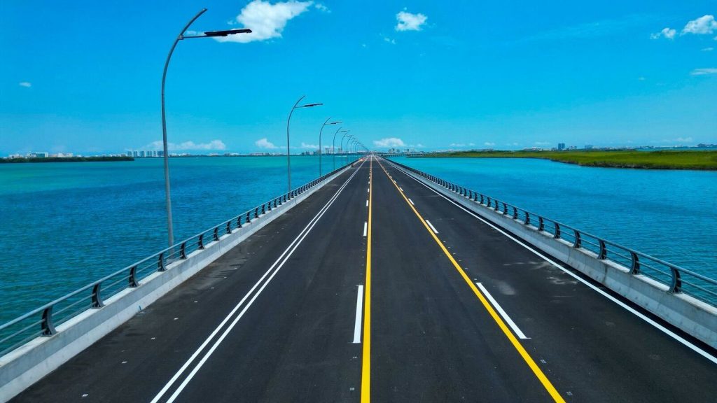
The bridge spans approximately 8.8 kilometers, serving as a sophisticated multi-lane thoroughfare that bypasses the traditional urban traffic of downtown Cancún. Engineering teams prioritized structural resilience, ensuring the bridge can withstand the severe weather events that frequently impact the Caribbean coast.
Beyond its physical dimensions, the economic implications are profound. By reducing the "logistical tax" on travel—the time lost in traffic—the region enhances its competitiveness against other Caribbean destinations. Data from the Mexican Caribbean Tourism Board suggests that improved transit flow directly correlates with higher visitor satisfaction rates and repeat visitation. When travelers spend less time in transit, they are statistically more likely to engage in off-resort dining, local tours, and cultural activities in downtown areas, thereby distributing tourism revenue more equitably across the city.
Perspectives from Leadership
The project has been championed by both federal infrastructure authorities and local tourism officials as a testament to the region’s commitment to modernization. Andrés Martínez Reynoso, CEO of the Mexican Caribbean Tourism Board, noted during the EDGE 2026 announcement that the bridge is far more than a simple shortcut. It is a "transformational project" that aligns the region’s physical infrastructure with the high expectations of the modern, time-sensitive traveler.
Local business leaders in downtown Cancún have also expressed optimism. The bridge effectively shrinks the distance between the high-spend tourists in the Hotel Zone and the local culinary and retail scene in the city center. Historically, the geographic divide limited the reach of downtown businesses; with the bridge, the city is positioning itself as a more integrated destination where visitors can fluidly move between the luxury of the beach and the authenticity of the urban center.
The Broader Impact on the Mexican Caribbean
The Nichupté Bridge is the flagship of a larger, regional strategy to upgrade the "experience between the destinations." In the past decade, the Mexican Caribbean has seen an explosion in popularity, with Tulum and Playa del Carmen becoming major international hubs alongside Cancún. This rapid growth necessitated a shift from isolated resort development to regional connectivity.
This transition is evident in the concurrent investments in the Maya Train, the expansion of the Tulum International Airport, and the refurbishment of existing highway networks. These projects are not independent initiatives but part of a cohesive effort to create a seamless, efficient, and interconnected tourism corridor. The strategy is to ensure that the "friction" of travel—the check-ins, the transfers, the navigation—is minimized, allowing the traveler to focus entirely on the destination.
Future Outlook and Sustainability
As the region looks toward hosting events like the upcoming EDGE 2027 in the Cancún-Riviera Maya area, the focus is shifting toward sustainable growth. Environmentalists have closely monitored the Nichupté Bridge project, emphasizing the importance of protecting the lagoon’s biodiversity. The project’s planners have implemented several mitigation strategies to ensure the long-term health of the ecosystem, including specialized drainage systems to prevent runoff and light pollution control measures that protect local wildlife.
Looking ahead, the success of the bridge will be measured by its ability to handle the increasing volume of travelers while maintaining its efficiency. The inclusion of the bridge in the wider regional infrastructure plan suggests that the Mexican Caribbean is maturing from a collection of competing resorts into a unified, world-class destination.
For the international traveler, the immediate benefit is clear: the arrival at a resort is now faster and less stressful. However, the long-term impact for the region is a more robust, accessible, and integrated economy. By prioritizing the rhythm and flow of travel, the Mexican Caribbean is setting a new standard for how major tourism destinations must evolve to thrive in an increasingly connected global market. As the city prepares for the influx of delegates and tourists expected for 2027, the bridge stands as a physical symbol of a region that is no longer just a destination, but a modern, accessible, and forward-thinking travel hub.
Related posts: