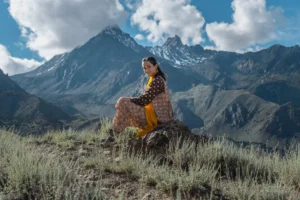
The Pakora Pass Trek: A Comprehensive Guide to Navigating the Naltar to Ishkoman Alpine Corridor

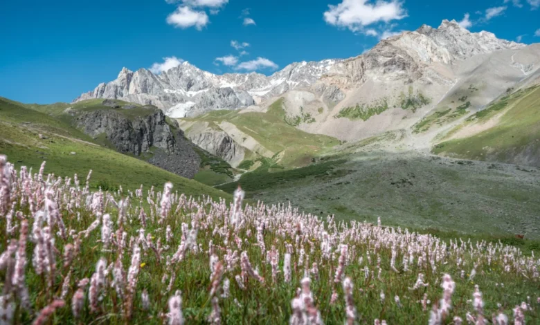
The Pakora Pass trek, which bridges the Naltar Valley and the Ishkoman Valley in the Gilgit-Baltistan region of Pakistan, stands as one of the most ecologically diverse and visually striking high-altitude routes in the Karakoram range. Frequently referred to as the Naltar Pass, this three-day expedition offers a rare opportunity to traverse a pristine alpine environment that has remained largely insulated from the mass tourism currently impacting more established trekking routes like the K2 Basecamp or the Baltoro Glacier.
Geographic and Strategic Context
The Gilgit-Baltistan region is uniquely positioned at the confluence of the Karakoram, Himalaya, and Hindu Kush mountain ranges. The Naltar-Ishkoman corridor serves as a vital traditional passage for local pastoralists who move their livestock between seasonal grazing grounds. Geographically, the route begins in the Naltar Valley—a region known for its high-altitude lakes and coniferous forests—and ascends toward the alpine meadows of the Shani base area before crossing the high-altitude Pakora Pass and descending into the lush, isolated topography of the Ishkoman Valley in the Ghizer District.
The trek is characterized by a significant transition in landscape. Trekkers encounter lush, wildflower-strewn meadows at lower elevations, transitioning into rugged, glacial terrain near the pass, and concluding in the dense juniper-forested valleys of the Pakora Nala. Unlike many commercialized trekking circuits, the Pakora Pass route requires self-sufficiency, as the region lacks permanent infrastructure, relying instead on the seasonal presence of shepherds and traditional nomadic settlements.
Chronology of the Expedition
The standard three-day itinerary is structured to account for the physical toll of high-altitude navigation and the variability of mountain terrain.
Day 1: The Ascent from Naltar to Lower Shani
The journey typically commences at the Naltar zero point, near Satrangi Lake. The initial leg of the trek covers approximately 10 to 12 kilometers. Professional navigation is critical here; while historical maps suggest crossing the river to the western bank, current reports from local pastoralists indicate that seasonal flooding often renders these bridges impassable. Consequently, the established safe route involves maintaining a path along the eastern side of the river, which offers more stable, albeit steeper, terrain. This phase of the trek is marked by the presence of traditional shepherd huts, providing a window into the transhumance culture of the region. The day concludes at Lower Shani, an ideal camping location situated near stream-fed water sources.
Day 2: Navigating the Pakora Pass and Glacial Hazards
The second day represents the most technical segment of the trek. Trekkers must negotiate a high-altitude pass and at least two distinct glacial crossings. Data regarding the pass indicates it is not among the highest in the region, yet it requires careful movement due to the shifting nature of glacial ice and the high likelihood of rockfall in the surrounding slopes. The ascent involves choosing between a higher, more stable route and a lower, flatter path that is frequently impacted by landslides. Once at the summit, the terrain opens into a panoramic view of Shani Peak and the surrounding glaciers. The descent from the pass requires precise navigation to avoid soft, unstable glacial ice, particularly in the late afternoon as temperatures rise.
Day 3: Descent through the Pakora Nala
The final phase involves a steep descent covering 17 to 22 kilometers. This portion of the trek is characterized by a transition from high-altitude scree to dense, ancient juniper forests. The path through the Pakora Nala is notably narrow, a constraint that has historically limited the use of pack animals, thereby preserving the ecological integrity of the corridor. The trek concludes upon reaching the village of Pakora, where the local community—known for its hospitality—often serves as the final waypoint for travelers before they continue toward the larger administrative centers in the Ishkoman Valley.
Infrastructure and Safety Data
For the modern trekker, the primary challenge remains the lack of formal, marked trails. The use of offline navigation tools, such as OSMand or similar GIS-based applications, is strongly recommended by experienced mountaineers.
The logistical costs associated with the trek vary based on the level of support required. For those seeking professional guidance, local experts from the Ishkoman Valley are available for hire. As of the current season, the market rate for a qualified guide—someone capable of managing group logistics, providing emergency medical oversight, and facilitating local cultural interactions—is approximately 12,000 PKR per day. For travelers on a more restricted budget, independent trekking is possible; however, local authorities and experienced mountaineers emphasize that this carries inherent risks, particularly regarding glacier crossing and altitude sickness.
The presence of shepherds is a constant, though intermittent, feature of the landscape. While they provide an essential, albeit informal, source of information regarding bridge conditions and water safety, they are not obligated to provide support services. Therefore, participants must maintain a high level of preparedness, including carrying adequate medical kits and communication equipment.
The Role of Local Tourism Development
The growth of interest in the Pakora Pass is part of a broader trend toward "slow travel" in Gilgit-Baltistan. Accommodations such as the Coyote Den in Chatorkhand represent a new wave of localized hospitality that caters to the post-trek recovery needs of hikers. These establishments are increasingly becoming hubs for safety coordination, where trekkers are encouraged to register their travel plans—a best practice that assists local administrators in monitoring the influx of visitors into sensitive, high-altitude zones.
Broader Implications and Sustainability
The environmental impact of increased foot traffic in the Naltar-Ishkoman corridor is a subject of concern for local conservationists. The fragile alpine meadows are susceptible to erosion, and the lack of waste management infrastructure at campsites necessitates a strict "leave no trace" policy.
Furthermore, the economic impact of trekking on local communities is significant but unevenly distributed. By engaging local guides and utilizing village-based homestays, travelers can contribute directly to the local economy. However, the reliance on seasonal labor suggests that tourism should be viewed as a supplemental, rather than primary, economic driver for these remote populations.
Conclusion: A Balancing Act
The Pakora Pass trek serves as a microcosm of the challenges and rewards associated with adventure tourism in northern Pakistan. It offers an unparalleled experience of the Karakoram wilderness, characterized by low human density and high environmental aesthetic value. However, the route remains a demanding physical undertaking that requires careful planning, respect for local customs, and a deep understanding of the safety protocols necessary for high-altitude trekking. As the region continues to gain attention, the preservation of this corridor will depend on the ability of local stakeholders and the international trekking community to maintain a sustainable balance between accessibility and environmental stewardship.