Urbanization across Europe has often been viewed as a barrier to wilderness access, yet a growing number of capital cities are leveraging their proximity to diverse topographies to integrate nature into the metropolitan experience. From the volcanic peaks of Scotland to the alpine ridges of Austria, municipal planning and historical preservation have maintained trail networks that offer a seamless transition from the urban grid to the natural environment. This integration serves not only as a recreational amenity for residents but also as a critical component of regional tourism strategies.
Sörmlandsleden: Stockholm’s Wilderness Gateway
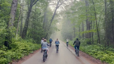
The Sörmland Trail, or Sörmlandsleden, represents one of Sweden’s most significant outdoor achievements, offering over 600 miles of interconnected pathways that begin within the Stockholm municipal boundaries. Accessible directly from the Björkhagen metro station, the trail serves as a logistical bridge between the high-density urban center and the rugged Swedish interior.
Historically, the Sörmlandsleden was established in the 1970s to ensure public access to the diverse landscapes of the Södermanland province, which include ancient forests, glacial valleys, and archipelagos. The trail is divided into roughly 100 individual sections, each ranging from one to 13 miles, allowing for granular planning of excursions. Environmental impact assessments for the region indicate that the trail acts as a vital corridor for local biodiversity, facilitating wildlife movement while providing low-impact recreation for thousands of city dwellers annually.
The Planet Trail: Zurich’s Educational Alpine Traverse
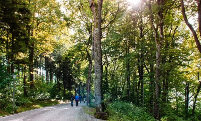
In Switzerland, the Planet Trail (Planetenweg) between Uetliberg and Felsenegg provides a model for thematic urban-fringe infrastructure. The two-hour hike is curated to represent the solar system at a scale of 1:1,000,000,000. Each meter of the trail corresponds to one million kilometers of space, offering a unique intersection of scientific education and alpine tourism.
The Uetliberg-Felsenegg route is not merely a recreational path; it is part of a broader transit-oriented development strategy that utilizes the S-Bahn rail system to funnel hikers to high-altitude starting points. By providing a low-intensity, family-oriented experience, the municipality of Zurich has successfully reduced vehicular traffic to the mountain peaks while maintaining a steady flow of visitors to the vantage points that overlook the city and the surrounding lakes.
Arthur’s Seat: The Geological Sentinel of Edinburgh
Edinburgh’s Holyrood Park features Arthur’s Seat, an extinct volcano that serves as the city’s most recognizable topographical feature. Rising 823 feet, the site offers a comprehensive view of the medieval Old Town and the neoclassical New Town. Archaeological surveys have confirmed that the summit was the site of a significant hill fort, with evidence of defensive structures dating back at least 2,000 years.
The management of the site falls under the purview of Historic Environment Scotland, which balances the conservation of the fragile volcanic geology with the intense foot traffic generated by the city’s tourism sector. The Salisbury Crags, a series of 150-foot cliff faces, remain a point of interest for both geologists and hikers, illustrating the region’s complex tectonic history. The park serves as a primary urban green space, essential for the city’s air quality management and public mental health.
Mount Parnitha: The Athenian Refuge
Located approximately 30 minutes north of Athens, Mount Parnitha National Park offers a dramatic contrast to the Mediterranean urban climate. As the highest range in the immediate vicinity of the capital, it has served as a refuge for both historical figures and, according to local mythology, the god Pan.
Modern usage of the park is supported by an extensive network of 12 marked trails and two primary mountain refuges, Bafi and Flambouri. These facilities are maintained by the Hellenic Federation of Mountaineering and Climbing, ensuring that the mountain remains a viable destination for year-round recreation. The ecological value of the park is high, featuring a diverse array of endemic flora and fauna, which requires strict regulatory oversight to prevent degradation from high visitor volume.
Dublin Mountains Way: A Strategic Corridor
The Dublin Mountains Way, a 25-mile long-distance trail, connects the suburban centers of Shankill and Tallaght. This route was specifically developed to provide a continuous, high-quality hiking experience through the Dublin Mountains, effectively linking several fragmented forest and parkland areas.
Data from the Dublin Mountains Partnership—a collaborative effort between the National Parks and Wildlife Service, Coillte (the Irish Forestry Board), and local authorities—suggests that the trail has significantly improved access to upland areas for city residents. By segmenting the route into three distinct, manageable sections, the project has encouraged a wider demographic of hikers to engage with the natural landscape, thereby reducing the pressure on singular, high-traffic points like the Fairy Castle summit.
Medvednica: Zagreb’s Vertical Extension
Mount Medvednica, overlooking Zagreb, is an exemplar of integrated municipal park management. The mountain is designated as a Nature Park, governed by specific legislative protections that regulate development and recreation. The infrastructure includes well-maintained trails, historic mines, and mountain lodges that are integral to the local cultural fabric.
The accessibility of the park via public transport is a key indicator of its success as an urban-adjacent natural site. The Leustek trail, known for its gentle gradient, serves as the primary artery for recreational hikers, while the ascent to Sljeme—the 3,300-foot peak—provides a more challenging environment. Economic impact studies suggest that these mountain lodges significantly contribute to the local economy, providing a seasonal revenue stream that sustains the surrounding mountain villages.
Barlindåsen Ridge: Oslo’s Accessible Vista
The Barlindåsen Ridge in Oslo exemplifies the Norwegian emphasis on "friluftsliv," or the philosophy of open-air life. The 3.5-mile loop is characterized by its high efficiency-to-effort ratio, providing expansive views of the Norwegian capital and its surrounding fjord system.
The proximity of the trail to the Sandermosen train station allows for a commute-to-hike transition that minimizes carbon footprints, aligning with Oslo’s broader municipal climate goals. Between May and October, the ridge is a primary site for local foraging, which has become a staple of the region’s recreational identity. The trail’s management prioritizes minimal interference with the landscape, maintaining natural terrain that requires moderate physical preparation from the hiker.
Goetheweg: The Innsbruck Alpine Ascent
Innsbruck’s integration of the Nordkette range into its urban structure is perhaps the most ambitious in Europe. The Nordkettenbahn cable car system transports passengers from the Altstadt to 7,000 feet in approximately 20 minutes. From there, the Goetheweg ridge trail provides a high-altitude experience that would otherwise take hours of strenuous climbing to access.
This infrastructure is a critical component of Innsbruck’s tourism economy. The descent toward the Arzler Alm, a traditional alpine hut, demonstrates a sustainable model of tourism where historical agricultural structures are repurposed to support modern hikers. However, local authorities and mountain rescue organizations frequently emphasize the need for proper equipment—such as hiking poles—to mitigate the physical strain caused by the significant elevation loss, highlighting the importance of public safety education in high-altitude urban corridors.
The Sintra-Cascais Natural Park: Lisbon’s Coastal Heritage
The Sintra-Cascais Natural Park, located 40 minutes from Lisbon, serves as a vital ecological and historical corridor. The trail network connects the UNESCO World Heritage sites of Sintra, including the Castelo dos Mouros and the Pena Palace, with the rugged coastline of the Atlantic.
The trail to the westernmost point of continental Europe, Cabo da Roca, involves traversing varied microclimates, from dense forest cover to exposed Atlantic cliffs. The management of this area requires a delicate balance between preserving the medieval structures and managing the heavy foot traffic of tourists. Regulations are strictly enforced to protect the fragile coastal ecosystems, and visitors are advised to prepare for rapid weather shifts—a common occurrence in the region—ensuring that the park remains a safe and sustainable destination for both international tourists and local commuters.
Implications for Urban Planning
The successful integration of these trails into the urban fabric suggests a future where capital cities must prioritize natural connectivity as a core component of infrastructure. The ability to transition from a metro station to a mountain range or forest trail reduces urban congestion, promotes public health, and fosters a deeper appreciation for regional ecological heritage. As urban populations continue to grow, the preservation and maintenance of these corridors will be essential for maintaining the quality of life within the European metropolitan landscape. Data-driven management, combined with robust public transit links, remains the gold standard for creating cities that are both technologically advanced and deeply connected to their natural surroundings.